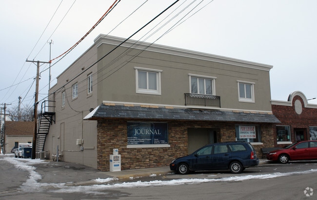
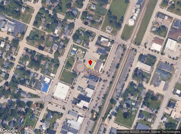
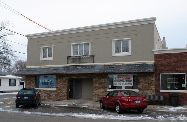
Property Record
47 W Second St, Manteno, IL 60950
NEARBY LISTINGS FOR SALE OR LEASE
-
-
View all Manteno listings for sale on LoopNet.com
Property Detail
47 W Second St
Kankakee, IL
Comstocks Add
03-02-15-314-015
COMSTOCKS ADDN W 50' LOT 8 & W 50' OF S 30' LOT 7 BLK 3
Commercialnec
Kankakee
X
Illinois
17197C0500G
7,8
2024
0.09 AC
2024
Illinois North Area
010204
Other Market Areas
DEMOGRAPHICS near 47 W Second St
1 Mile
3 Mile
5 Mile
2024 Total Population
6,658
10,737
15,124
2029 Population
6,472
10,509
14,857
Pop Growth 2024-2029
(2.79%)
(2.12%)
(1.77%)
Average Age
44
43
41
2024 Total Households
2,863
4,302
5,879
HH Growth 2024-2029
(2.83%)
(2.19%)
(1.80%)
Median Household Inc
$83,227
$87,208
$82,902
Avg Household Size
2.30
2.40
2.50
2024 Avg HH Vehicles
2.00
2.00
2.00
Median Home Value
$218,597
$231,452
$223,095
Median Year Built
1989
1993
1994
Nearby Places
Map Layers
Map Styles
 Street
 Aerial
- Restaurants
- Banks
- Shops
- Fitness
- Groceries
Nearby Properties
Address
Land Use
TOTAL SIZE
Lot Size
Zoning
Address
Land Use
TOTAL SIZE
Lot Size
Zoning
112.85 AC
Address
Land Use
TOTAL SIZE
Lot Size
Zoning
50.11 AC
I2
Address
Land Use
TOTAL SIZE
Lot Size
Zoning
68.70 AC
I2
Address
Land Use
TOTAL SIZE
Lot Size
Zoning
75 AC
I2
Address
Land Use
TOTAL SIZE
Lot Size
Zoning
Address
Land Use
TOTAL SIZE
Lot Size
Zoning
11.58 AC
I2
Address
Land Use
TOTAL SIZE
Lot Size
Zoning
Address
Land Use
TOTAL SIZE
Lot Size
Zoning
17.30 AC
I2
Address
Land Use
TOTAL SIZE
Lot Size
Zoning
8 AC
I2
Address
Land Use
TOTAL SIZE
Lot Size
Zoning
12 AC
I2
Address
Land Use
TOTAL SIZE
Lot Size
Zoning
13 AC
I2
Address
Land Use
TOTAL SIZE
Lot Size
Zoning
43.74 AC
A1
Address
Land Use
TOTAL SIZE
Lot Size
Zoning
0.60 AC
Address
Land Use
TOTAL SIZE
Lot Size
Zoning
3.50 AC
I2
Address
Land Use
TOTAL SIZE
Lot Size
Zoning
9.11 AC
I2
Address
Land Use
TOTAL SIZE
Lot Size
Zoning
10.26 AC
I2
Address
Land Use
TOTAL SIZE
Lot Size
Zoning
7.32 AC
Address
Land Use
TOTAL SIZE
Lot Size
Zoning
Address
Land Use
TOTAL SIZE
Lot Size
Zoning
12.40 AC
I2
Address
Land Use
TOTAL SIZE
Lot Size
Zoning
Address
Land Use
TOTAL SIZE
Lot Size
Zoning
2.55 AC
Address
Land Use
TOTAL SIZE
Lot Size
Zoning
2.21 AC
Address
Land Use
TOTAL SIZE
Lot Size
Zoning
4.67 AC
Address
Land Use
TOTAL SIZE
Lot Size
Zoning
7.12 AC
I2
Address
Land Use
TOTAL SIZE
Lot Size
Zoning
11.63 AC
I2
Address
Land Use
TOTAL SIZE
Lot Size
Zoning
3.65 AC
I2
Address
Land Use
TOTAL SIZE
Lot Size
Zoning
5.65 AC
I1
Address
Land Use
TOTAL SIZE
Lot Size
Zoning
6.37 AC
Address
Land Use
TOTAL SIZE
Lot Size
Zoning
0.54 AC
The World's #1 Commercial Real Estate Marketplace
Connect with us
© 2026 CoStar Group
The information above has been obtained from sources believed reliable. While we do not doubt its accuracy we have not verified it and make no guarantee, warranty or representation about it. It is your responsibility to independently confirm its accuracy and completeness. Any projections, opinions, assumptions, or estimates used are for example only and do not represent the current or future performance of the property. The value of this transaction to you depends on tax and other factors which should be evaluated by your tax, financial, and legal advisors. You and your advisors should conduct a careful, independent investigation of the property to determine to your satisfaction the suitability of the property for your needs.