Property Record
470 Belle Terre Blvd, Palm Coast, FL 32164

This Property Is For Sale
NEARBY LISTINGS FOR SALE OR LEASE
Property Detail
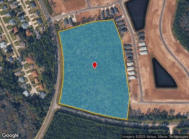
470 Belle Terre Blvd
Deltona-Daytona Beach-Ormond Beach, FL
Palm Coast Section 64
07-11-31-7064-000RP-0040
15.60 AC PALM COAST SECTION 64 RP 8-1 OR 553 PG 1539 OR 946/981 (EX ALL THAT PORTION DEEDED TO CITATION ESTATES OR 1402/1340) OR 1937/912 OR 2100/1316 OR 2100/1328
Commercialacreage
Flagler
X
Florida
12035C0230E
4
2024
15.60 AC
2025
Daytona Area
060208
Other Market Areas
DEMOGRAPHICS near 470 Belle Terre Blvd
1 Mile
3 Mile
5 Mile
2024 Total Population
2,158
15,858
39,419
2029 Population
2,642
19,509
48,247
Pop Growth 2024-2029
+ 22.43%
+ 23.02%
+ 22.40%
Average Age
42
43
45
2024 Total Households
837
6,187
15,919
HH Growth 2024-2029
+ 21.74%
+ 22.40%
+ 21.66%
Median Household Inc
$65,739
$55,900
$62,265
Avg Household Size
2.50
2.50
2.40
2024 Avg HH Vehicles
2.00
2.00
2.00
Median Home Value
$302,557
$274,919
$267,965
Median Year Built
2006
2006
2004
Nearby Places
Map Layers
Map Styles
 Street
 Aerial
- Restaurants
- Banks
- Shops
- Fitness
- Groceries
PUBLIC TRANSPORTATION
AIRPORT
Daytona Beach International
DRIVE
WALK
Distance
Daytona Beach International
33 min
25.2 mi
Freight Ports
Jacksonville Port
DRIVE
WALK
Distance
Jacksonville Port
89 min
75.1 mi
Nearby Properties
Address
Land Use
TOTAL SIZE
Lot Size
Zoning
Address
Land Use
TOTAL SIZE
Lot Size
Zoning
345,915 SF
94.85 AC
COM-2
Address
Land Use
TOTAL SIZE
Lot Size
Zoning
913,614 SF
85.53 AC
PSP
Address
Land Use
TOTAL SIZE
Lot Size
Zoning
331,401 SF
36.51 AC
MFR-2
Address
Land Use
TOTAL SIZE
Lot Size
Zoning
320,259 SF
83.19 AC
P
Address
Land Use
TOTAL SIZE
Lot Size
Zoning
217,927 SF
1,165.37 AC
I-C
Address
Land Use
TOTAL SIZE
Lot Size
Zoning
280,742 SF
16.06 AC
MPD
Address
Land Use
TOTAL SIZE
Lot Size
Zoning
225,108 SF
41.71 AC
MPD
Address
Land Use
TOTAL SIZE
Lot Size
Zoning
141,171 SF
8.18 AC
MPD
Address
Land Use
TOTAL SIZE
Lot Size
Zoning
121,173 SF
10 AC
AC
Address
Land Use
TOTAL SIZE
Lot Size
Zoning
64,208 SF
8.41 AC
PSP
Address
Land Use
TOTAL SIZE
Lot Size
Zoning
76,544 SF
48.85 AC
R/C
Address
Land Use
TOTAL SIZE
Lot Size
Zoning
124,911 SF
10.18 AC
PUD
Address
Land Use
TOTAL SIZE
Lot Size
Zoning
220,314 SF
17.41 AC
MPD
Address
Land Use
TOTAL SIZE
Lot Size
Zoning
82,459 SF
4.09 AC
MPD
Address
Land Use
TOTAL SIZE
Lot Size
Zoning
208,450 SF
11.85 AC
MPD
Address
Land Use
TOTAL SIZE
Lot Size
Zoning
89,590 SF
9.90 AC
B-1
Address
Land Use
TOTAL SIZE
Lot Size
Zoning
35,243 SF
8.45 AC
COM-3
Address
Land Use
TOTAL SIZE
Lot Size
Zoning
28,591 SF
3.84 AC
PUD
Address
Land Use
TOTAL SIZE
Lot Size
Zoning
59,889 SF
0.75 AC
R-3A
Address
Land Use
TOTAL SIZE
Lot Size
Zoning
54,500 SF
4.95 AC
COM-2
Address
Land Use
TOTAL SIZE
Lot Size
Zoning
47,264 SF
10.20 AC
MPD
Address
Land Use
TOTAL SIZE
Lot Size
Zoning
67,008 SF
5.34 AC
B-1
Address
Land Use
TOTAL SIZE
Lot Size
Zoning
35,065 SF
19.37 AC
PSP
Address
Land Use
TOTAL SIZE
Lot Size
Zoning
20,990 SF
18.10 AC
Address
Land Use
TOTAL SIZE
Lot Size
Zoning
47,573 SF
18.48 AC
MPD
Address
Land Use
TOTAL SIZE
Lot Size
Zoning
79,814 SF
9.09 AC
MPD
Address
Land Use
TOTAL SIZE
Lot Size
Zoning
140,302 SF
13.08 AC
MPD
Address
Land Use
TOTAL SIZE
Lot Size
Zoning
120.23 AC
SFR-1
The World's #1 Commercial Real Estate Marketplace
Connect with us
© 2026 CoStar Group
The information above has been obtained from sources believed reliable. While we do not doubt its accuracy we have not verified it and make no guarantee, warranty or representation about it. It is your responsibility to independently confirm its accuracy and completeness. Any projections, opinions, assumptions, or estimates used are for example only and do not represent the current or future performance of the property. The value of this transaction to you depends on tax and other factors which should be evaluated by your tax, financial, and legal advisors. You and your advisors should conduct a careful, independent investigation of the property to determine to your satisfaction the suitability of the property for your needs.