Property Record
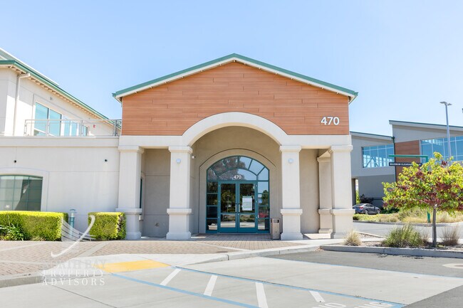
470 Devlin Rd, Napa, CA 94558


Property Detail
470 Devlin Rd
Commercialbuilding
NAPA
IPAC
California
B and X Area of moderate flood hazard, usually the area between the limits of the 100-year and 500-year floods.
1.44 AC
2025
Napa County
2025
North Bay/Santa Rosa
201005
Napa, CA
14,917 SF
057-200-016
NEARBY LISTINGS FOR SALE OR LEASE
DEMOGRAPHICS near 470 Devlin Rd
1 mile
3 mile
5 mile
2025 Total Population
40
1,464
46,685
2030 Population
37
1,454
46,036
Pop Growth 2025-2030
(7.50%)
(0.68%)
(1.39%)
Average Age
44
42
40
2025 Total Households
13
511
14,859
HH Growth 2025-2030
(7.69%)
(0.59%)
(1.53%)
Median Household Inc
$199,999
$137,962
$118,445
Avg Household Size
2.80
2.80
3.00
2025 Avg HH Vehicles
3.00
3.00
2.00
Median Home Value
$1,075,000
$964,788
$760,939
Median Year Built
1969
1996
1982
Nearby Places
Map Layers
Map Styles
 Street
 Aerial
Layers
 Traffic
 Biking
Places
Listings with unknown addresses are not visible on the map
- Restaurants
- Banks
- Shops
- Fitness
- Groceries
PUBLIC TRANSPORTATION
AIRPORT
Metro Oakland International
Drive
Walk
Distance
Metro Oakland International
60 min
45.8 mi
Charles M Schulz - Sonoma County
Drive
Walk
Distance
Charles M Schulz - Sonoma County
67 min
49.0 mi
Freight Ports
Port of Richmond
Drive
Walk
Distance
Port of Richmond
44 min
31.5 mi
SALE & LEASE HISTORY
LISTING DATE
SALE/LEASE

Sep 25, 2016
For Lease
Nov 09, 2017
For Lease
Jun 30, 2025
For Lease
Nearby Properties
Address
Land Use
TOTAL SIZE
Lot Size
Zoning
Address
Land Use
TOTAL SIZE
Lot Size
Zoning
38.18 AC
Address
Land Use
TOTAL SIZE
Lot Size
Zoning
219,739 SF
8.40 AC
AWAC
Address
Land Use
TOTAL SIZE
Lot Size
Zoning
259,544 SF
20.63 AC
AWAC
Address
Land Use
TOTAL SIZE
Lot Size
Zoning
702,540 SF
37.21 AC
Address
Land Use
TOTAL SIZE
Lot Size
Zoning
645,540 SF
41.78 AC
Address
Land Use
TOTAL SIZE
Lot Size
Zoning
58.03 AC
Address
Land Use
TOTAL SIZE
Lot Size
Zoning
9.32 AC
IPA
Address
Land Use
TOTAL SIZE
Lot Size
Zoning
198,534 SF
10 AC
Address
Land Use
TOTAL SIZE
Lot Size
Zoning
139,409 SF
6.54 AC
IPA
Address
Land Use
TOTAL SIZE
Lot Size
Zoning
648,238 SF
36.52 AC
Address
Land Use
TOTAL SIZE
Lot Size
Zoning
149,600 SF
7.08 AC
Address
Land Use
TOTAL SIZE
Lot Size
Zoning
330,528 SF
15.24 AC
Address
Land Use
TOTAL SIZE
Lot Size
Zoning
39,720 SF
5.97 AC
Address
Land Use
TOTAL SIZE
Lot Size
Zoning
380,700 SF
17.52 AC
AWAC
Address
Land Use
TOTAL SIZE
Lot Size
Zoning
158,793 SF
16.04 AC
Address
Land Use
TOTAL SIZE
Lot Size
Zoning
250,652 SF
16.18 AC
Address
Land Use
TOTAL SIZE
Lot Size
Zoning
249,016 SF
12.64 AC
Address
Land Use
TOTAL SIZE
Lot Size
Zoning
Address
Land Use
TOTAL SIZE
Lot Size
Zoning
410,458 SF
28.79 AC
Address
Land Use
TOTAL SIZE
Lot Size
Zoning
226,044 SF
6.22 AC
Address
Land Use
TOTAL SIZE
Lot Size
Zoning
150,904 SF
9.96 AC
IPAC
Address
Land Use
TOTAL SIZE
Lot Size
Zoning
169,748 SF
13.96 AC
Address
Land Use
TOTAL SIZE
Lot Size
Zoning
192,321 SF
8.95 AC
IPAC
Address
Land Use
TOTAL SIZE
Lot Size
Zoning
77,404 SF
10.09 AC
IPAC
Address
Land Use
TOTAL SIZE
Lot Size
Zoning
115,968 SF
6.34 AC
AWAC
Address
Land Use
TOTAL SIZE
Lot Size
Zoning
27,442 SF
16.58 AC
IPB
Address
Land Use
TOTAL SIZE
Lot Size
Zoning
335,044 SF
17.28 AC
Address
Land Use
TOTAL SIZE
Lot Size
Zoning
258,048 SF
12.29 AC
Address
Land Use
TOTAL SIZE
Lot Size
Zoning
34,214 SF
9.17 AC
IPAC
The World's #1 Commercial Real Estate Marketplace
Connect with us
© 2026 CoStar Group
The information above has been obtained from sources believed reliable. While we do not doubt its accuracy we have not verified it and make no guarantee, warranty or representation about it. It is your responsibility to independently confirm its accuracy and completeness. Any projections, opinions, assumptions, or estimates used are for example only and do not represent the current or future performance of the property. The value of this transaction to you depends on tax and other factors which should be evaluated by your tax, financial, and legal advisors. You and your advisors should conduct a careful, independent investigation of the property to determine to your satisfaction the suitability of the property for your needs.