Property Record
470 Mincy Way, Covington, GA 30016

NEARBY LISTINGS FOR SALE OR LEASE
Property Detail
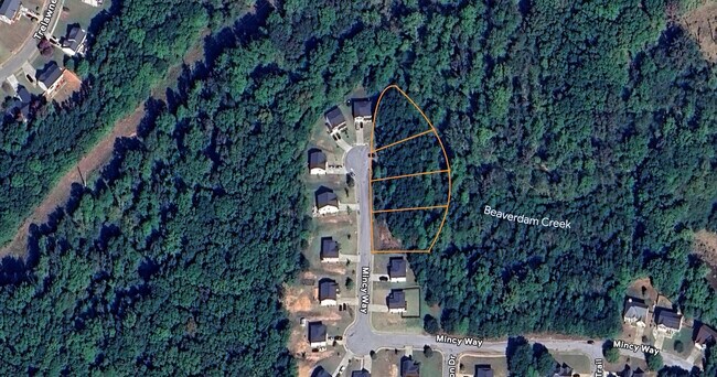
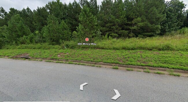
470 Mincy Way
Atlanta-Sandy Springs-Roswell, GA
Holly Hills
0045C00000130000
LT 130 HOLLY HILLS PHII
Residentialacreage
Newton
A
Georgia
13217C0108D
130
2025
0.36 AC
2025
Newton County
100507
Atlanta
DEMOGRAPHICS near 470 Mincy Way
1 Mile
3 Mile
5 Mile
2024 Total Population
5,199
35,957
87,041
2029 Population
5,671
39,038
94,238
Pop Growth 2024-2029
+ 9.08%
+ 8.57%
+ 8.27%
Average Age
37
37
38
2024 Total Households
1,699
12,530
30,715
HH Growth 2024-2029
+ 9.18%
+ 8.66%
+ 8.43%
Median Household Inc
$73,330
$71,478
$73,068
Avg Household Size
3.00
2.80
2.80
2024 Avg HH Vehicles
2.00
2.00
2.00
Median Home Value
$250,719
$243,044
$264,451
Median Year Built
2002
2000
1997
Nearby Places
Map Layers
Map Styles
 Street
 Aerial
- Restaurants
- Banks
- Shops
- Fitness
- Groceries
PUBLIC TRANSPORTATION
AIRPORT
Hartsfield - Jackson Atlanta International
DRIVE
WALK
Distance
Hartsfield - Jackson Atlanta International
56 min
39.6 mi
Freight Ports
Georgia Ports - Savannah
DRIVE
WALK
Distance
Georgia Ports - Savannah
273 min
226.9 mi
Nearby Properties
Address
Land Use
TOTAL SIZE
Lot Size
Zoning
Address
Land Use
TOTAL SIZE
Lot Size
Zoning
4,734 SF
35.19 AC
RMF
Address
Land Use
TOTAL SIZE
Lot Size
Zoning
306,886 SF
118.50 AC
R2
Address
Land Use
TOTAL SIZE
Lot Size
Zoning
14,624 SF
26.09 AC
C1
Address
Land Use
TOTAL SIZE
Lot Size
Zoning
19,292 SF
8.20 AC
H1
Address
Land Use
TOTAL SIZE
Lot Size
Zoning
92,162 SF
11.21 AC
R2
Address
Land Use
TOTAL SIZE
Lot Size
Zoning
5,160 SF
45.17 AC
C1
Address
Land Use
TOTAL SIZE
Lot Size
Zoning
82,716 SF
21.04 AC
R2
Address
Land Use
TOTAL SIZE
Lot Size
Zoning
3,888 SF
7.17 AC
C1
Address
Land Use
TOTAL SIZE
Lot Size
Zoning
65,520 SF
35 AC
E6
Address
Land Use
TOTAL SIZE
Lot Size
Zoning
65,008 SF
23.81 AC
R2
Address
Land Use
TOTAL SIZE
Lot Size
Zoning
151,955 SF
26.17 AC
R1
Address
Land Use
TOTAL SIZE
Lot Size
Zoning
64,799 SF
19.10 AC
E6
Address
Land Use
TOTAL SIZE
Lot Size
Zoning
4,768 SF
263.26 AC
C1
Address
Land Use
TOTAL SIZE
Lot Size
Zoning
6,936 SF
8.88 AC
C1
Address
Land Use
TOTAL SIZE
Lot Size
Zoning
28,512 SF
0.52 AC
Address
Land Use
TOTAL SIZE
Lot Size
Zoning
38,120 SF
155.15 AC
E1
Address
Land Use
TOTAL SIZE
Lot Size
Zoning
54,712 SF
54.54 AC
E6
Address
Land Use
TOTAL SIZE
Lot Size
Zoning
27,492 SF
0.47 AC
Address
Land Use
TOTAL SIZE
Lot Size
Zoning
5,226 SF
8.13 AC
C1
Address
Land Use
TOTAL SIZE
Lot Size
Zoning
66,660 SF
12.80 AC
C1
Address
Land Use
TOTAL SIZE
Lot Size
Zoning
85,560 SF
10.26 AC
C1
Address
Land Use
TOTAL SIZE
Lot Size
Zoning
73,624 SF
15.25 AC
C1
Address
Land Use
TOTAL SIZE
Lot Size
Zoning
24,788 SF
2 AC
C1
Address
Land Use
TOTAL SIZE
Lot Size
Zoning
65,360 SF
20 AC
E6
Address
Land Use
TOTAL SIZE
Lot Size
Zoning
51,230 SF
7.46 AC
C1
Address
Land Use
TOTAL SIZE
Lot Size
Zoning
36,615 SF
9.78 AC
E2
Address
Land Use
TOTAL SIZE
Lot Size
Zoning
74,050 SF
4.27 AC
C1
Address
Land Use
TOTAL SIZE
Lot Size
Zoning
311,423 SF
20.78 AC
I1
Address
Land Use
TOTAL SIZE
Lot Size
Zoning
81,400 SF
5.18 AC
C1
Address
Land Use
TOTAL SIZE
Lot Size
Zoning
1,790 SF
79.74 AC
E2
The World's #1 Commercial Real Estate Marketplace
Connect with us
© 2025 CoStar Group
The information above has been obtained from sources believed reliable. While we do not doubt its accuracy we have not verified it and make no guarantee, warranty or representation about it. It is your responsibility to independently confirm its accuracy and completeness. Any projections, opinions, assumptions, or estimates used are for example only and do not represent the current or future performance of the property. The value of this transaction to you depends on tax and other factors which should be evaluated by your tax, financial, and legal advisors. You and your advisors should conduct a careful, independent investigation of the property to determine to your satisfaction the suitability of the property for your needs.