Property Record
470 Newtown Rd, Virginia Beach, VA 23462


NEARBY LISTINGS FOR SALE OR LEASE
Property Detail
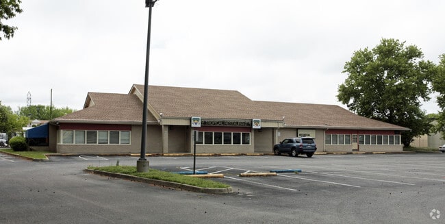
470 Newtown Rd
Virginia Beach-Norfolk-Newport News, VA-NC
Milburn Manor
1467-29-5260
MILBURN MANOR 1.2473 AC PAR A
Restaurantbuilding
Virginia Beach
X
Virginia
5101040081H
00a00
2024
1.25 AC
2025
Newtown
040600
Hampton Roads
6,875 SF
DEMOGRAPHICS near 470 Newtown Rd
1 Mile
3 Mile
5 Mile
2024 Total Population
18,092
101,496
288,675
2029 Population
17,924
100,394
285,872
Pop Growth 2024-2029
(0.93%)
(1.09%)
(0.97%)
Average Age
35
39
39
2024 Total Households
7,051
40,844
113,978
HH Growth 2024-2029
(1.19%)
(1.28%)
(1.20%)
Median Household Inc
$56,581
$68,761
$70,446
Avg Household Size
2.40
2.40
2.40
2024 Avg HH Vehicles
2.00
2.00
2.00
Median Home Value
$185,758
$261,697
$265,050
Median Year Built
1983
1978
1976
Nearby Places
Map Layers
Map Styles
 Street
 Aerial
- Restaurants
- Banks
- Shops
- Fitness
- Groceries
PUBLIC TRANSPORTATION
COMMUTER RAIL
Norfolk (Northeast Regional - Amtrak)
DRIVE
WALK
Distance
Norfolk (Northeast Regional - Amtrak)
11 min
6.2 mi
AIRPORT
Norfolk International
DRIVE
WALK
Distance
Norfolk International
12 min
5.5 mi
Newport News/Williamsburg International
DRIVE
WALK
Distance
Newport News/Williamsburg International
47 min
31.0 mi
Freight Ports
Virginia Port Authority - Portsmouth
DRIVE
WALK
Distance
Virginia Port Authority - Portsmouth
23 min
11.7 mi
SALE & LEASE HISTORY
LISTING DATE
SALE/LEASE

Jan 23, 2025
For Lease
Nearby Properties
Address
Land Use
TOTAL SIZE
Lot Size
Zoning
Address
Land Use
TOTAL SIZE
Lot Size
Zoning
2,301.65 AC
Address
Land Use
TOTAL SIZE
Lot Size
Zoning
223 AC
I5
Address
Land Use
TOTAL SIZE
Lot Size
Zoning
Address
Land Use
TOTAL SIZE
Lot Size
Zoning
Address
Land Use
TOTAL SIZE
Lot Size
Zoning
52.36 AC
Address
Land Use
TOTAL SIZE
Lot Size
Zoning
281,816 SF
11.72 AC
Address
Land Use
TOTAL SIZE
Lot Size
Zoning
697,880 SF
200.35 AC
R15
Address
Land Use
TOTAL SIZE
Lot Size
Zoning
30,036 SF
50.39 AC
Address
Land Use
TOTAL SIZE
Lot Size
Zoning
23.51 AC
R13
Address
Land Use
TOTAL SIZE
Lot Size
Zoning
132 SF
71.89 AC
Address
Land Use
TOTAL SIZE
Lot Size
Zoning
197,812 SF
8.21 AC
Address
Land Use
TOTAL SIZE
Lot Size
Zoning
15.92 AC
A18
Address
Land Use
TOTAL SIZE
Lot Size
Zoning
95.32 AC
Address
Land Use
TOTAL SIZE
Lot Size
Zoning
15.12 AC
Address
Land Use
TOTAL SIZE
Lot Size
Zoning
434,920 SF
8.35 AC
A36
Address
Land Use
TOTAL SIZE
Lot Size
Zoning
9.62 AC
A36
Address
Land Use
TOTAL SIZE
Lot Size
Zoning
226,775 SF
13.14 AC
B2
Address
Land Use
TOTAL SIZE
Lot Size
Zoning
7.45 AC
B4
Address
Land Use
TOTAL SIZE
Lot Size
Zoning
340,291 SF
18.77 AC
O1
Address
Land Use
TOTAL SIZE
Lot Size
Zoning
18.61 AC
PDH2
Address
Land Use
TOTAL SIZE
Lot Size
Zoning
Address
Land Use
TOTAL SIZE
Lot Size
Zoning
Address
Land Use
TOTAL SIZE
Lot Size
Zoning
23.96 AC
IN2
Address
Land Use
TOTAL SIZE
Lot Size
Zoning
301,631 SF
31.91 AC
I1
Address
Land Use
TOTAL SIZE
Lot Size
Zoning
210,872 SF
2.13 AC
B4
Address
Land Use
TOTAL SIZE
Lot Size
Zoning
246,500 SF
B3A
Address
Land Use
TOTAL SIZE
Lot Size
Zoning
12.85 AC
A24
Address
Land Use
TOTAL SIZE
Lot Size
Zoning
86,497 SF
1.56 AC
B3A
Address
Land Use
TOTAL SIZE
Lot Size
Zoning
319,444 SF
19.02 AC
O1
Address
Land Use
TOTAL SIZE
Lot Size
Zoning
3,858 SF
17.85 AC
The World's #1 Commercial Real Estate Marketplace
Connect with us
© 2026 CoStar Group
The information above has been obtained from sources believed reliable. While we do not doubt its accuracy we have not verified it and make no guarantee, warranty or representation about it. It is your responsibility to independently confirm its accuracy and completeness. Any projections, opinions, assumptions, or estimates used are for example only and do not represent the current or future performance of the property. The value of this transaction to you depends on tax and other factors which should be evaluated by your tax, financial, and legal advisors. You and your advisors should conduct a careful, independent investigation of the property to determine to your satisfaction the suitability of the property for your needs.