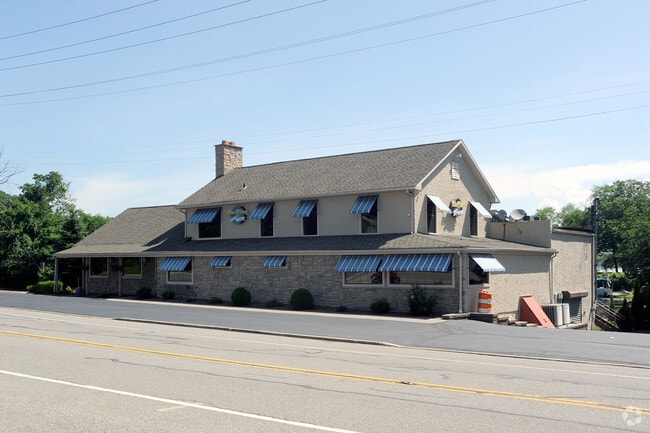
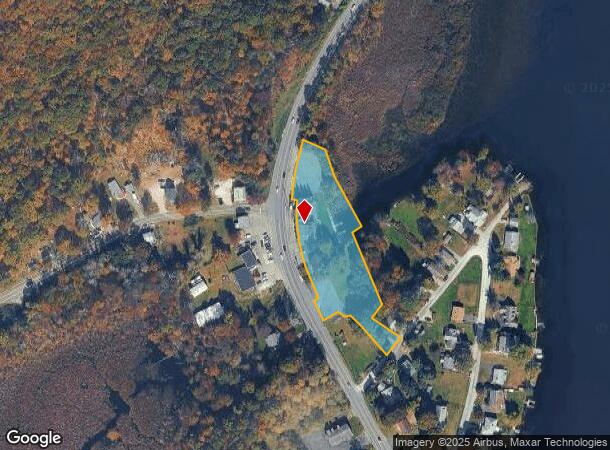
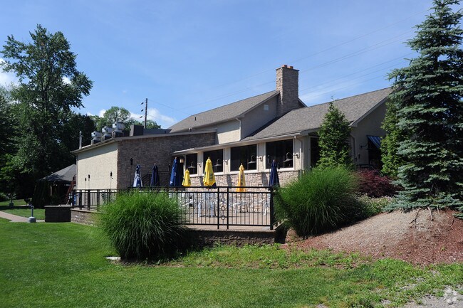
Property Record
470 Us Highway 206, Branchville, NJ 07826

NEARBY LISTINGS FOR SALE OR LEASE
Property Detail
470 Us Highway 206
Newark, NJ
ADDITIONAL LOTS: CARRIAGE HOUSE
05-00160-0000-00008
Sussex
Restaurantbuilding
New Jersey
A
8
34037C0141E
1.78 AC
2024
Sussex County
2025
Northern New Jersey
371000
DEMOGRAPHICS near 470 Us Highway 206
1 Mile
3 Mile
5 Mile
2024 Total Population
1,263
4,291
9,276
2029 Population
1,300
4,365
9,354
Pop Growth 2024-2029
+ 2.93%
+ 1.72%
+ 0.84%
Average Age
47
46
45
2024 Total Households
550
1,816
3,732
HH Growth 2024-2029
+ 2.91%
+ 1.87%
+ 0.96%
Median Household Inc
$93,749
$97,201
$100,415
Avg Household Size
2.30
2.30
2.50
2024 Avg HH Vehicles
2.00
2.00
2.00
Median Home Value
$312,602
$327,984
$339,093
Median Year Built
1958
1960
1967
Nearby Places
Map Layers
Map Styles
 Street
 Aerial
- Restaurants
- Banks
- Shops
- Fitness
- Groceries
SALE & LEASE HISTORY
LISTING DATE
SALE/LEASE

Aug 25, 2024
For Sale
Nearby Properties
Address
Land Use
TOTAL SIZE
Lot Size
Zoning
Address
Land Use
TOTAL SIZE
Lot Size
Zoning
55.05 AC
O
Address
Land Use
TOTAL SIZE
Lot Size
Zoning
4.46 AC
COM
Address
Land Use
TOTAL SIZE
Lot Size
Zoning
882.48 AC
R-3
Address
Land Use
TOTAL SIZE
Lot Size
Zoning
592 AC
AR
Address
Land Use
TOTAL SIZE
Lot Size
Zoning
560.50 AC
E 5A
Address
Land Use
TOTAL SIZE
Lot Size
Zoning
1,368 SF
505 AC
E
Address
Land Use
TOTAL SIZE
Lot Size
Zoning
4.44 AC
AR
Address
Land Use
TOTAL SIZE
Lot Size
Zoning
351.51 AC
AR
Address
Land Use
TOTAL SIZE
Lot Size
Zoning
595 AC
E
Address
Land Use
TOTAL SIZE
Lot Size
Zoning
310 AC
AR
Address
Land Use
TOTAL SIZE
Lot Size
Zoning
187 AC
AR
Address
Land Use
TOTAL SIZE
Lot Size
Zoning
482.65 AC
E
Address
Land Use
TOTAL SIZE
Lot Size
Zoning
5.60 AC
CED2
Address
Land Use
TOTAL SIZE
Lot Size
Zoning
1,792 SF
24.32 AC
D 2A
Address
Land Use
TOTAL SIZE
Lot Size
Zoning
351.14 AC
E 5A
Address
Land Use
TOTAL SIZE
Lot Size
Zoning
1,229 SF
40 AC
CRAR
Address
Land Use
TOTAL SIZE
Lot Size
Zoning
342.54 AC
E
Address
Land Use
TOTAL SIZE
Lot Size
Zoning
1,207 SF
107.48 AC
E
Address
Land Use
TOTAL SIZE
Lot Size
Zoning
7.41 AC
CED1
Address
Land Use
TOTAL SIZE
Lot Size
Zoning
294.56 AC
E
Address
Land Use
TOTAL SIZE
Lot Size
Zoning
8,840 SF
1 AC
AR
Address
Land Use
TOTAL SIZE
Lot Size
Zoning
4.40 AC
LI
Address
Land Use
TOTAL SIZE
Lot Size
Zoning
3,494 SF
1 AC
AR
Address
Land Use
TOTAL SIZE
Lot Size
Zoning
10.27 AC
LI
Address
Land Use
TOTAL SIZE
Lot Size
Zoning
153.64 AC
AR
Address
Land Use
TOTAL SIZE
Lot Size
Zoning
0.20 AC
COM
Address
Land Use
TOTAL SIZE
Lot Size
Zoning
251.60 AC
E
Address
Land Use
TOTAL SIZE
Lot Size
Zoning
2.31 AC
R-1
Address
Land Use
TOTAL SIZE
Lot Size
Zoning
1.74 AC
COM
Address
Land Use
TOTAL SIZE
Lot Size
Zoning
0.37 AC
COM
The World's #1 Commercial Real Estate Marketplace
Connect with us
© 2026 CoStar Group
The information above has been obtained from sources believed reliable. While we do not doubt its accuracy we have not verified it and make no guarantee, warranty or representation about it. It is your responsibility to independently confirm its accuracy and completeness. Any projections, opinions, assumptions, or estimates used are for example only and do not represent the current or future performance of the property. The value of this transaction to you depends on tax and other factors which should be evaluated by your tax, financial, and legal advisors. You and your advisors should conduct a careful, independent investigation of the property to determine to your satisfaction the suitability of the property for your needs.