Property Record
4700 Gilbert Ave, Western Springs, IL 60558


NEARBY LISTINGS FOR SALE OR LEASE
Property Detail
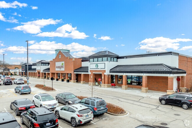
4700 Gilbert Ave
18-08-104-005-0000
EAST 890 61 FT N2 NE4 NW4 OF SEC08 T38N R12E 3P
Regionalshoppingcenterormallwithanchorstore
Cook
X
Illinois
17031C0467J
11.30 AC
2023
Eastern East/West Corr
2025
Chicago
819802
Chicago-Naperville-Elgin, IL-IN
140,579 SF
DEMOGRAPHICS near 4700 Gilbert Ave
1 Mile
3 Mile
5 Mile
2024 Total Population
14,686
107,042
250,778
2029 Population
14,198
105,172
245,693
Pop Growth 2024-2029
(3.32%)
(1.75%)
(2.03%)
Average Age
40
42
42
2024 Total Households
4,794
38,939
94,322
HH Growth 2024-2029
(3.73%)
(2.01%)
(2.27%)
Median Household Inc
$173,676
$120,889
$95,824
Avg Household Size
3.00
2.70
2.60
2024 Avg HH Vehicles
2.00
2.00
2.00
Median Home Value
$692,796
$465,449
$364,418
Median Year Built
1953
1962
1963
Nearby Places
Map Layers
Map Styles
 Street
 Aerial
- Restaurants
- Banks
- Shops
- Fitness
- Groceries
PUBLIC TRANSPORTATION
COMMUTER RAIL
Western Springs Station (Burlington Northern-Santa Fe Railway Line - Northeast Illinois Regional Commuter Railroad (Metra))
DRIVE
WALK
Distance
Western Springs Station (Burlington Northern-Santa Fe Railway Line - Northeast Illinois Regional Commuter Railroad (Metra))
2 min
16 min
0.8 mi
Lagrange/Stone Avenue Station (Burlington Northern-Santa Fe Railway Line - Northeast Illinois Regional Commuter Railroad (Metra))
DRIVE
WALK
Distance
Lagrange/Stone Avenue Station (Burlington Northern-Santa Fe Railway Line - Northeast Illinois Regional Commuter Railroad (Metra))
3 min
1.4 mi
AIRPORT
Chicago Midway International
DRIVE
WALK
Distance
Chicago Midway International
13 min
7.9 mi
Chicago O'Hare International
DRIVE
WALK
Distance
Chicago O'Hare International
27 min
18.1 mi
Freight Ports
Port Milwaukee
DRIVE
WALK
Distance
Port Milwaukee
108 min
89.8 mi
SALE & LEASE HISTORY
LISTING DATE
SALE/LEASE

Sep 25, 2016
For Lease
Sep 25, 2016
For Lease
Mar 30, 2018
For Lease
Jan 18, 2017
For Lease
Nearby Properties
Address
Land Use
TOTAL SIZE
Lot Size
Zoning
Address
Land Use
TOTAL SIZE
Lot Size
Zoning
1,182,079 SF
Address
Land Use
TOTAL SIZE
Lot Size
Zoning
54,675 SF
3.05 AC
C
Address
Land Use
TOTAL SIZE
Lot Size
Zoning
4.69 AC
C
Address
Land Use
TOTAL SIZE
Lot Size
Zoning
8.53 AC
Address
Land Use
TOTAL SIZE
Lot Size
Zoning
134,361 SF
4.09 AC
Address
Land Use
TOTAL SIZE
Lot Size
Zoning
7.16 AC
Address
Land Use
TOTAL SIZE
Lot Size
Zoning
424,376 SF
3.48 AC
Address
Land Use
TOTAL SIZE
Lot Size
Zoning
8.01 AC
Address
Land Use
TOTAL SIZE
Lot Size
Zoning
246,248 SF
19.35 AC
Address
Land Use
TOTAL SIZE
Lot Size
Zoning
Address
Land Use
TOTAL SIZE
Lot Size
Zoning
445,440 SF
24.50 AC
Address
Land Use
TOTAL SIZE
Lot Size
Zoning
140,814 SF
Address
Land Use
TOTAL SIZE
Lot Size
Zoning
137,144 SF
11.77 AC
Address
Land Use
TOTAL SIZE
Lot Size
Zoning
125,376 SF
5.38 AC
C
Address
Land Use
TOTAL SIZE
Lot Size
Zoning
136,570 SF
6.02 AC
C
Address
Land Use
TOTAL SIZE
Lot Size
Zoning
49,503 SF
1.47 AC
Address
Land Use
TOTAL SIZE
Lot Size
Zoning
274,900 SF
13.14 AC
Address
Land Use
TOTAL SIZE
Lot Size
Zoning
Address
Land Use
TOTAL SIZE
Lot Size
Zoning
124.04 AC
Address
Land Use
TOTAL SIZE
Lot Size
Zoning
85,622 SF
6.14 AC
A
Address
Land Use
TOTAL SIZE
Lot Size
Zoning
44,863 SF
9.87 AC
COM-2
Address
Land Use
TOTAL SIZE
Lot Size
Zoning
11.53 AC
Address
Land Use
TOTAL SIZE
Lot Size
Zoning
89,705 SF
2.46 AC
C
Address
Land Use
TOTAL SIZE
Lot Size
Zoning
Address
Land Use
TOTAL SIZE
Lot Size
Zoning
98,811 SF
10.02 AC
Address
Land Use
TOTAL SIZE
Lot Size
Zoning
99.88 AC
Address
Land Use
TOTAL SIZE
Lot Size
Zoning
317,321 SF
15.99 AC
Address
Land Use
TOTAL SIZE
Lot Size
Zoning
117,394 SF
9.33 AC
Address
Land Use
TOTAL SIZE
Lot Size
Zoning
65,877 SF
5.60 AC
The World's #1 Commercial Real Estate Marketplace
Connect with us
© 2026 CoStar Group
The information above has been obtained from sources believed reliable. While we do not doubt its accuracy we have not verified it and make no guarantee, warranty or representation about it. It is your responsibility to independently confirm its accuracy and completeness. Any projections, opinions, assumptions, or estimates used are for example only and do not represent the current or future performance of the property. The value of this transaction to you depends on tax and other factors which should be evaluated by your tax, financial, and legal advisors. You and your advisors should conduct a careful, independent investigation of the property to determine to your satisfaction the suitability of the property for your needs.