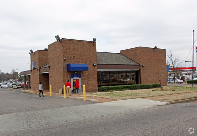
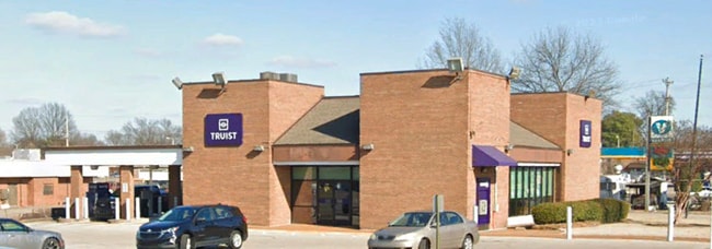
Property Record
4700 Knight Arnold Rd, Memphis, TN 38118

NEARBY LISTINGS FOR SALE OR LEASE
Property Detail
4700 Knight Arnold Rd
07-3080-0-0031C
Pt Parkway Village Community Center
Financialbuilding
NS KNIGHT ARNOLD RD
X
Shelby
47157C0435F
Tennessee
2024
0.35 AC
2025
Southeast
010610
Memphis
3,139 SF
Memphis, TN-MS-AR
DEMOGRAPHICS near 4700 Knight Arnold Rd
1 Mile
3 Mile
5 Mile
2024 Total Population
16,912
82,069
190,246
2029 Population
16,832
81,461
188,172
Pop Growth 2024-2029
(0.47%)
(0.74%)
(1.09%)
Average Age
33
35
37
2024 Total Households
5,483
30,512
75,688
HH Growth 2024-2029
(0.49%)
(0.84%)
(1.15%)
Median Household Inc
$39,854
$42,730
$46,682
Avg Household Size
3.00
2.60
2.40
2024 Avg HH Vehicles
2.00
2.00
2.00
Median Home Value
$79,390
$129,755
$166,394
Median Year Built
1969
1970
1972
Nearby Places
Map Layers
Map Styles
 Street
 Aerial
- Restaurants
- Banks
- Shops
- Fitness
- Groceries
PUBLIC TRANSPORTATION
AIRPORT
Memphis International
DRIVE
WALK
Distance
Memphis International
11 min
6.0 mi
SALE & LEASE HISTORY
LISTING DATE
SALE/LEASE

Jun 16, 2023
For Sale
Feb 20, 2018
For Sale
Nearby Properties
Address
Land Use
TOTAL SIZE
Lot Size
Zoning
Address
Land Use
TOTAL SIZE
Lot Size
Zoning
704,564 SF
28.30 AC
EMP
Address
Land Use
TOTAL SIZE
Lot Size
Zoning
189,536 SF
49.14 AC
CMU-2
Address
Land Use
TOTAL SIZE
Lot Size
Zoning
237,911 SF
21.38 AC
EMP
Address
Land Use
TOTAL SIZE
Lot Size
Zoning
118,116 SF
60.70 AC
CMU-2
Address
Land Use
TOTAL SIZE
Lot Size
Zoning
1,292,907 SF
83.13 AC
IH
Address
Land Use
TOTAL SIZE
Lot Size
Zoning
286,167 SF
18.91 AC
R-10
Address
Land Use
TOTAL SIZE
Lot Size
Zoning
419,065 SF
19.92 AC
EMP
Address
Land Use
TOTAL SIZE
Lot Size
Zoning
190,263 SF
6.59 AC
R-10
Address
Land Use
TOTAL SIZE
Lot Size
Zoning
38,488 SF
5.68 AC
CMU-1
Address
Land Use
TOTAL SIZE
Lot Size
Zoning
269,022 SF
23.76 AC
RU-3
Address
Land Use
TOTAL SIZE
Lot Size
Zoning
51,600 SF
24.06 AC
RU-3
Address
Land Use
TOTAL SIZE
Lot Size
Zoning
188,458 SF
29.19 AC
RU-3
Address
Land Use
TOTAL SIZE
Lot Size
Zoning
618,133 SF
37.58 AC
EMP
Address
Land Use
TOTAL SIZE
Lot Size
Zoning
176,176 SF
26.62 AC
R-8
Address
Land Use
TOTAL SIZE
Lot Size
Zoning
592,766 SF
26.76 AC
EMP
Address
Land Use
TOTAL SIZE
Lot Size
Zoning
500,000 SF
22.75 AC
EMP
Address
Land Use
TOTAL SIZE
Lot Size
Zoning
585,535 SF
31.96 AC
EMP
Address
Land Use
TOTAL SIZE
Lot Size
Zoning
1,137,460 SF
62.54 AC
IH
Address
Land Use
TOTAL SIZE
Lot Size
Zoning
81,454 SF
EMP
Address
Land Use
TOTAL SIZE
Lot Size
Zoning
58.21 AC
R-6
Address
Land Use
TOTAL SIZE
Lot Size
Zoning
532,073 SF
20.99 AC
EMP
Address
Land Use
TOTAL SIZE
Lot Size
Zoning
79,884 SF
16.73 AC
CMU-2
Address
Land Use
TOTAL SIZE
Lot Size
Zoning
427,500 SF
19.49 AC
EMP
Address
Land Use
TOTAL SIZE
Lot Size
Zoning
300,702 SF
14.40 AC
RU-3
Address
Land Use
TOTAL SIZE
Lot Size
Zoning
411,635 SF
18.35 AC
EMP
Address
Land Use
TOTAL SIZE
Lot Size
Zoning
355,473 SF
27.62 AC
EMP
Address
Land Use
TOTAL SIZE
Lot Size
Zoning
409,298 SF
18.94 AC
RU-1
Address
Land Use
TOTAL SIZE
Lot Size
Zoning
414,189 SF
16.71 AC
R-6
Address
Land Use
TOTAL SIZE
Lot Size
Zoning
15,370 SF
18.69 AC
RU-3
Address
Land Use
TOTAL SIZE
Lot Size
Zoning
129 AC
CMP-1
The World's #1 Commercial Real Estate Marketplace
Connect with us
© 2026 CoStar Group
The information above has been obtained from sources believed reliable. While we do not doubt its accuracy we have not verified it and make no guarantee, warranty or representation about it. It is your responsibility to independently confirm its accuracy and completeness. Any projections, opinions, assumptions, or estimates used are for example only and do not represent the current or future performance of the property. The value of this transaction to you depends on tax and other factors which should be evaluated by your tax, financial, and legal advisors. You and your advisors should conduct a careful, independent investigation of the property to determine to your satisfaction the suitability of the property for your needs.