Property Record
4700 S Westmoreland Rd, Dallas, TX 75237
NEARBY LISTINGS FOR SALE OR LEASE
Property Detail
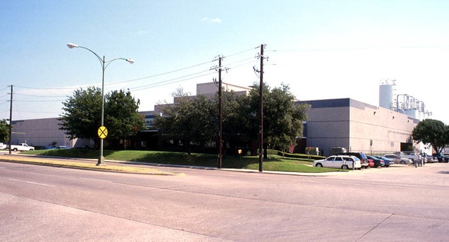
4700 S Westmoreland Rd
0060500G000000400
Redbird Business Center Ph 2
Officebuilding
REDBIRD BUSINESS CENTER PH 2 BLK G/6050 ACS 5.089 INT202400021389 DD01242024 CO-DC 6050 G00 00060 2DA6050 G00
X
Dallas
48113C0470K
Texas
2024
5.25 AC
2025
Redbird Airport
010904
Dallas/Ft Worth
140,612 SF
Dallas-Fort Worth-Arlington, TX
DEMOGRAPHICS near 4700 S Westmoreland Rd
1 Mile
3 Mile
5 Mile
2024 Total Population
5,114
103,791
267,980
2029 Population
5,110
102,489
264,871
Pop Growth 2024-2029
(0.08%)
(1.25%)
(1.16%)
Average Age
36
36
36
2024 Total Households
1,836
35,186
87,325
HH Growth 2024-2029
+ 0.11%
(1.40%)
(1.35%)
Median Household Inc
$47,836
$44,414
$47,926
Avg Household Size
2.70
2.90
3.00
2024 Avg HH Vehicles
2.00
2.00
2.00
Median Home Value
$226,825
$189,894
$190,905
Median Year Built
1981
1975
1972
Nearby Places
Map Layers
Map Styles
 Street
 Aerial
- Restaurants
- Banks
- Shops
- Fitness
- Groceries
PUBLIC TRANSPORTATION
AIRPORT
Dallas Love Field
DRIVE
WALK
Distance
Dallas Love Field
26 min
15.5 mi
Dallas-Fort Worth International
DRIVE
WALK
Distance
Dallas-Fort Worth International
33 min
24.3 mi
Nearby Properties
Address
Land Use
TOTAL SIZE
Lot Size
Zoning
Address
Land Use
TOTAL SIZE
Lot Size
Zoning
726,662 SF
44.94 AC
Z239
Address
Land Use
TOTAL SIZE
Lot Size
Zoning
344,801 SF
7.24 AC
Z125
Address
Land Use
TOTAL SIZE
Lot Size
Zoning
192,086 SF
27.05 AC
Z125
Address
Land Use
TOTAL SIZE
Lot Size
Zoning
399,458 SF
24.51 AC
MF2
Address
Land Use
TOTAL SIZE
Lot Size
Zoning
381,633 SF
21.25 AC
Z239
Address
Land Use
TOTAL SIZE
Lot Size
Zoning
172,840 SF
49.65 AC
Z164
Address
Land Use
TOTAL SIZE
Lot Size
Zoning
552,991 SF
34.27 AC
Z164
Address
Land Use
TOTAL SIZE
Lot Size
Zoning
374,400 SF
6.15 AC
Z150
Address
Land Use
TOTAL SIZE
Lot Size
Zoning
164,120 SF
15.85 AC
Z163
Address
Land Use
TOTAL SIZE
Lot Size
Zoning
344,952 SF
14.39 AC
Z239
Address
Land Use
TOTAL SIZE
Lot Size
Zoning
389,900 SF
22.88 AC
Z298
Address
Land Use
TOTAL SIZE
Lot Size
Zoning
131,904 SF
11.99 AC
Z297
Address
Land Use
TOTAL SIZE
Lot Size
Zoning
237,127 SF
12.43 AC
Z164
Address
Land Use
TOTAL SIZE
Lot Size
Zoning
414,118 SF
49.01 AC
Z294
Address
Land Use
TOTAL SIZE
Lot Size
Zoning
350,000 SF
19.77 AC
Z109
Address
Land Use
TOTAL SIZE
Lot Size
Zoning
305,727 SF
25.02 AC
Z06
Address
Land Use
TOTAL SIZE
Lot Size
Zoning
187,130 SF
15.39 AC
Z163
Address
Land Use
TOTAL SIZE
Lot Size
Zoning
500,000 SF
25 AC
Z116
Address
Land Use
TOTAL SIZE
Lot Size
Zoning
220,975 SF
10.52 AC
Z151
Address
Land Use
TOTAL SIZE
Lot Size
Zoning
235,897 SF
7.97 AC
Z150
Address
Land Use
TOTAL SIZE
Lot Size
Zoning
312,180 SF
22.71 AC
Z163
Address
Land Use
TOTAL SIZE
Lot Size
Zoning
465,000 SF
24.71 AC
Z116
Address
Land Use
TOTAL SIZE
Lot Size
Zoning
248,376 SF
15.62 AC
Z164
Address
Land Use
TOTAL SIZE
Lot Size
Zoning
160,113 SF
9.45 AC
Z187
Address
Land Use
TOTAL SIZE
Lot Size
Zoning
194,837 SF
10.79 AC
Z09
Address
Land Use
TOTAL SIZE
Lot Size
Zoning
142,616 SF
13.99 AC
Z125
Address
Land Use
TOTAL SIZE
Lot Size
Zoning
273,300 SF
12.52 AC
Z164
Address
Land Use
TOTAL SIZE
Lot Size
Zoning
206,202 SF
11.18 AC
Z163
Address
Land Use
TOTAL SIZE
Lot Size
Zoning
189,584 SF
10.09 AC
Z09
Address
Land Use
TOTAL SIZE
Lot Size
Zoning
213,351 SF
9.88 AC
Z164
The World's #1 Commercial Real Estate Marketplace
Connect with us
© 2025 CoStar Group
The information above has been obtained from sources believed reliable. While we do not doubt its accuracy we have not verified it and make no guarantee, warranty or representation about it. It is your responsibility to independently confirm its accuracy and completeness. Any projections, opinions, assumptions, or estimates used are for example only and do not represent the current or future performance of the property. The value of this transaction to you depends on tax and other factors which should be evaluated by your tax, financial, and legal advisors. You and your advisors should conduct a careful, independent investigation of the property to determine to your satisfaction the suitability of the property for your needs.