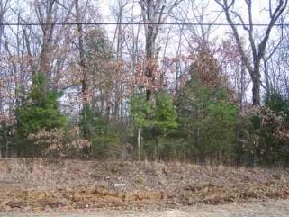
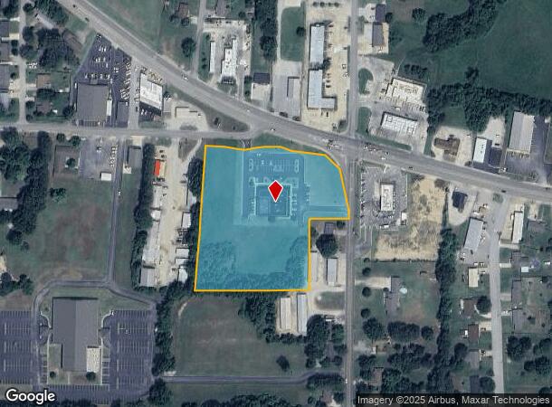
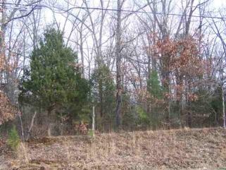
Property Record
4700 W Kingshighway, Paragould, AR 72450
NEARBY LISTINGS FOR SALE OR LEASE
Property Detail
4700 W Kingshighway
1002-33410-033
PT SE NE (.43AC) & PT NE SE (4.53AC) AS DESCRIBED IN 201702041.
Medicalbuilding
Greene
X
Arkansas
05055C0345F
4.96 AC
2025
Arkansas North Area
2025
Other Market Areas
480801
Paragould, AR
8,592 SF
DEMOGRAPHICS near 4700 W Kingshighway
1 Mile
3 Mile
5 Mile
2024 Total Population
4,475
15,132
34,076
2029 Population
4,650
15,821
35,783
Pop Growth 2024-2029
+ 3.91%
+ 4.55%
+ 5.01%
Average Age
38
40
39
2024 Total Households
1,669
5,884
13,127
HH Growth 2024-2029
+ 3.95%
+ 4.61%
+ 5.09%
Median Household Inc
$61,987
$59,258
$49,810
Avg Household Size
2.50
2.40
2.50
2024 Avg HH Vehicles
2.00
2.00
2.00
Median Home Value
$149,075
$163,446
$153,584
Median Year Built
1989
1990
1989
Nearby Places
Map Layers
Map Styles
 Street
 Aerial
- Restaurants
- Banks
- Shops
- Fitness
- Groceries
Nearby Properties
Address
Land Use
TOTAL SIZE
Lot Size
Zoning
Address
Land Use
TOTAL SIZE
Lot Size
Zoning
3,506 SF
15.68 AC
Address
Land Use
TOTAL SIZE
Lot Size
Zoning
63,070 SF
14.03 AC
Address
Land Use
TOTAL SIZE
Lot Size
Zoning
126,604 SF
11.69 AC
Address
Land Use
TOTAL SIZE
Lot Size
Zoning
181,782 SF
19.67 AC
Address
Land Use
TOTAL SIZE
Lot Size
Zoning
112,124 SF
12.49 AC
Address
Land Use
TOTAL SIZE
Lot Size
Zoning
94,163 SF
10.15 AC
Address
Land Use
TOTAL SIZE
Lot Size
Zoning
67,898 SF
19.35 AC
Address
Land Use
TOTAL SIZE
Lot Size
Zoning
21,772 SF
7.75 AC
Address
Land Use
TOTAL SIZE
Lot Size
Zoning
45,706 SF
6.39 AC
Address
Land Use
TOTAL SIZE
Lot Size
Zoning
8,960 SF
1.61 AC
Address
Land Use
TOTAL SIZE
Lot Size
Zoning
27,172 SF
1.83 AC
Address
Land Use
TOTAL SIZE
Lot Size
Zoning
18,998 SF
7.15 AC
Address
Land Use
TOTAL SIZE
Lot Size
Zoning
78,432 SF
3.84 AC
Address
Land Use
TOTAL SIZE
Lot Size
Zoning
13,340 SF
1.48 AC
Address
Land Use
TOTAL SIZE
Lot Size
Zoning
40,836 SF
6.15 AC
Address
Land Use
TOTAL SIZE
Lot Size
Zoning
14,466 SF
1.76 AC
Address
Land Use
TOTAL SIZE
Lot Size
Zoning
26,350 SF
10.36 AC
Address
Land Use
TOTAL SIZE
Lot Size
Zoning
15,421 SF
1.41 AC
Address
Land Use
TOTAL SIZE
Lot Size
Zoning
3,572 SF
2.39 AC
Address
Land Use
TOTAL SIZE
Lot Size
Zoning
6,435 SF
1.74 AC
Address
Land Use
TOTAL SIZE
Lot Size
Zoning
83,780 SF
7.49 AC
Address
Land Use
TOTAL SIZE
Lot Size
Zoning
14,224 SF
2.65 AC
Address
Land Use
TOTAL SIZE
Lot Size
Zoning
4,950 SF
1.70 AC
Address
Land Use
TOTAL SIZE
Lot Size
Zoning
9,407 SF
3.21 AC
Address
Land Use
TOTAL SIZE
Lot Size
Zoning
2,498 SF
1.62 AC
Address
Land Use
TOTAL SIZE
Lot Size
Zoning
26,723 SF
1.54 AC
Address
Land Use
TOTAL SIZE
Lot Size
Zoning
4,479 SF
1.46 AC
Address
Land Use
TOTAL SIZE
Lot Size
Zoning
7,407 SF
3.50 AC
Address
Land Use
TOTAL SIZE
Lot Size
Zoning
3,062 SF
1.09 AC
Address
Land Use
TOTAL SIZE
Lot Size
Zoning
9,942 SF
2 AC
The World's #1 Commercial Real Estate Marketplace
Connect with us
© 2026 CoStar Group
The information above has been obtained from sources believed reliable. While we do not doubt its accuracy we have not verified it and make no guarantee, warranty or representation about it. It is your responsibility to independently confirm its accuracy and completeness. Any projections, opinions, assumptions, or estimates used are for example only and do not represent the current or future performance of the property. The value of this transaction to you depends on tax and other factors which should be evaluated by your tax, financial, and legal advisors. You and your advisors should conduct a careful, independent investigation of the property to determine to your satisfaction the suitability of the property for your needs.