Property Record
4700 Wilmer Ct, Cincinnati, OH 45226

NEARBY LISTINGS FOR SALE OR LEASE
-
-
View all Cincinnati listings for sale on LoopNet.com
Property Detail
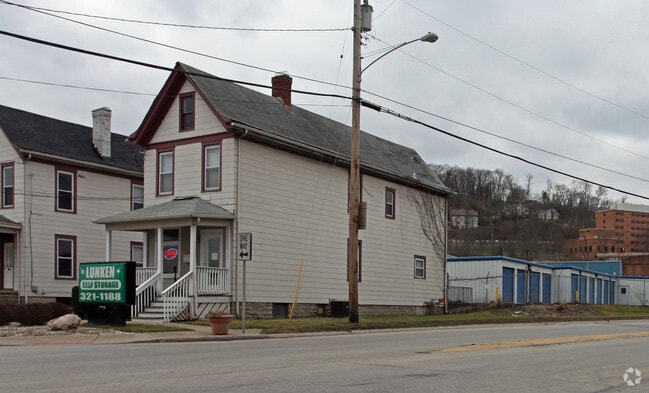
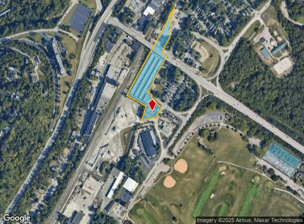
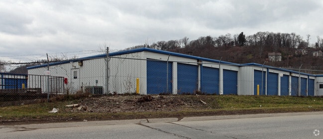
4700 Wilmer Ct
015-0002-0153
WS WILMER AVE 5.15 AC R2-T4-S19
Publicstorage
Hamilton
AE
Ohio
39061C0356G
5.15 AC
2024
Fairfax/Mt. Lookout
2024
Cincinnati/Dayton
004703
Cincinnati, OH-KY-IN
2,984 SF
DEMOGRAPHICS near 4700 Wilmer Ct
1 Mile
3 Mile
5 Mile
2024 Total Population
4,656
68,302
229,341
2029 Population
4,587
67,654
229,121
Pop Growth 2024-2029
(1.48%)
(0.95%)
(0.10%)
Average Age
38
39
39
2024 Total Households
1,999
32,480
103,034
HH Growth 2024-2029
(1.60%)
(1.11%)
(0.18%)
Median Household Inc
$117,261
$90,491
$70,673
Avg Household Size
2.30
2.00
2.10
2024 Avg HH Vehicles
2.00
2.00
2.00
Median Home Value
$538,713
$331,138
$262,947
Median Year Built
1948
1953
1951
Nearby Places
Map Layers
Map Styles
 Street
 Aerial
- Restaurants
- Banks
- Shops
- Fitness
- Groceries
PUBLIC TRANSPORTATION
COMMUTER RAIL
Cincinnati Union Terminal (Cardinal - Amtrak)
DRIVE
WALK
Distance
Cincinnati Union Terminal (Cardinal - Amtrak)
18 min
9.4 mi
AIRPORT
Cincinnati/Northern Kentucky International
DRIVE
WALK
Distance
Cincinnati/Northern Kentucky International
37 min
20.9 mi
Freight Ports
Port of Toledo
DRIVE
WALK
Distance
Port of Toledo
246 min
208.1 mi
Nearby Properties
Address
Land Use
TOTAL SIZE
Lot Size
Zoning
Address
Land Use
TOTAL SIZE
Lot Size
Zoning
13.80 AC
Address
Land Use
TOTAL SIZE
Lot Size
Zoning
27.30 AC
M2
Address
Land Use
TOTAL SIZE
Lot Size
Zoning
11.68 AC
Address
Land Use
TOTAL SIZE
Lot Size
Zoning
26,453 SF
19.91 AC
M2
Address
Land Use
TOTAL SIZE
Lot Size
Zoning
148,748 SF
24.90 AC
CGA
Address
Land Use
TOTAL SIZE
Lot Size
Zoning
3.17 AC
R2PUD
Address
Land Use
TOTAL SIZE
Lot Size
Zoning
Address
Land Use
TOTAL SIZE
Lot Size
Zoning
5.07 AC
Address
Land Use
TOTAL SIZE
Lot Size
Zoning
Address
Land Use
TOTAL SIZE
Lot Size
Zoning
6.93 AC
MG
Address
Land Use
TOTAL SIZE
Lot Size
Zoning
12.46 AC
Address
Land Use
TOTAL SIZE
Lot Size
Zoning
89,925 SF
1.72 AC
Address
Land Use
TOTAL SIZE
Lot Size
Zoning
83,122 SF
1.99 AC
Address
Land Use
TOTAL SIZE
Lot Size
Zoning
6.91 AC
Address
Land Use
TOTAL SIZE
Lot Size
Zoning
24,572 SF
4.70 AC
Address
Land Use
TOTAL SIZE
Lot Size
Zoning
3,864 SF
5.30 AC
PD
Address
Land Use
TOTAL SIZE
Lot Size
Zoning
4,706 SF
18.29 AC
RM20
Address
Land Use
TOTAL SIZE
Lot Size
Zoning
33,468 SF
1.04 AC
Address
Land Use
TOTAL SIZE
Lot Size
Zoning
2.17 AC
O
Address
Land Use
TOTAL SIZE
Lot Size
Zoning
9,515 SF
19.13 AC
Address
Land Use
TOTAL SIZE
Lot Size
Zoning
18.51 AC
RM20
Address
Land Use
TOTAL SIZE
Lot Size
Zoning
15.86 AC
Address
Land Use
TOTAL SIZE
Lot Size
Zoning
2.20 AC
Address
Land Use
TOTAL SIZE
Lot Size
Zoning
84,028 SF
0.52 AC
Address
Land Use
TOTAL SIZE
Lot Size
Zoning
81,670 SF
12.50 AC
SF20
Address
Land Use
TOTAL SIZE
Lot Size
Zoning
11.04 AC
SF20
Address
Land Use
TOTAL SIZE
Lot Size
Zoning
0.74 AC
R2PUD
Address
Land Use
TOTAL SIZE
Lot Size
Zoning
1.33 AC
R2PUD
Address
Land Use
TOTAL SIZE
Lot Size
Zoning
Address
Land Use
TOTAL SIZE
Lot Size
Zoning
20.38 AC
The World's #1 Commercial Real Estate Marketplace
Connect with us
© 2025 CoStar Group
The information above has been obtained from sources believed reliable. While we do not doubt its accuracy we have not verified it and make no guarantee, warranty or representation about it. It is your responsibility to independently confirm its accuracy and completeness. Any projections, opinions, assumptions, or estimates used are for example only and do not represent the current or future performance of the property. The value of this transaction to you depends on tax and other factors which should be evaluated by your tax, financial, and legal advisors. You and your advisors should conduct a careful, independent investigation of the property to determine to your satisfaction the suitability of the property for your needs.