Property Record
4701 Ayers St, Corpus Christi, TX 78415


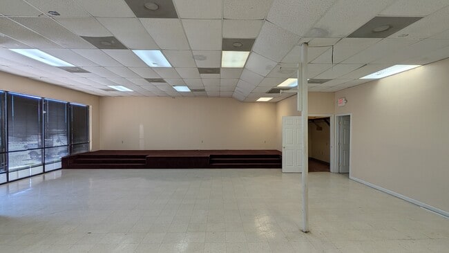
Property Detail
4701 Ayers St
192775
BEHMANN ADD LT 1-A BK 2
Commercialnec
NUECES
I-2
Texas
B and X Area of moderate flood hazard, usually the area between the limits of the 100-year and 500-year floods.
1a
2024
5.06 AC
2025
Mid-City
001801
Corpus Christi
48,520 SF
Corpus Christi, TX
NEARBY LISTINGS FOR SALE OR LEASE
DEMOGRAPHICS near 4701 Ayers St
1 mile
3 mile
5 mile
2025 Total Population
12,582
98,744
172,097
2030 Population
12,236
97,226
170,054
Pop Growth 2025-2030
(2.75%)
(1.54%)
(1.19%)
Average Age
39
39
39
2025 Total Households
4,262
35,804
64,332
HH Growth 2025-2030
(2.96%)
(1.58%)
(1.22%)
Median Household Inc
$51,651
$53,254
$55,915
Avg Household Size
2.80
2.70
2.60
2025 Avg HH Vehicles
2.00
2.00
2.00
Median Home Value
$93,787
$138,965
$163,116
Median Year Built
1955
1962
1970
Nearby Places
Map Layers
Map Styles
 Street
 Aerial
Layers
 Traffic
 Biking
Places
Listings with unknown addresses are not visible on the map
- Restaurants
- Banks
- Shops
- Fitness
- Groceries
PUBLIC TRANSPORTATION
AIRPORT
Corpus Christi International
Drive
Walk
Distance
Corpus Christi International
14 min
8.1 mi
Freight Ports
Port of Corpus Christi
Drive
Walk
Distance
Port of Corpus Christi
8 min
5.4 mi
SALE & LEASE HISTORY
LISTING DATE
SALE/LEASE

Sep 25, 2016
For Lease
Oct 13, 2025
For Lease
Nov 27, 2024
For Lease
Nov 09, 2017
For Lease
Apr 24, 2025
For Lease
Nearby Properties
Address
Land Use
TOTAL SIZE
Lot Size
Zoning
Address
Land Use
TOTAL SIZE
Lot Size
Zoning
567,638 SF
18.37 AC
B4
Address
Land Use
TOTAL SIZE
Lot Size
Zoning
419,479 SF
32.65 AC
Address
Land Use
TOTAL SIZE
Lot Size
Zoning
382,448 SF
14.98 AC
Address
Land Use
TOTAL SIZE
Lot Size
Zoning
1 SF
62.73 AC
III
Address
Land Use
TOTAL SIZE
Lot Size
Zoning
302,344 SF
5 AC
Address
Land Use
TOTAL SIZE
Lot Size
Zoning
176,076 SF
19.84 AC
R1B
Address
Land Use
TOTAL SIZE
Lot Size
Zoning
251,402 SF
7.17 AC
Address
Land Use
TOTAL SIZE
Lot Size
Zoning
117,000 SF
19.20 AC
R1B
Address
Land Use
TOTAL SIZE
Lot Size
Zoning
278,919 SF
39.27 AC
R1B
Address
Land Use
TOTAL SIZE
Lot Size
Zoning
78,000 SF
6.92 AC
R1B
Address
Land Use
TOTAL SIZE
Lot Size
Zoning
1 SF
40.02 AC
R1B
Address
Land Use
TOTAL SIZE
Lot Size
Zoning
74,247 SF
6.39 AC
Address
Land Use
TOTAL SIZE
Lot Size
Zoning
124,257 SF
7.63 AC
Address
Land Use
TOTAL SIZE
Lot Size
Zoning
65,301 SF
7.37 AC
B-4
Address
Land Use
TOTAL SIZE
Lot Size
Zoning
85,871 SF
18.68 AC
R1B
Address
Land Use
TOTAL SIZE
Lot Size
Zoning
11,109 SF
76.58 AC
R1B
Address
Land Use
TOTAL SIZE
Lot Size
Zoning
89,537 SF
11.35 AC
R1B
Address
Land Use
TOTAL SIZE
Lot Size
Zoning
83,835 SF
19.14 AC
Address
Land Use
TOTAL SIZE
Lot Size
Zoning
108,420 SF
20 AC
R1B
Address
Land Use
TOTAL SIZE
Lot Size
Zoning
101,912 SF
13.89 AC
I-2
Address
Land Use
TOTAL SIZE
Lot Size
Zoning
74,261 SF
4.44 AC
R1B
Address
Land Use
TOTAL SIZE
Lot Size
Zoning
105.49 AC
R1B
Address
Land Use
TOTAL SIZE
Lot Size
Zoning
13,773 SF
28.82 AC
R1B
Address
Land Use
TOTAL SIZE
Lot Size
Zoning
114,121 SF
2.64 AC
B-4
Address
Land Use
TOTAL SIZE
Lot Size
Zoning
42,984 SF
5.20 AC
Address
Land Use
TOTAL SIZE
Lot Size
Zoning
186,106 SF
6.54 AC
B1
Address
Land Use
TOTAL SIZE
Lot Size
Zoning
94,600 SF
9.29 AC
R2
Address
Land Use
TOTAL SIZE
Lot Size
Zoning
108,064 SF
6.09 AC
R1A
Address
Land Use
TOTAL SIZE
Lot Size
Zoning
140,058 SF
90.04 AC
I2
Address
Land Use
TOTAL SIZE
Lot Size
Zoning
95,658 SF
21.87 AC
I2
The World's #1 Commercial Real Estate Marketplace
Connect with us
© 2026 CoStar Group
The information above has been obtained from sources believed reliable. While we do not doubt its accuracy we have not verified it and make no guarantee, warranty or representation about it. It is your responsibility to independently confirm its accuracy and completeness. Any projections, opinions, assumptions, or estimates used are for example only and do not represent the current or future performance of the property. The value of this transaction to you depends on tax and other factors which should be evaluated by your tax, financial, and legal advisors. You and your advisors should conduct a careful, independent investigation of the property to determine to your satisfaction the suitability of the property for your needs.