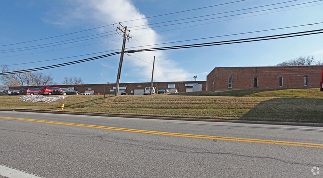
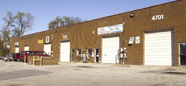
Property Record
4701 Belle Grove Rd, Brooklyn, MD 21225

Current Lease Availabilities
NEARBY LISTINGS FOR SALE OR LEASE
Property Detail
4701 Belle Grove Rd
05-047-09474583
Brooklyn Park
Warehouse
3.7067 ACRES BROOKLYN PARK
X
Anne Arundel
2400100530H
Maryland
2024
3.70 AC
2025
Route 2 Corridor
750204
Baltimore
40,820 SF
Baltimore-Columbia-Towson, MD
DEMOGRAPHICS near 4701 Belle Grove Rd
1 Mile
3 Mile
5 Mile
2024 Total Population
14,596
86,117
253,650
2029 Population
14,664
85,548
250,616
Pop Growth 2024-2029
+ 0.47%
(0.66%)
(1.20%)
Average Age
37
37
38
2024 Total Households
5,005
31,667
108,345
HH Growth 2024-2029
+ 0.52%
(0.73%)
(1.62%)
Median Household Inc
$67,963
$59,413
$68,892
Avg Household Size
2.80
2.60
2.30
2024 Avg HH Vehicles
2.00
2.00
1.00
Median Home Value
$188,352
$230,297
$272,986
Median Year Built
1952
1957
1955
Nearby Places
Map Layers
Map Styles
 Street
 Aerial
- Restaurants
- Banks
- Shops
- Fitness
- Groceries
PUBLIC TRANSPORTATION
COMMUTER RAIL
Camden Station (Camden Line - Maryland Area Regional Commuter Trains (The MARC))
DRIVE
WALK
Distance
Camden Station (Camden Line - Maryland Area Regional Commuter Trains (The MARC))
12 min
4.9 mi
DRIVE
WALK
Distance
14 min
6.5 mi
AIRPORT
Baltimore/Washington International Thurgood Marshall
DRIVE
WALK
Distance
Baltimore/Washington International Thurgood Marshall
14 min
5.6 mi
Ronald Reagan Washington Ntl
DRIVE
WALK
Distance
Ronald Reagan Washington Ntl
62 min
39.8 mi
Freight Ports
Port of Baltimore
DRIVE
WALK
Distance
Port of Baltimore
12 min
5.2 mi
Nearby Properties
Address
Land Use
TOTAL SIZE
Lot Size
Zoning
Address
Land Use
TOTAL SIZE
Lot Size
Zoning
467.03 AC
W2
Address
Land Use
TOTAL SIZE
Lot Size
Zoning
642,817 SF
1.91 AC
PC-2
Address
Land Use
TOTAL SIZE
Lot Size
Zoning
520,407 SF
16.85 AC
H
Address
Land Use
TOTAL SIZE
Lot Size
Zoning
309,558 SF
3.01 AC
C-2
Address
Land Use
TOTAL SIZE
Lot Size
Zoning
315,605 SF
1.80 AC
Address
Land Use
TOTAL SIZE
Lot Size
Zoning
442,145 SF
2.30 AC
C-2
Address
Land Use
TOTAL SIZE
Lot Size
Zoning
383,697 SF
68.35 AC
R5
Address
Land Use
TOTAL SIZE
Lot Size
Zoning
289,829 SF
24.56 AC
C3
Address
Land Use
TOTAL SIZE
Lot Size
Zoning
234,439 SF
1.02 AC
Address
Land Use
TOTAL SIZE
Lot Size
Zoning
290,000 SF
1.51 AC
PC-2
Address
Land Use
TOTAL SIZE
Lot Size
Zoning
19.20 AC
R15
Address
Land Use
TOTAL SIZE
Lot Size
Zoning
12.90 AC
R15
Address
Land Use
TOTAL SIZE
Lot Size
Zoning
233,408 SF
24.73 AC
C3
Address
Land Use
TOTAL SIZE
Lot Size
Zoning
132,655 SF
0.74 AC
Address
Land Use
TOTAL SIZE
Lot Size
Zoning
263,024 SF
6.87 AC
C3
Address
Land Use
TOTAL SIZE
Lot Size
Zoning
18.86 AC
DR16
Address
Land Use
TOTAL SIZE
Lot Size
Zoning
173,735 SF
17.31 AC
PC-4
Address
Land Use
TOTAL SIZE
Lot Size
Zoning
41.14 AC
W1-BW
Address
Land Use
TOTAL SIZE
Lot Size
Zoning
16.26 AC
R15
Address
Land Use
TOTAL SIZE
Lot Size
Zoning
15.05 AC
R15
Address
Land Use
TOTAL SIZE
Lot Size
Zoning
239,476 SF
19.02 AC
MI
Address
Land Use
TOTAL SIZE
Lot Size
Zoning
12 AC
C3
Address
Land Use
TOTAL SIZE
Lot Size
Zoning
101,220 SF
17.51 AC
DR5.5
Address
Land Use
TOTAL SIZE
Lot Size
Zoning
190,650 SF
20.80 AC
I-2
Address
Land Use
TOTAL SIZE
Lot Size
Zoning
393,126 SF
2.18 AC
OR-2
Address
Land Use
TOTAL SIZE
Lot Size
Zoning
19.86 AC
DR16
Address
Land Use
TOTAL SIZE
Lot Size
Zoning
10.92 AC
R15
Address
Land Use
TOTAL SIZE
Lot Size
Zoning
227,704 SF
23.52 AC
C4
Address
Land Use
TOTAL SIZE
Lot Size
Zoning
265,423 SF
22.26 AC
MI
Address
Land Use
TOTAL SIZE
Lot Size
Zoning
209,044 SF
17.28 AC
C3
The World's #1 Commercial Real Estate Marketplace
Connect with us
© 2026 CoStar Group
The information above has been obtained from sources believed reliable. While we do not doubt its accuracy we have not verified it and make no guarantee, warranty or representation about it. It is your responsibility to independently confirm its accuracy and completeness. Any projections, opinions, assumptions, or estimates used are for example only and do not represent the current or future performance of the property. The value of this transaction to you depends on tax and other factors which should be evaluated by your tax, financial, and legal advisors. You and your advisors should conduct a careful, independent investigation of the property to determine to your satisfaction the suitability of the property for your needs.