Property Record
4701 Farwell St, Mcfarland, WI 53558

NEARBY LISTINGS FOR SALE OR LEASE
-
-
View all Mcfarland listings for sale on LoopNet.com
Property Detail
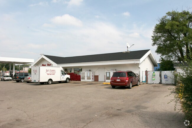
4701 Farwell St
Madison, WI
LOT 1 CSM 13439 CS87/168&169-1/28/2013 F/K/A LOTS 1 & 2 CSM 10138 CS59/191&192- 8/10/2001 F/K/A LOT 1 CSM 8341 CS45/135 F/K/A LOT 1 CSM 5589 & ALSO F/K/A PRT OF OUTLOT 70 ASSR PLAT VIL OF MCFARLAND & ALSO F/K/A LOTS 1 & 2 CSM 3176 CS12/233- 5/17/79 D
0610-032-5321-1
Dane
Commercialnec
Wisconsin
X
1,2
55025C0443J
1.57 AC
2024
Southeast Madison
2024
Milwaukee/Madison
010504
DEMOGRAPHICS near 4701 Farwell St
1 Mile
3 Mile
5 Mile
2024 Total Population
5,681
17,955
55,273
2029 Population
5,900
18,661
57,340
Pop Growth 2024-2029
+ 3.85%
+ 3.93%
+ 3.74%
Average Age
41
40
41
2024 Total Households
2,399
7,266
23,910
HH Growth 2024-2029
+ 4.04%
+ 4.05%
+ 3.88%
Median Household Inc
$77,243
$94,418
$81,055
Avg Household Size
2.30
2.40
2.20
2024 Avg HH Vehicles
2.00
2.00
2.00
Median Home Value
$327,202
$335,035
$311,559
Median Year Built
1984
1989
1978
Nearby Places
Map Layers
Map Styles
 Street
 Aerial
- Restaurants
- Banks
- Shops
- Fitness
- Groceries
PUBLIC TRANSPORTATION
AIRPORT
Dane County Regional/Truax Field
DRIVE
WALK
Distance
Dane County Regional/Truax Field
18 min
10.7 mi
Nearby Properties
Address
Land Use
TOTAL SIZE
Lot Size
Zoning
Address
Land Use
TOTAL SIZE
Lot Size
Zoning
168,685 SF
14.05 AC
IL
Address
Land Use
TOTAL SIZE
Lot Size
Zoning
3.59 AC
Address
Land Use
TOTAL SIZE
Lot Size
Zoning
2.38 AC
Address
Land Use
TOTAL SIZE
Lot Size
Zoning
19.81 AC
Address
Land Use
TOTAL SIZE
Lot Size
Zoning
5.53 AC
Address
Land Use
TOTAL SIZE
Lot Size
Zoning
3.49 AC
Address
Land Use
TOTAL SIZE
Lot Size
Zoning
6,868 SF
18.35 AC
IL
Address
Land Use
TOTAL SIZE
Lot Size
Zoning
202,800 SF
13.05 AC
IL
Address
Land Use
TOTAL SIZE
Lot Size
Zoning
49,562 SF
4.42 AC
SE
Address
Land Use
TOTAL SIZE
Lot Size
Zoning
17,980 SF
6.25 AC
SR-V2
Address
Land Use
TOTAL SIZE
Lot Size
Zoning
9,030 SF
6.59 AC
SR-V2
Address
Land Use
TOTAL SIZE
Lot Size
Zoning
113,341 SF
11.66 AC
IL
Address
Land Use
TOTAL SIZE
Lot Size
Zoning
131,874 SF
8.98 AC
IL
Address
Land Use
TOTAL SIZE
Lot Size
Zoning
14.34 AC
IL
Address
Land Use
TOTAL SIZE
Lot Size
Zoning
11.76 AC
Address
Land Use
TOTAL SIZE
Lot Size
Zoning
7.98 AC
Address
Land Use
TOTAL SIZE
Lot Size
Zoning
7.24 AC
C-2
Address
Land Use
TOTAL SIZE
Lot Size
Zoning
3,600 SF
50.85 AC
PMHP
Address
Land Use
TOTAL SIZE
Lot Size
Zoning
2.07 AC
Address
Land Use
TOTAL SIZE
Lot Size
Zoning
10,440 SF
9.53 AC
IL
Address
Land Use
TOTAL SIZE
Lot Size
Zoning
Address
Land Use
TOTAL SIZE
Lot Size
Zoning
86,400 SF
6.53 AC
IL
Address
Land Use
TOTAL SIZE
Lot Size
Zoning
7.52 AC
IL
Address
Land Use
TOTAL SIZE
Lot Size
Zoning
3.30 AC
Address
Land Use
TOTAL SIZE
Lot Size
Zoning
122,500 SF
9.99 AC
IL
Address
Land Use
TOTAL SIZE
Lot Size
Zoning
50,000 SF
4.07 AC
IL
Address
Land Use
TOTAL SIZE
Lot Size
Zoning
43,740 SF
3.45 AC
IL
Address
Land Use
TOTAL SIZE
Lot Size
Zoning
111,000 SF
8.80 AC
IL
Address
Land Use
TOTAL SIZE
Lot Size
Zoning
72,273 SF
2.67 AC
SR-V2
The World's #1 Commercial Real Estate Marketplace
Connect with us
© 2026 CoStar Group
The information above has been obtained from sources believed reliable. While we do not doubt its accuracy we have not verified it and make no guarantee, warranty or representation about it. It is your responsibility to independently confirm its accuracy and completeness. Any projections, opinions, assumptions, or estimates used are for example only and do not represent the current or future performance of the property. The value of this transaction to you depends on tax and other factors which should be evaluated by your tax, financial, and legal advisors. You and your advisors should conduct a careful, independent investigation of the property to determine to your satisfaction the suitability of the property for your needs.