Property Record
4703 Interstate Blvd, Loves Park, IL 61111
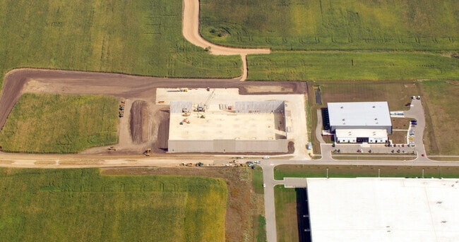

Property Detail
4703 Interstate Blvd
Rockford, IL
BUSINESS PARK AT SPRING CREEK LAKES PLAT 3 PT SE1/4 SEC 35-45-2 & SW1/4 SEC36-45-2 LT 13
08-36-300-034
WINNEBAGO
Industrialgeneral
Illinois
B and X Area of moderate flood hazard, usually the area between the limits of the 100-year and 500-year floods.
13
2024
I-39 Cor/Winnebago Cy
2024
Chicago
003809
NEARBY LISTINGS FOR SALE OR LEASE
-
-
View all Loves Park listings for sale on LoopNet.com
DEMOGRAPHICS near 4703 Interstate Blvd
1 mile
3 mile
5 mile
2025 Total Population
2,216
22,015
76,497
2030 Population
2,266
22,097
76,811
Pop Growth 2025-2030
+ 2.26%
+ 0.37%
+ 0.41%
Average Age
42
43
43
2025 Total Households
937
9,220
31,291
HH Growth 2025-2030
+ 2.24%
+ 0.38%
+ 0.42%
Median Household Inc
$86,582
$89,394
$82,007
Avg Household Size
2.40
2.40
2.40
2025 Avg HH Vehicles
2.00
2.00
2.00
Median Home Value
$212,459
$211,965
$191,631
Median Year Built
2002
1994
1987
Nearby Places
Map Layers
Map Styles
 Street
 Aerial
Layers
 Traffic
 Biking
Places
Listings with unknown addresses are not visible on the map
- Restaurants
- Banks
- Shops
- Fitness
- Groceries
PUBLIC TRANSPORTATION
AIRPORT
Chicago/Rockford International
Drive
Walk
Distance
Chicago/Rockford International
30 min
18.2 mi
Freight Ports
Port Milwaukee
Drive
Walk
Distance
Port Milwaukee
104 min
86.5 mi
Nearby Properties
Address
Land Use
TOTAL SIZE
Lot Size
Zoning
Address
Land Use
TOTAL SIZE
Lot Size
Zoning
189,000 SF
56.75 AC
IL - INDUS
Address
Land Use
TOTAL SIZE
Lot Size
Zoning
Address
Land Use
TOTAL SIZE
Lot Size
Zoning
Address
Land Use
TOTAL SIZE
Lot Size
Zoning
Address
Land Use
TOTAL SIZE
Lot Size
Zoning
69,864 SF
9.39 AC
C3
Address
Land Use
TOTAL SIZE
Lot Size
Zoning
195,672 SF
10.63 AC
C3
Address
Land Use
TOTAL SIZE
Lot Size
Zoning
213,659 SF
18 AC
IL
Address
Land Use
TOTAL SIZE
Lot Size
Zoning
10.01 AC
Address
Land Use
TOTAL SIZE
Lot Size
Zoning
151,523 SF
16.05 AC
CR
Address
Land Use
TOTAL SIZE
Lot Size
Zoning
65,541 SF
24.36 AC
C3
Address
Land Use
TOTAL SIZE
Lot Size
Zoning
67,360 SF
5.91 AC
C2
Address
Land Use
TOTAL SIZE
Lot Size
Zoning
81,248 SF
10.20 AC
Address
Land Use
TOTAL SIZE
Lot Size
Zoning
79,147 SF
5.08 AC
R3
Address
Land Use
TOTAL SIZE
Lot Size
Zoning
210,007 SF
15.86 AC
C2
Address
Land Use
TOTAL SIZE
Lot Size
Zoning
Address
Land Use
TOTAL SIZE
Lot Size
Zoning
31,080 SF
2.53 AC
C2
Address
Land Use
TOTAL SIZE
Lot Size
Zoning
46,750 SF
9.11 AC
Address
Land Use
TOTAL SIZE
Lot Size
Zoning
62.32 AC
C3
Address
Land Use
TOTAL SIZE
Lot Size
Zoning
44,989 SF
4.51 AC
C2
Address
Land Use
TOTAL SIZE
Lot Size
Zoning
72,149 SF
1.12 AC
C1
Address
Land Use
TOTAL SIZE
Lot Size
Zoning
85,500 SF
9.10 AC
C1
Address
Land Use
TOTAL SIZE
Lot Size
Zoning
136,775 SF
24.28 AC
IL_CR
Address
Land Use
TOTAL SIZE
Lot Size
Zoning
55,928 SF
7.86 AC
IL_CR
Address
Land Use
TOTAL SIZE
Lot Size
Zoning
52,560 SF
5.21 AC
C1
Address
Land Use
TOTAL SIZE
Lot Size
Zoning
50,608 SF
7.99 AC
Address
Land Use
TOTAL SIZE
Lot Size
Zoning
31,547 SF
10.40 AC
R3
Address
Land Use
TOTAL SIZE
Lot Size
Zoning
58,913 SF
2.07 AC
IL_CR
Address
Land Use
TOTAL SIZE
Lot Size
Zoning
75,350 SF
10 AC
C2
Address
Land Use
TOTAL SIZE
Lot Size
Zoning
48,421 SF
6.67 AC
IL_CR
The World's #1 Commercial Real Estate Marketplace
Connect with us
© 2026 CoStar Group
The information above has been obtained from sources believed reliable. While we do not doubt its accuracy we have not verified it and make no guarantee, warranty or representation about it. It is your responsibility to independently confirm its accuracy and completeness. Any projections, opinions, assumptions, or estimates used are for example only and do not represent the current or future performance of the property. The value of this transaction to you depends on tax and other factors which should be evaluated by your tax, financial, and legal advisors. You and your advisors should conduct a careful, independent investigation of the property to determine to your satisfaction the suitability of the property for your needs.