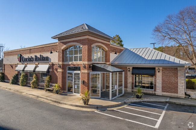
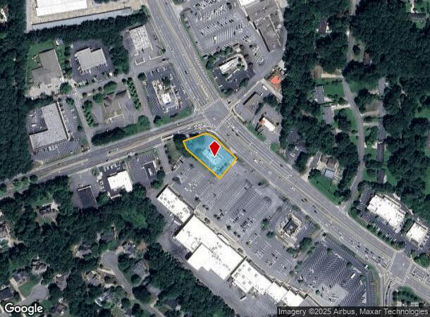
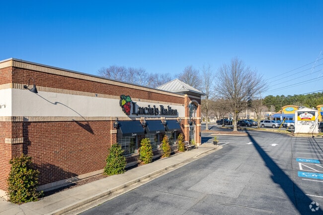
Property Record
4705 Woodstock Rd, Roswell, GA 30075

NEARBY LISTINGS FOR SALE OR LEASE
Property Detail
4705 Woodstock Rd
16-0107-0-030-0
Cobb
Restaurantbuilding
Georgia
X
107
13057C0358E
0.70 AC
2025
Roswell/Alpharetta
2025
Atlanta
030342
Atlanta-Sandy Springs-Roswell, GA
3,113 SF
DEMOGRAPHICS near 4705 Woodstock Rd
1 Mile
3 Mile
5 Mile
2024 Total Population
5,816
53,932
155,735
2029 Population
5,906
56,225
162,480
Pop Growth 2024-2029
+ 1.55%
+ 4.25%
+ 4.33%
Average Age
41
42
41
2024 Total Households
1,940
18,965
55,471
HH Growth 2024-2029
+ 1.70%
+ 4.65%
+ 4.62%
Median Household Inc
$163,573
$145,817
$137,243
Avg Household Size
3.00
2.80
2.80
2024 Avg HH Vehicles
2.00
2.00
2.00
Median Home Value
$479,351
$462,218
$446,480
Median Year Built
1985
1988
1988
Nearby Places
Map Layers
Map Styles
 Street
 Aerial
- Restaurants
- Banks
- Shops
- Fitness
- Groceries
PUBLIC TRANSPORTATION
AIRPORT
Hartsfield - Jackson Atlanta International
DRIVE
WALK
Distance
Hartsfield - Jackson Atlanta International
54 min
36.8 mi
Nearby Properties
Address
Land Use
TOTAL SIZE
Lot Size
Zoning
Address
Land Use
TOTAL SIZE
Lot Size
Zoning
330,192 SF
20.40 AC
GC
Address
Land Use
TOTAL SIZE
Lot Size
Zoning
264,255 SF
51 AC
E2
Address
Land Use
TOTAL SIZE
Lot Size
Zoning
71,000 SF
48.73 AC
E1
Address
Land Use
TOTAL SIZE
Lot Size
Zoning
179,182 SF
15.06 AC
OI
Address
Land Use
TOTAL SIZE
Lot Size
Zoning
377,080 SF
19.37 AC
E1
Address
Land Use
TOTAL SIZE
Lot Size
Zoning
299,502 SF
19.77 AC
E2
Address
Land Use
TOTAL SIZE
Lot Size
Zoning
139,694 SF
16.35 AC
GC/WS
Address
Land Use
TOTAL SIZE
Lot Size
Zoning
113,274 SF
14.30 AC
NRC
Address
Land Use
TOTAL SIZE
Lot Size
Zoning
95,478 SF
3 AC
Address
Land Use
TOTAL SIZE
Lot Size
Zoning
75,560 SF
10.32 AC
E2
Address
Land Use
TOTAL SIZE
Lot Size
Zoning
158,427 SF
11.17 AC
GC
Address
Land Use
TOTAL SIZE
Lot Size
Zoning
96,575 SF
14.19 AC
CRC
Address
Land Use
TOTAL SIZE
Lot Size
Zoning
25.40 AC
E1
Address
Land Use
TOTAL SIZE
Lot Size
Zoning
100,696 SF
9.96 AC
E2
Address
Land Use
TOTAL SIZE
Lot Size
Zoning
82,005 SF
15.82 AC
E1
Address
Land Use
TOTAL SIZE
Lot Size
Zoning
86,896 SF
8.08 AC
E2
Address
Land Use
TOTAL SIZE
Lot Size
Zoning
121,240 SF
21.04 AC
R1C
Address
Land Use
TOTAL SIZE
Lot Size
Zoning
59,241 SF
8.98 AC
Address
Land Use
TOTAL SIZE
Lot Size
Zoning
138,200 SF
17.70 AC
CRC/WS
Address
Land Use
TOTAL SIZE
Lot Size
Zoning
43,403 SF
4.09 AC
OI
Address
Land Use
TOTAL SIZE
Lot Size
Zoning
90,942 SF
1.33 AC
NRC/WS
Address
Land Use
TOTAL SIZE
Lot Size
Zoning
121,844 SF
17.61 AC
CRC/WS
Address
Land Use
TOTAL SIZE
Lot Size
Zoning
99,450 SF
14.63 AC
E1
Address
Land Use
TOTAL SIZE
Lot Size
Zoning
56,868 SF
6.41 AC
CRC
Address
Land Use
TOTAL SIZE
Lot Size
Zoning
34,875 SF
5.35 AC
E2
Address
Land Use
TOTAL SIZE
Lot Size
Zoning
101,452 SF
5.42 AC
PUD
Address
Land Use
TOTAL SIZE
Lot Size
Zoning
105,216 SF
10.42 AC
GC
Address
Land Use
TOTAL SIZE
Lot Size
Zoning
35,511 SF
15.74 AC
R1
Address
Land Use
TOTAL SIZE
Lot Size
Zoning
33,478 SF
3.57 AC
E2
Address
Land Use
TOTAL SIZE
Lot Size
Zoning
79,905 SF
3.39 AC
NRC
The World's #1 Commercial Real Estate Marketplace
Connect with us
© 2025 CoStar Group
The information above has been obtained from sources believed reliable. While we do not doubt its accuracy we have not verified it and make no guarantee, warranty or representation about it. It is your responsibility to independently confirm its accuracy and completeness. Any projections, opinions, assumptions, or estimates used are for example only and do not represent the current or future performance of the property. The value of this transaction to you depends on tax and other factors which should be evaluated by your tax, financial, and legal advisors. You and your advisors should conduct a careful, independent investigation of the property to determine to your satisfaction the suitability of the property for your needs.