Property Record
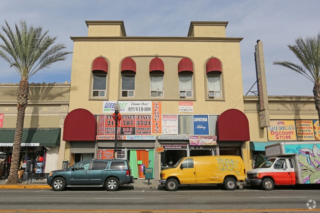
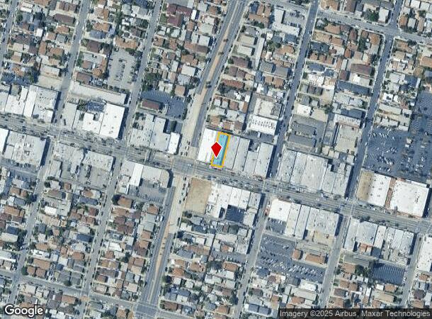
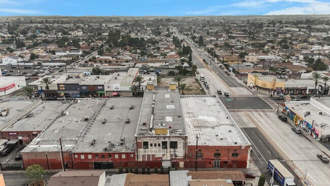
4709 Whittier Blvd, Los Angeles, CA 90022
This Property Is For Sale
NEARBY LISTINGS FOR SALE OR LEASE
Property Detail
4709 Whittier Blvd
Los Angeles-Long Beach-Glendale, CA
4190
5240-002-027
TRACT # 4190 LOT 14 BLK 1
Storemultistory
Los Angeles
X
California
06037C1643F
14
2024
0.17 AC
2025
Southeast Los Angeles
531604
Los Angeles
15,000 SF
DEMOGRAPHICS near 4709 Whittier Blvd
1 Mile
3 Mile
5 Mile
2024 Total Population
37,813
237,958
688,810
2029 Population
35,476
226,651
657,097
Pop Growth 2024-2029
(6.18%)
(4.75%)
(4.60%)
Average Age
36
37
38
2024 Total Households
9,687
66,065
198,006
HH Growth 2024-2029
(6.57%)
(5.01%)
(4.83%)
Median Household Inc
$55,441
$60,438
$59,450
Avg Household Size
3.70
3.50
3.30
2024 Avg HH Vehicles
2.00
2.00
2.00
Median Home Value
$586,349
$662,488
$676,145
Median Year Built
1948
1950
1955
Nearby Places
- Restaurants
- Banks
- Shops
- Fitness
- Groceries
PUBLIC TRANSPORTATION
TRANSIT/SUBWAY
East LA Civic Center (Gold Line - Los Angeles County Metropolitan Transportation Authority (Metro))
DRIVE
WALK
Distance
East LA Civic Center (Gold Line - Los Angeles County Metropolitan Transportation Authority (Metro))
3 min
17 min
0.9 mi
COMMUTER RAIL
Montebello/Commerce (Riverside Line - Southern California Regional Rail Authority (Metrolink))
DRIVE
WALK
Distance
Montebello/Commerce (Riverside Line - Southern California Regional Rail Authority (Metrolink))
8 min
3.3 mi
Commerce (91 Line - Southern California Regional Rail Authority (Metrolink), Orange County Line - Southern California Regional Rail Authority (Metrolink))
DRIVE
WALK
Distance
Commerce (91 Line - Southern California Regional Rail Authority (Metrolink), Orange County Line - Southern California Regional Rail Authority (Metrolink))
9 min
4.2 mi
AIRPORT
Long Beach (Daugherty Field)
DRIVE
WALK
Distance
Long Beach (Daugherty Field)
27 min
18.3 mi
Bob Hope
DRIVE
WALK
Distance
Bob Hope
31 min
21.6 mi
Los Angeles International
DRIVE
WALK
Distance
Los Angeles International
33 min
23.2 mi
Freight Ports
Port of Long Beach
DRIVE
WALK
Distance
Port of Long Beach
30 min
20.2 mi
Nearby Properties
Address
Land Use
TOTAL SIZE
Lot Size
Zoning
Address
Land Use
TOTAL SIZE
Lot Size
Zoning
479,272 SF
16.14 AC
LAM3
Address
Land Use
TOTAL SIZE
Lot Size
Zoning
271,020 SF
18.93 AC
CMM2*
Address
Land Use
TOTAL SIZE
Lot Size
Zoning
693,282 SF
30.34 AC
CMM2*
Address
Land Use
TOTAL SIZE
Lot Size
Zoning
527,173 SF
12.36 AC
CMM2*
Address
Land Use
TOTAL SIZE
Lot Size
Zoning
397,549 SF
15.73 AC
CMM2*
Address
Land Use
TOTAL SIZE
Lot Size
Zoning
368,164 SF
7.82 AC
CMM2YY
Address
Land Use
TOTAL SIZE
Lot Size
Zoning
557,445 SF
14.08 AC
CMM2YY
Address
Land Use
TOTAL SIZE
Lot Size
Zoning
621,121 SF
13.07 AC
CMM2*
Address
Land Use
TOTAL SIZE
Lot Size
Zoning
841,076 SF
23.77 AC
CMM2*
Address
Land Use
TOTAL SIZE
Lot Size
Zoning
330,904 SF
12.09 AC
VEM*
Address
Land Use
TOTAL SIZE
Lot Size
Zoning
260,714 SF
9.99 AC
VEM*
Address
Land Use
TOTAL SIZE
Lot Size
Zoning
117,004 SF
6.27 AC
CMM2*
Address
Land Use
TOTAL SIZE
Lot Size
Zoning
303,030 SF
7.14 AC
CMM2-M1*
Address
Land Use
TOTAL SIZE
Lot Size
Zoning
500,495 SF
16.23 AC
CMM2*
Address
Land Use
TOTAL SIZE
Lot Size
Zoning
382,648 SF
14.73 AC
CMM2*
Address
Land Use
TOTAL SIZE
Lot Size
Zoning
175,443 SF
7.18 AC
BLCM*
Address
Land Use
TOTAL SIZE
Lot Size
Zoning
1,094,138 SF
23.73 AC
CMM2YY
Address
Land Use
TOTAL SIZE
Lot Size
Zoning
118,026 SF
5.73 AC
CMM2*
Address
Land Use
TOTAL SIZE
Lot Size
Zoning
342,940 SF
6.21 AC
LAM2
Address
Land Use
TOTAL SIZE
Lot Size
Zoning
726,275 SF
14.41 AC
VEM*
Address
Land Use
TOTAL SIZE
Lot Size
Zoning
149,846 SF
5.85 AC
VEM*
Address
Land Use
TOTAL SIZE
Lot Size
Zoning
289,422 SF
12.43 AC
CMM2*
Address
Land Use
TOTAL SIZE
Lot Size
Zoning
116,480 SF
11.81 AC
MPC2
Address
Land Use
TOTAL SIZE
Lot Size
Zoning
483,890 SF
12.45 AC
BLM*
Address
Land Use
TOTAL SIZE
Lot Size
Zoning
102,761 SF
4.47 AC
CMM2YY
Address
Land Use
TOTAL SIZE
Lot Size
Zoning
199,809 SF
7.57 AC
CMM2*
Address
Land Use
TOTAL SIZE
Lot Size
Zoning
331,322 SF
13.69 AC
MNM2*
Address
Land Use
TOTAL SIZE
Lot Size
Zoning
323,519 SF
19.54 AC
BLCM*
Address
Land Use
TOTAL SIZE
Lot Size
Zoning
155,529 SF
2.64 AC
LARD1.5
Address
Land Use
TOTAL SIZE
Lot Size
Zoning
244,489 SF
6.73 AC
CMM2*
The World's #1 Commercial Real Estate Marketplace
Connect with us
© 2025 CoStar Group
The information above has been obtained from sources believed reliable. While we do not doubt its accuracy we have not verified it and make no guarantee, warranty or representation about it. It is your responsibility to independently confirm its accuracy and completeness. Any projections, opinions, assumptions, or estimates used are for example only and do not represent the current or future performance of the property. The value of this transaction to you depends on tax and other factors which should be evaluated by your tax, financial, and legal advisors. You and your advisors should conduct a careful, independent investigation of the property to determine to your satisfaction the suitability of the property for your needs.