Property Record
471 E County Line Rd, Warminster, PA 18974
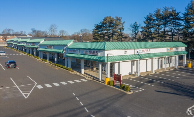


Property Detail
471 E County Line Rd
49-027-001
NW COR COUNTY LINE & CENT ENNIAL RD 76X150
Commercialnec
BUCKS
MF-1
Pennsylvania
B and X Area of moderate flood hazard, usually the area between the limits of the 100-year and 500-year floods.
0.27 AC
2025
Lower Bucks County
2026
Philadelphia
101609
Philadelphia-Camden-Wilmington, PA-NJ-DE-MD
NEARBY LISTINGS FOR SALE OR LEASE
DEMOGRAPHICS near 471 E County Line Rd
1 mile
3 mile
5 mile
2025 Total Population
12,325
87,179
201,904
2030 Population
12,594
89,089
204,403
Pop Growth 2025-2030
+ 2.18%
+ 2.19%
+ 1.24%
Average Age
44
44
43
2025 Total Households
5,093
35,308
77,701
HH Growth 2025-2030
+ 2.26%
+ 2.40%
+ 1.36%
Median Household Inc
$91,496
$96,222
$104,839
Avg Household Size
2.30
2.40
2.50
2025 Avg HH Vehicles
2.00
2.00
2.00
Median Home Value
$419,728
$418,671
$436,206
Median Year Built
1965
1967
1968
Nearby Places
Map Layers
Map Styles
 Street
 Aerial
Layers
 Traffic
 Biking
Places
Listings with unknown addresses are not visible on the map
- Restaurants
- Banks
- Shops
- Fitness
- Groceries
PUBLIC TRANSPORTATION
COMMUTER RAIL
Hatboro (R2 - Southeastern Pennsylvania Transportation Authority Regional Rail (SEPTA Regional Rail))
Drive
Walk
Distance
Hatboro (R2 - Southeastern Pennsylvania Transportation Authority Regional Rail (SEPTA Regional Rail))
4 min
1.7 mi
Warminster (R2 - Southeastern Pennsylvania Transportation Authority Regional Rail (SEPTA Regional Rail))
Drive
Walk
Distance
Warminster (R2 - Southeastern Pennsylvania Transportation Authority Regional Rail (SEPTA Regional Rail))
5 min
2.5 mi
AIRPORT
Trenton Mercer
Drive
Walk
Distance
Trenton Mercer
36 min
20.7 mi
Philadelphia International
Drive
Walk
Distance
Philadelphia International
52 min
30.7 mi
Freight Ports
Port of Philadelphia
Drive
Walk
Distance
Port of Philadelphia
29 min
16.5 mi
SALE & LEASE HISTORY
LISTING DATE
SALE/LEASE

Sep 25, 2016
For Lease
Nov 28, 2023
For Lease
Mar 19, 2019
For Lease
Mar 04, 2025
For Sale
Nearby Properties
Address
Land Use
TOTAL SIZE
Lot Size
Zoning
Address
Land Use
TOTAL SIZE
Lot Size
Zoning
377,044 SF
58.73 AC
INST
Address
Land Use
TOTAL SIZE
Lot Size
Zoning
297,172 SF
37.55 AC
R4
Address
Land Use
TOTAL SIZE
Lot Size
Zoning
571,213 SF
67.31 AC
M
Address
Land Use
TOTAL SIZE
Lot Size
Zoning
498,072 SF
5.39 AC
TC1
Address
Land Use
TOTAL SIZE
Lot Size
Zoning
251,655 SF
48.95 AC
SC
Address
Land Use
TOTAL SIZE
Lot Size
Zoning
257,010 SF
34.12 AC
INST
Address
Land Use
TOTAL SIZE
Lot Size
Zoning
84,400 SF
4.70 AC
I
Address
Land Use
TOTAL SIZE
Lot Size
Zoning
309,264 SF
9.93 AC
I
Address
Land Use
TOTAL SIZE
Lot Size
Zoning
420,736 SF
29.47 AC
LI
Address
Land Use
TOTAL SIZE
Lot Size
Zoning
256,679 SF
14 AC
MI
Address
Land Use
TOTAL SIZE
Lot Size
Zoning
344,636 SF
25.02 AC
R7
Address
Land Use
TOTAL SIZE
Lot Size
Zoning
110,198 SF
12.18 AC
R2
Address
Land Use
TOTAL SIZE
Lot Size
Zoning
273,531 SF
11.11 AC
INST
Address
Land Use
TOTAL SIZE
Lot Size
Zoning
123,538 SF
12.32 AC
CC
Address
Land Use
TOTAL SIZE
Lot Size
Zoning
171,179 SF
6.12 AC
C2
Address
Land Use
TOTAL SIZE
Lot Size
Zoning
205,254 SF
4.71 AC
HR
Address
Land Use
TOTAL SIZE
Lot Size
Zoning
205,254 SF
4.71 AC
HR
Address
Land Use
TOTAL SIZE
Lot Size
Zoning
120,549 SF
10 AC
C2
Address
Land Use
TOTAL SIZE
Lot Size
Zoning
149,423 SF
12.70 AC
I1
Address
Land Use
TOTAL SIZE
Lot Size
Zoning
91,814 SF
38.63 AC
RC
Address
Land Use
TOTAL SIZE
Lot Size
Zoning
193,590 SF
14.23 AC
I1
Address
Land Use
TOTAL SIZE
Lot Size
Zoning
126,660 SF
17.26 AC
C2
Address
Land Use
TOTAL SIZE
Lot Size
Zoning
213,350 SF
11.78 AC
R7
Address
Land Use
TOTAL SIZE
Lot Size
Zoning
182,364 SF
21.06 AC
M
Address
Land Use
TOTAL SIZE
Lot Size
Zoning
141,532 SF
21.43 AC
R6
Address
Land Use
TOTAL SIZE
Lot Size
Zoning
157,870 SF
13.20 AC
I1
Address
Land Use
TOTAL SIZE
Lot Size
Zoning
240,682 SF
4.81 AC
HI
Address
Land Use
TOTAL SIZE
Lot Size
Zoning
220,338 SF
16.76 AC
M
Address
Land Use
TOTAL SIZE
Lot Size
Zoning
96,823 SF
9.77 AC
INST
Address
Land Use
TOTAL SIZE
Lot Size
Zoning
318,625 SF
19.01 AC
I
The World's #1 Commercial Real Estate Marketplace
Connect with us
© 2026 CoStar Group
The information above has been obtained from sources believed reliable. While we do not doubt its accuracy we have not verified it and make no guarantee, warranty or representation about it. It is your responsibility to independently confirm its accuracy and completeness. Any projections, opinions, assumptions, or estimates used are for example only and do not represent the current or future performance of the property. The value of this transaction to you depends on tax and other factors which should be evaluated by your tax, financial, and legal advisors. You and your advisors should conduct a careful, independent investigation of the property to determine to your satisfaction the suitability of the property for your needs.