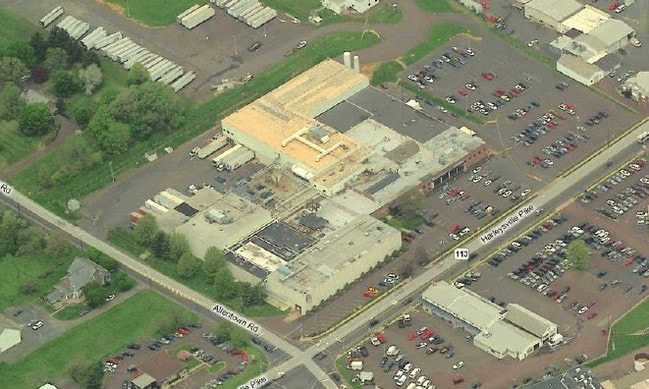
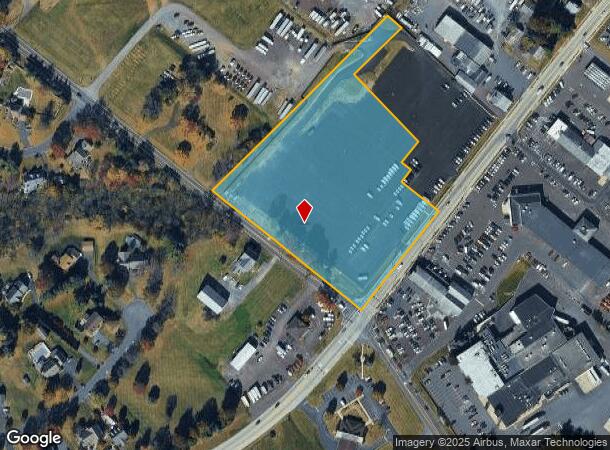
Property Record
471 Harleysville Pike, Harleysville, PA 19438
NEARBY LISTINGS FOR SALE OR LEASE
Property Detail
471 Harleysville Pike
Philadelphia-Camden-Wilmington, PA-NJ-DE-MD
William L Rosenberger
34-00-02242-001
U 2-3
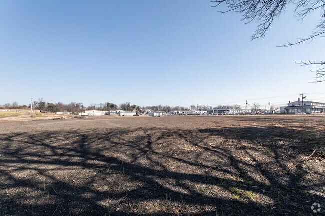
Industrialacreage
Montgomery
X
Pennsylvania
42091C0136G
1
2024
6.23 AC
2025
West Montgomery Cty
207003
Philadelphia
169,700 SF
DEMOGRAPHICS near 471 Harleysville Pike
1 Mile
3 Mile
5 Mile
2024 Total Population
2,145
39,424
89,426
2029 Population
2,160
40,110
90,554
Pop Growth 2024-2029
+ 0.70%
+ 1.74%
+ 1.26%
Average Age
44
43
43
2024 Total Households
755
15,142
34,339
HH Growth 2024-2029
+ 0.66%
+ 1.68%
+ 1.19%
Median Household Inc
$103,515
$96,391
$100,573
Avg Household Size
2.70
2.50
2.50
2024 Avg HH Vehicles
2.00
2.00
2.00
Median Home Value
$389,269
$344,334
$363,224
Median Year Built
1972
1978
1981
Nearby Places
Map Layers
Map Styles
 Street
 Aerial
- Restaurants
- Banks
- Shops
- Fitness
- Groceries
PUBLIC TRANSPORTATION
COMMUTER RAIL
Fortuna (R5 - Southeastern Pennsylvania Transportation Authority Regional Rail (SEPTA Regional Rail))
DRIVE
WALK
Distance
Fortuna (R5 - Southeastern Pennsylvania Transportation Authority Regional Rail (SEPTA Regional Rail))
12 min
6.5 mi
9Th Street Lansdale (Lansdale/Doylestown Line - SEPTA)
DRIVE
WALK
Distance
9Th Street Lansdale (Lansdale/Doylestown Line - SEPTA)
14 min
7.6 mi
AIRPORT
Lehigh Valley International
DRIVE
WALK
Distance
Lehigh Valley International
49 min
34.1 mi
Trenton Mercer
DRIVE
WALK
Distance
Trenton Mercer
65 min
38.1 mi
Freight Ports
Port of Philadelphia
DRIVE
WALK
Distance
Port of Philadelphia
50 min
30.3 mi
Nearby Properties
Address
Land Use
TOTAL SIZE
Lot Size
Zoning
Address
Land Use
TOTAL SIZE
Lot Size
Zoning
437,908 SF
104.29 AC
INST
Address
Land Use
TOTAL SIZE
Lot Size
Zoning
677,546 SF
92.50 AC
INST
Address
Land Use
TOTAL SIZE
Lot Size
Zoning
412,306 SF
40.91 AC
I
Address
Land Use
TOTAL SIZE
Lot Size
Zoning
139,733 SF
46.65 AC
R130
Address
Land Use
TOTAL SIZE
Lot Size
Zoning
211,561 SF
38.80 AC
LI
Address
Land Use
TOTAL SIZE
Lot Size
Zoning
152,085 SF
38.16 AC
INST
Address
Land Use
TOTAL SIZE
Lot Size
Zoning
149,259 SF
4.30 AC
R3
Address
Land Use
TOTAL SIZE
Lot Size
Zoning
324,796 SF
42.20 AC
LI
Address
Land Use
TOTAL SIZE
Lot Size
Zoning
156,186 SF
31.41 AC
R1
Address
Land Use
TOTAL SIZE
Lot Size
Zoning
136,281 SF
4.05 AC
R3
Address
Land Use
TOTAL SIZE
Lot Size
Zoning
52,348 SF
21.30 AC
R5
Address
Land Use
TOTAL SIZE
Lot Size
Zoning
216,372 SF
18.46 AC
INST
Address
Land Use
TOTAL SIZE
Lot Size
Zoning
84,887 SF
38.07 AC
INST
Address
Land Use
TOTAL SIZE
Lot Size
Zoning
197,233 SF
15.66 AC
LI
Address
Land Use
TOTAL SIZE
Lot Size
Zoning
246,631 SF
48.78 AC
AO
Address
Land Use
TOTAL SIZE
Lot Size
Zoning
184,471 SF
0.80 AC
INST
Address
Land Use
TOTAL SIZE
Lot Size
Zoning
112,282 SF
11.23 AC
R5
Address
Land Use
TOTAL SIZE
Lot Size
Zoning
94,598 SF
27.72 AC
INST
Address
Land Use
TOTAL SIZE
Lot Size
Zoning
90,053 SF
24.28 AC
LI
Address
Land Use
TOTAL SIZE
Lot Size
Zoning
77,878 SF
17.60 AC
INST
Address
Land Use
TOTAL SIZE
Lot Size
Zoning
176,700 SF
16.03 AC
LI
Address
Land Use
TOTAL SIZE
Lot Size
Zoning
96,305 SF
3.02 AC
Address
Land Use
TOTAL SIZE
Lot Size
Zoning
95,494 SF
13.67 AC
C
Address
Land Use
TOTAL SIZE
Lot Size
Zoning
60,470 SF
14.60 AC
ER
Address
Land Use
TOTAL SIZE
Lot Size
Zoning
85,508 SF
25.83 AC
Address
Land Use
TOTAL SIZE
Lot Size
Zoning
54,212 SF
18.38 AC
RR
Address
Land Use
TOTAL SIZE
Lot Size
Zoning
9.46 AC
LI
Address
Land Use
TOTAL SIZE
Lot Size
Zoning
237,667 SF
37.86 AC
LI
Address
Land Use
TOTAL SIZE
Lot Size
Zoning
9.46 AC
LI
Address
Land Use
TOTAL SIZE
Lot Size
Zoning
140,008 SF
10.25 AC
C
The World's #1 Commercial Real Estate Marketplace
Connect with us
© 2025 CoStar Group
The information above has been obtained from sources believed reliable. While we do not doubt its accuracy we have not verified it and make no guarantee, warranty or representation about it. It is your responsibility to independently confirm its accuracy and completeness. Any projections, opinions, assumptions, or estimates used are for example only and do not represent the current or future performance of the property. The value of this transaction to you depends on tax and other factors which should be evaluated by your tax, financial, and legal advisors. You and your advisors should conduct a careful, independent investigation of the property to determine to your satisfaction the suitability of the property for your needs.