Property Record
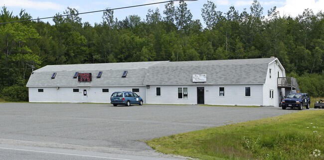
471 Us Route 2 E, Wilton, ME 04294


Property Detail
471 Us Route 2 E
WILN-000028-000000-000057
FRANKLIN
Storebuilding
Maine
21
57
2025
1.06 AC
2025
Maine South & Augusta
971300
Other Market Areas
NEARBY LISTINGS FOR SALE OR LEASE
DEMOGRAPHICS near 471 Us Route 2 E
1 mile
3 mile
5 mile
2025 Total Population
838
3,594
6,283
2030 Population
822
3,557
6,278
Pop Growth 2025-2030
(1.91%)
(1.03%)
(0.08%)
Average Age
44
44
44
2025 Total Households
355
1,528
2,674
HH Growth 2025-2030
(1.69%)
(0.85%)
0.00%
Median Household Inc
$69,999
$71,326
$76,422
Avg Household Size
2.30
2.30
2.30
2025 Avg HH Vehicles
2.00
2.00
2.00
Median Home Value
$226,744
$183,916
$174,308
Median Year Built
1957
1973
1975
Nearby Places
Map Layers
Map Styles
 Street
 Aerial
Transit
 Traffic
 Biking
Places
Listings with unknown addresses are not visible on the map
- Restaurants
- Banks
- Shops
- Fitness
- Groceries
Nearby Properties
Address
Land Use
TOTAL SIZE
Lot Size
Zoning
Address
Land Use
TOTAL SIZE
Lot Size
Zoning
4,500 SF
29.70 AC
SEASON
Address
Land Use
TOTAL SIZE
Lot Size
Zoning
9.60 AC
13
Address
Land Use
TOTAL SIZE
Lot Size
Zoning
7.60 AC
11
Address
Land Use
TOTAL SIZE
Lot Size
Zoning
6.50 AC
21
Address
Land Use
TOTAL SIZE
Lot Size
Zoning
32,454 SF
6.33 AC
RA
Address
Land Use
TOTAL SIZE
Lot Size
Zoning
16 AC
11
Address
Land Use
TOTAL SIZE
Lot Size
Zoning
19.70 AC
11
Address
Land Use
TOTAL SIZE
Lot Size
Zoning
5 AC
SEASON
Address
Land Use
TOTAL SIZE
Lot Size
Zoning
1.50 AC
SEASON
Address
Land Use
TOTAL SIZE
Lot Size
Zoning
20.52 AC
23
Address
Land Use
TOTAL SIZE
Lot Size
Zoning
1,224 SF
7 AC
11
Address
Land Use
TOTAL SIZE
Lot Size
Zoning
16.77 AC
21
Address
Land Use
TOTAL SIZE
Lot Size
Zoning
936 SF
18 AC
21
Address
Land Use
TOTAL SIZE
Lot Size
Zoning
4.20 AC
Address
Land Use
TOTAL SIZE
Lot Size
Zoning
11 AC
21
Address
Land Use
TOTAL SIZE
Lot Size
Zoning
31.40 AC
23
Address
Land Use
TOTAL SIZE
Lot Size
Zoning
0.87 AC
19
Address
Land Use
TOTAL SIZE
Lot Size
Zoning
8,998 SF
48.82 AC
11
Address
Land Use
TOTAL SIZE
Lot Size
Zoning
2,816 SF
4.37 AC
11
Address
Land Use
TOTAL SIZE
Lot Size
Zoning
288 SF
8.97 AC
12
Address
Land Use
TOTAL SIZE
Lot Size
Zoning
14,600 SF
0.99 AC
SEASON
Address
Land Use
TOTAL SIZE
Lot Size
Zoning
7.80 AC
21
Address
Land Use
TOTAL SIZE
Lot Size
Zoning
1,852 SF
1.29 AC
SEASON
Address
Land Use
TOTAL SIZE
Lot Size
Zoning
1.71 AC
21
Address
Land Use
TOTAL SIZE
Lot Size
Zoning
11 AC
23
Address
Land Use
TOTAL SIZE
Lot Size
Zoning
0.95 AC
21
Address
Land Use
TOTAL SIZE
Lot Size
Zoning
17.20 AC
21
Address
Land Use
TOTAL SIZE
Lot Size
Zoning
2.95 AC
21
Address
Land Use
TOTAL SIZE
Lot Size
Zoning
1,630 SF
0.61 AC
SEASON
Address
Land Use
TOTAL SIZE
Lot Size
Zoning
3.83 AC
RA
The World's #1 Commercial Real Estate Marketplace
Connect with us
© 2026 CoStar Group
The information above has been obtained from sources believed reliable. While we do not doubt its accuracy we have not verified it and make no guarantee, warranty or representation about it. It is your responsibility to independently confirm its accuracy and completeness. Any projections, opinions, assumptions, or estimates used are for example only and do not represent the current or future performance of the property. The value of this transaction to you depends on tax and other factors which should be evaluated by your tax, financial, and legal advisors. You and your advisors should conduct a careful, independent investigation of the property to determine to your satisfaction the suitability of the property for your needs.