Property Record
4710 Bailey Rd, Pearland, TX 77584


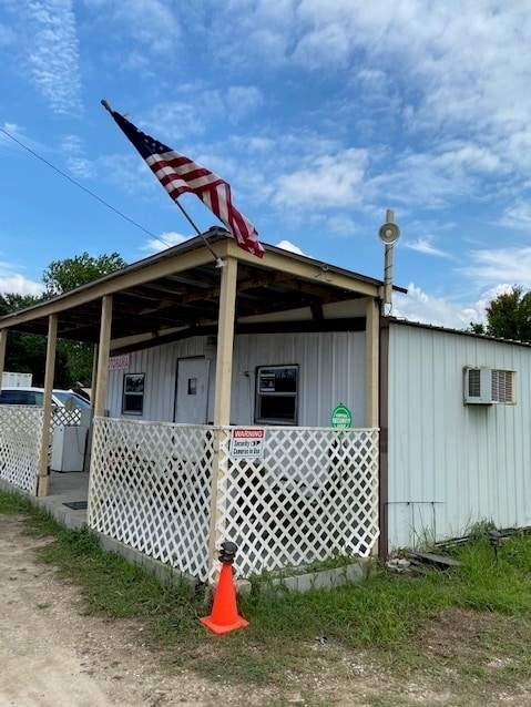
This Property Is For Sale
Property Detail
4710 Bailey Rd
Houston-Pasadena-The Woodlands, TX
A0550 H T & B R R TRACT 11B2 ACRES 0.50 (PEARLAND)
0550-0123-002
Brazoria
Vacantlandnec
Texas
AE The base floodplain where base flood elevations are provided. AE Zones are now used on new format FIRMs instead of A1-A30 Zones.
0.50 AC
2024
South
2025
Houston
660902
NEARBY LISTINGS FOR SALE OR LEASE
DEMOGRAPHICS near 4710 Bailey Rd
1 mile
3 mile
5 mile
2025 Total Population
7,964
47,774
125,201
2030 Population
8,702
52,258
135,915
Pop Growth 2025-2030
+ 9.27%
+ 9.39%
+ 8.56%
Average Age
35
37
38
2025 Total Households
2,469
16,045
42,230
HH Growth 2025-2030
+ 9.60%
+ 9.62%
+ 8.74%
Median Household Inc
$115,128
$104,526
$113,117
Avg Household Size
3.20
2.90
2.90
2025 Avg HH Vehicles
3.00
2.00
2.00
Median Home Value
$332,519
$332,211
$344,343
Median Year Built
2002
1998
1999
Nearby Places
Map Layers
Map Styles
 Street
 Aerial
Layers
 Traffic
 Biking
Places
Listings with unknown addresses are not visible on the map
- Restaurants
- Banks
- Shops
- Fitness
- Groceries
PUBLIC TRANSPORTATION
AIRPORT
William P Hobby
Drive
Walk
Distance
William P Hobby
20 min
9.6 mi
Freight Ports
Port of Houston
Drive
Walk
Distance
Port of Houston
31 min
17.8 mi
Nearby Properties
Address
Land Use
TOTAL SIZE
Lot Size
Zoning
Address
Land Use
TOTAL SIZE
Lot Size
Zoning
40.52 AC
0017
Address
Land Use
TOTAL SIZE
Lot Size
Zoning
83.37 AC
0004
Address
Land Use
TOTAL SIZE
Lot Size
Zoning
64.56 AC
0016
Address
Land Use
TOTAL SIZE
Lot Size
Zoning
236,642 SF
11.48 AC
Address
Land Use
TOTAL SIZE
Lot Size
Zoning
7.42 AC
Address
Land Use
TOTAL SIZE
Lot Size
Zoning
128,754 SF
14.83 AC
Address
Land Use
TOTAL SIZE
Lot Size
Zoning
97,736 SF
16.49 AC
Address
Land Use
TOTAL SIZE
Lot Size
Zoning
252,472 SF
13.28 AC
Address
Land Use
TOTAL SIZE
Lot Size
Zoning
79.45 AC
1000
Address
Land Use
TOTAL SIZE
Lot Size
Zoning
144,879 SF
8.91 AC
Address
Land Use
TOTAL SIZE
Lot Size
Zoning
110,990 SF
18.25 AC
Address
Land Use
TOTAL SIZE
Lot Size
Zoning
89.23 AC
Address
Land Use
TOTAL SIZE
Lot Size
Zoning
155,524 SF
7.86 AC
Address
Land Use
TOTAL SIZE
Lot Size
Zoning
113,376 SF
9.80 AC
Address
Land Use
TOTAL SIZE
Lot Size
Zoning
148,902 SF
11.40 AC
Address
Land Use
TOTAL SIZE
Lot Size
Zoning
114,828 SF
7.94 AC
Address
Land Use
TOTAL SIZE
Lot Size
Zoning
134,596 SF
7.21 AC
Address
Land Use
TOTAL SIZE
Lot Size
Zoning
67,595 SF
4.97 AC
Address
Land Use
TOTAL SIZE
Lot Size
Zoning
106,341 SF
12.12 AC
0550
Address
Land Use
TOTAL SIZE
Lot Size
Zoning
49.29 AC
0007
Address
Land Use
TOTAL SIZE
Lot Size
Zoning
80,715 SF
8.73 AC
Address
Land Use
TOTAL SIZE
Lot Size
Zoning
129,025 SF
7.02 AC
Address
Land Use
TOTAL SIZE
Lot Size
Zoning
63,615 SF
6.42 AC
0010
Address
Land Use
TOTAL SIZE
Lot Size
Zoning
86,550 SF
8.45 AC
Address
Land Use
TOTAL SIZE
Lot Size
Zoning
19.61 AC
Address
Land Use
TOTAL SIZE
Lot Size
Zoning
95,592 SF
5.93 AC
Address
Land Use
TOTAL SIZE
Lot Size
Zoning
122,473 SF
2.30 AC
Address
Land Use
TOTAL SIZE
Lot Size
Zoning
151,863 SF
15.04 AC
Address
Land Use
TOTAL SIZE
Lot Size
Zoning
55,751 SF
5.04 AC
Address
Land Use
TOTAL SIZE
Lot Size
Zoning
28,019 SF
5.16 AC
The World's #1 Commercial Real Estate Marketplace
Connect with us
© 2026 CoStar Group
The information above has been obtained from sources believed reliable. While we do not doubt its accuracy we have not verified it and make no guarantee, warranty or representation about it. It is your responsibility to independently confirm its accuracy and completeness. Any projections, opinions, assumptions, or estimates used are for example only and do not represent the current or future performance of the property. The value of this transaction to you depends on tax and other factors which should be evaluated by your tax, financial, and legal advisors. You and your advisors should conduct a careful, independent investigation of the property to determine to your satisfaction the suitability of the property for your needs.