Property Record
4710 Ecton Dr, Marietta, GA 30066
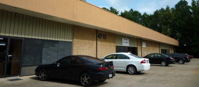
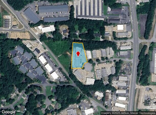
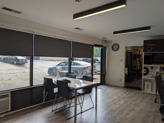
This Property Is For Sale
Current Lease Availabilities
NEARBY LISTINGS FOR SALE OR LEASE
Property Detail
4710 Ecton Dr
16-0085-0-025-0
Cobb
Warehouse
Georgia
X
6
13057C0334E
1.32 AC
2025
Woodstock/Canton
2025
Atlanta
030347
Atlanta-Sandy Springs-Roswell, GA
14,400 SF
DEMOGRAPHICS near 4710 Ecton Dr
1 Mile
3 Mile
5 Mile
2024 Total Population
5,898
69,512
193,396
2029 Population
5,958
74,273
207,026
Pop Growth 2024-2029
+ 1.02%
+ 6.85%
+ 7.05%
Average Age
39
40
39
2024 Total Households
2,086
25,934
71,314
HH Growth 2024-2029
+ 0.91%
+ 7.37%
+ 7.28%
Median Household Inc
$90,140
$95,435
$96,502
Avg Household Size
2.70
2.60
2.60
2024 Avg HH Vehicles
2.00
2.00
2.00
Median Home Value
$262,287
$317,148
$331,464
Median Year Built
1982
1988
1992
Nearby Places
- Restaurants
- Banks
- Shops
- Fitness
- Groceries
PUBLIC TRANSPORTATION
AIRPORT
Hartsfield - Jackson Atlanta International
DRIVE
WALK
Distance
Hartsfield - Jackson Atlanta International
50 min
35.7 mi
Freight Ports
Georgia Ports - Savannah
DRIVE
WALK
Distance
Georgia Ports - Savannah
313 min
275.0 mi
Nearby Properties
Address
Land Use
TOTAL SIZE
Lot Size
Zoning
Address
Land Use
TOTAL SIZE
Lot Size
Zoning
228,644 SF
7.88 AC
DT-CBD
Address
Land Use
TOTAL SIZE
Lot Size
Zoning
309,011 SF
64.20 AC
PUD
Address
Land Use
TOTAL SIZE
Lot Size
Zoning
197,890 SF
14.60 AC
R-4
Address
Land Use
TOTAL SIZE
Lot Size
Zoning
181,704 SF
17.56 AC
DT-MRA
Address
Land Use
TOTAL SIZE
Lot Size
Zoning
128,196 SF
24.68 AC
R-4
Address
Land Use
TOTAL SIZE
Lot Size
Zoning
266,487 SF
21.69 AC
R-4
Address
Land Use
TOTAL SIZE
Lot Size
Zoning
188,105 SF
25.86 AC
R-5
Address
Land Use
TOTAL SIZE
Lot Size
Zoning
346,900 SF
104.10 AC
CD
Address
Land Use
TOTAL SIZE
Lot Size
Zoning
235,861 SF
31.92 AC
RM10
Address
Land Use
TOTAL SIZE
Lot Size
Zoning
232,415 SF
19.23 AC
RM-12
Address
Land Use
TOTAL SIZE
Lot Size
Zoning
229,440 SF
13 AC
OI
Address
Land Use
TOTAL SIZE
Lot Size
Zoning
113,849 SF
7.46 AC
R-5
Address
Land Use
TOTAL SIZE
Lot Size
Zoning
85,166 SF
3.41 AC
DT-CBD
Address
Land Use
TOTAL SIZE
Lot Size
Zoning
186,090 SF
30.08 AC
GC
Address
Land Use
TOTAL SIZE
Lot Size
Zoning
63,264 SF
8 AC
PUD
Address
Land Use
TOTAL SIZE
Lot Size
Zoning
132,022 SF
12.69 AC
GC
Address
Land Use
TOTAL SIZE
Lot Size
Zoning
5.46 AC
RSL
Address
Land Use
TOTAL SIZE
Lot Size
Zoning
86,307 SF
13.49 AC
GC
Address
Land Use
TOTAL SIZE
Lot Size
Zoning
89,552 SF
14.69 AC
DT-MR
Address
Land Use
TOTAL SIZE
Lot Size
Zoning
77,924 SF
9.84 AC
GC
Address
Land Use
TOTAL SIZE
Lot Size
Zoning
346,544 SF
16.28 AC
OS
Address
Land Use
TOTAL SIZE
Lot Size
Zoning
61,433 SF
9.52 AC
GC
Address
Land Use
TOTAL SIZE
Lot Size
Zoning
28,438 SF
GC
Address
Land Use
TOTAL SIZE
Lot Size
Zoning
93,120 SF
14.84 AC
NRC
Address
Land Use
TOTAL SIZE
Lot Size
Zoning
72,376 SF
12.25 AC
GC
Address
Land Use
TOTAL SIZE
Lot Size
Zoning
115,107 SF
12.90 AC
NRC/NS
Address
Land Use
TOTAL SIZE
Lot Size
Zoning
135,538 SF
12.34 AC
DT-CMU
Address
Land Use
TOTAL SIZE
Lot Size
Zoning
138,918 SF
13.96 AC
GC
Address
Land Use
TOTAL SIZE
Lot Size
Zoning
1,284 SF
3.04 AC
RSL
Address
Land Use
TOTAL SIZE
Lot Size
Zoning
56,141 SF
9.83 AC
GC
The World's #1 Commercial Real Estate Marketplace
Connect with us
© 2025 CoStar Group
The information above has been obtained from sources believed reliable. While we do not doubt its accuracy we have not verified it and make no guarantee, warranty or representation about it. It is your responsibility to independently confirm its accuracy and completeness. Any projections, opinions, assumptions, or estimates used are for example only and do not represent the current or future performance of the property. The value of this transaction to you depends on tax and other factors which should be evaluated by your tax, financial, and legal advisors. You and your advisors should conduct a careful, independent investigation of the property to determine to your satisfaction the suitability of the property for your needs.