Property Record
4710 S Hackberry, San Antonio, TX 78223
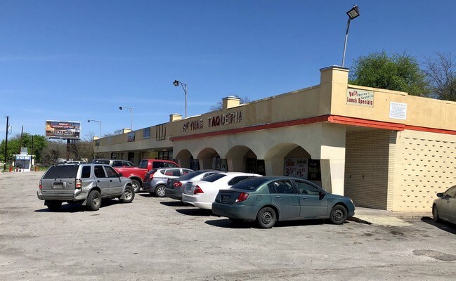


Property Detail
4710 S Hackberry
San Antonio-New Braunfels, TX
NCB 8090 BLK LOT 29, EXC S IRR 6.0 FT & LOT 30
08090-000-0291
BEXAR
Regionalshoppingcenterormallwithanchorstore
Texas
B and X Area of moderate flood hazard, usually the area between the limits of the 100-year and 500-year floods.
291
2025
1.08 AC
2025
South
140800
San Antonio
9,988 SF
NEARBY LISTINGS FOR SALE OR LEASE
DEMOGRAPHICS near 4710 S Hackberry
1 mile
3 mile
5 mile
2025 Total Population
14,539
129,370
301,793
2030 Population
15,369
136,589
319,041
Pop Growth 2025-2030
+ 5.71%
+ 5.58%
+ 5.72%
Average Age
37
39
38
2025 Total Households
5,160
47,232
107,237
HH Growth 2025-2030
+ 5.93%
+ 5.77%
+ 6.05%
Median Household Inc
$42,564
$48,294
$48,401
Avg Household Size
2.70
2.70
2.70
2025 Avg HH Vehicles
1.00
2.00
2.00
Median Home Value
$170,575
$161,184
$161,128
Median Year Built
1959
1957
1963
Nearby Places
Map Layers
Map Styles
 Street
 Aerial
Layers
 Traffic
 Biking
Places
Listings with unknown addresses are not visible on the map
- Restaurants
- Banks
- Shops
- Fitness
- Groceries
PUBLIC TRANSPORTATION
AIRPORT
San Antonio International
Drive
Walk
Distance
San Antonio International
16 min
11.6 mi
SALE & LEASE HISTORY
LISTING DATE
SALE/LEASE

Mar 30, 2017
For Lease
Nearby Properties
Address
Land Use
TOTAL SIZE
Lot Size
Zoning
Address
Land Use
TOTAL SIZE
Lot Size
Zoning
738,650 SF
2.93 AC
Address
Land Use
TOTAL SIZE
Lot Size
Zoning
156,480 SF
3.46 AC
Address
Land Use
TOTAL SIZE
Lot Size
Zoning
14,492 SF
6.62 AC
Address
Land Use
TOTAL SIZE
Lot Size
Zoning
291,374 SF
13.49 AC
Address
Land Use
TOTAL SIZE
Lot Size
Zoning
61,085 SF
16.73 AC
Address
Land Use
TOTAL SIZE
Lot Size
Zoning
197,115 SF
2.29 AC
Address
Land Use
TOTAL SIZE
Lot Size
Zoning
158,546 SF
6.45 AC
Address
Land Use
TOTAL SIZE
Lot Size
Zoning
273,370 SF
11.93 AC
Address
Land Use
TOTAL SIZE
Lot Size
Zoning
12,504,292 SF
32.18 AC
Address
Land Use
TOTAL SIZE
Lot Size
Zoning
242,297 SF
7.45 AC
Address
Land Use
TOTAL SIZE
Lot Size
Zoning
187,369 SF
5.69 AC
Address
Land Use
TOTAL SIZE
Lot Size
Zoning
245,745 SF
11.99 AC
Address
Land Use
TOTAL SIZE
Lot Size
Zoning
174,316 SF
15.38 AC
Address
Land Use
TOTAL SIZE
Lot Size
Zoning
88,420 SF
7.62 AC
Address
Land Use
TOTAL SIZE
Lot Size
Zoning
353,148 SF
14.10 AC
Address
Land Use
TOTAL SIZE
Lot Size
Zoning
148,525 SF
30.72 AC
Address
Land Use
TOTAL SIZE
Lot Size
Zoning
163.70 AC
Address
Land Use
TOTAL SIZE
Lot Size
Zoning
63,850 SF
33.42 AC
Address
Land Use
TOTAL SIZE
Lot Size
Zoning
145,389 SF
18.70 AC
Address
Land Use
TOTAL SIZE
Lot Size
Zoning
187,369 SF
2.72 AC
Address
Land Use
TOTAL SIZE
Lot Size
Zoning
372,078 SF
10.95 AC
Address
Land Use
TOTAL SIZE
Lot Size
Zoning
89,000 SF
1.48 AC
Address
Land Use
TOTAL SIZE
Lot Size
Zoning
148,672 SF
11.84 AC
Address
Land Use
TOTAL SIZE
Lot Size
Zoning
87,686 SF
32.01 AC
Address
Land Use
TOTAL SIZE
Lot Size
Zoning
186,995 SF
14.18 AC
Address
Land Use
TOTAL SIZE
Lot Size
Zoning
144,692 SF
10.83 AC
Address
Land Use
TOTAL SIZE
Lot Size
Zoning
20.58 AC
Address
Land Use
TOTAL SIZE
Lot Size
Zoning
239,575 SF
15.27 AC
Address
Land Use
TOTAL SIZE
Lot Size
Zoning
38,754 SF
3.92 AC
Address
Land Use
TOTAL SIZE
Lot Size
Zoning
The World's #1 Commercial Real Estate Marketplace
Connect with us
© 2026 CoStar Group
The information above has been obtained from sources believed reliable. While we do not doubt its accuracy we have not verified it and make no guarantee, warranty or representation about it. It is your responsibility to independently confirm its accuracy and completeness. Any projections, opinions, assumptions, or estimates used are for example only and do not represent the current or future performance of the property. The value of this transaction to you depends on tax and other factors which should be evaluated by your tax, financial, and legal advisors. You and your advisors should conduct a careful, independent investigation of the property to determine to your satisfaction the suitability of the property for your needs.