Property Record
4711 Nw Loop 410, San Antonio, TX 78229
NEARBY LISTINGS FOR SALE OR LEASE
Property Detail
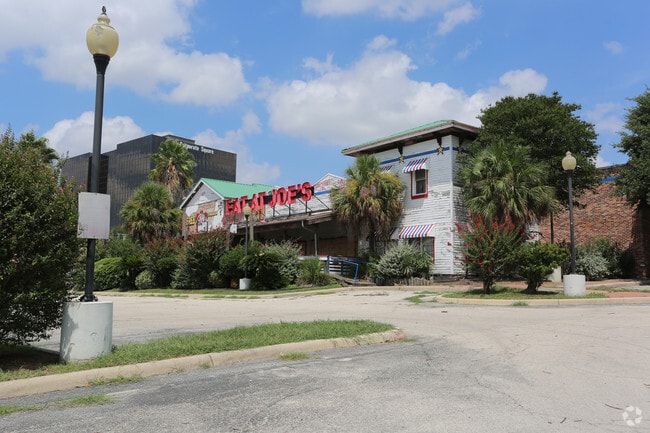
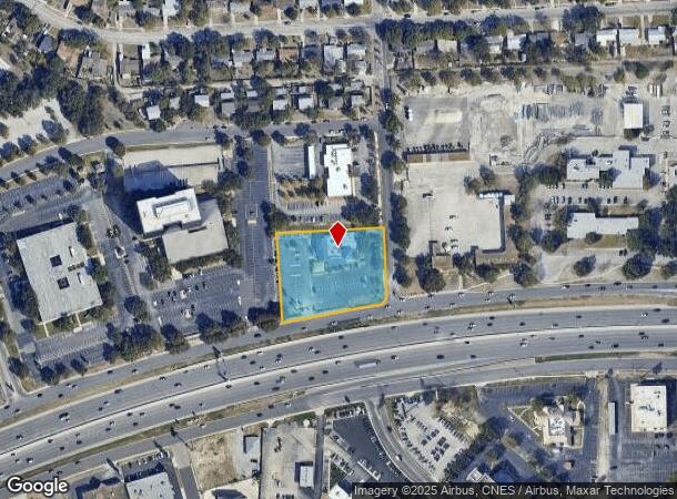
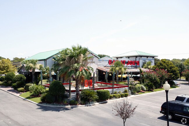
4711 Nw Loop 410
San Antonio-New Braunfels, TX
Baywater Sub
16836-001-0050
NCB 16836 BLK 1 LOT 5 BAYWATER SUBD
Restaurantbuilding
Bexar
X
Texas
48029C0380G
5
2024
1.94 AC
2025
Northwest
180702
San Antonio
9,073 SF
DEMOGRAPHICS near 4711 Nw Loop 410
1 Mile
3 Mile
5 Mile
2024 Total Population
13,411
151,358
369,803
2029 Population
14,229
160,925
391,907
Pop Growth 2024-2029
+ 6.10%
+ 6.32%
+ 5.98%
Average Age
38
37
38
2024 Total Households
5,701
64,631
147,779
HH Growth 2024-2029
+ 6.46%
+ 6.63%
+ 6.25%
Median Household Inc
$46,787
$45,444
$48,943
Avg Household Size
2.30
2.30
2.40
2024 Avg HH Vehicles
1.00
1.00
2.00
Median Home Value
$175,673
$171,537
$180,424
Median Year Built
1973
1979
1978
Nearby Places
Map Layers
Map Styles
 Street
 Aerial
- Restaurants
- Banks
- Shops
- Fitness
- Groceries
PUBLIC TRANSPORTATION
AIRPORT
San Antonio International
DRIVE
WALK
Distance
San Antonio International
13 min
9.2 mi
SALE & LEASE HISTORY
LISTING DATE
SALE/LEASE

Aug 20, 2018
For Lease
Aug 20, 2018
For Sale
Nearby Properties
Address
Land Use
TOTAL SIZE
Lot Size
Zoning
Address
Land Use
TOTAL SIZE
Lot Size
Zoning
1,414,945 SF
16.77 AC
Address
Land Use
TOTAL SIZE
Lot Size
Zoning
609,267 SF
30.47 AC
Address
Land Use
TOTAL SIZE
Lot Size
Zoning
429,561 SF
25.70 AC
Address
Land Use
TOTAL SIZE
Lot Size
Zoning
541,776 SF
22.15 AC
Address
Land Use
TOTAL SIZE
Lot Size
Zoning
97.47 AC
Address
Land Use
TOTAL SIZE
Lot Size
Zoning
352,231 SF
19.54 AC
Address
Land Use
TOTAL SIZE
Lot Size
Zoning
278,352 SF
10 AC
Address
Land Use
TOTAL SIZE
Lot Size
Zoning
482,412 SF
22.97 AC
Address
Land Use
TOTAL SIZE
Lot Size
Zoning
301,817 SF
12.22 AC
Address
Land Use
TOTAL SIZE
Lot Size
Zoning
284,359 SF
21.53 AC
Address
Land Use
TOTAL SIZE
Lot Size
Zoning
227,744 SF
3.99 AC
Address
Land Use
TOTAL SIZE
Lot Size
Zoning
239,623 SF
26.63 AC
Address
Land Use
TOTAL SIZE
Lot Size
Zoning
213,968 SF
21.30 AC
Address
Land Use
TOTAL SIZE
Lot Size
Zoning
253,862 SF
14.78 AC
Address
Land Use
TOTAL SIZE
Lot Size
Zoning
288,719 SF
14.66 AC
Address
Land Use
TOTAL SIZE
Lot Size
Zoning
495,484 SF
5.81 AC
Address
Land Use
TOTAL SIZE
Lot Size
Zoning
61.64 AC
Address
Land Use
TOTAL SIZE
Lot Size
Zoning
264,676 SF
11.91 AC
Address
Land Use
TOTAL SIZE
Lot Size
Zoning
259,934 SF
9.81 AC
Address
Land Use
TOTAL SIZE
Lot Size
Zoning
285,150 SF
13.62 AC
Address
Land Use
TOTAL SIZE
Lot Size
Zoning
211,045 SF
8.08 AC
Address
Land Use
TOTAL SIZE
Lot Size
Zoning
308,010 SF
9.93 AC
Address
Land Use
TOTAL SIZE
Lot Size
Zoning
340,653 SF
19.27 AC
Address
Land Use
TOTAL SIZE
Lot Size
Zoning
8,508 SF
3.34 AC
Address
Land Use
TOTAL SIZE
Lot Size
Zoning
243,251 SF
10 AC
Address
Land Use
TOTAL SIZE
Lot Size
Zoning
221,778 SF
16.31 AC
Address
Land Use
TOTAL SIZE
Lot Size
Zoning
272,456 SF
21.53 AC
Address
Land Use
TOTAL SIZE
Lot Size
Zoning
63.25 AC
Address
Land Use
TOTAL SIZE
Lot Size
Zoning
299,088 SF
15.66 AC
Address
Land Use
TOTAL SIZE
Lot Size
Zoning
232,398 SF
12.66 AC
The World's #1 Commercial Real Estate Marketplace
Connect with us
© 2025 CoStar Group
The information above has been obtained from sources believed reliable. While we do not doubt its accuracy we have not verified it and make no guarantee, warranty or representation about it. It is your responsibility to independently confirm its accuracy and completeness. Any projections, opinions, assumptions, or estimates used are for example only and do not represent the current or future performance of the property. The value of this transaction to you depends on tax and other factors which should be evaluated by your tax, financial, and legal advisors. You and your advisors should conduct a careful, independent investigation of the property to determine to your satisfaction the suitability of the property for your needs.