Property Record
4711 W Metaline Ave, Kennewick, WA 99336
NEARBY LISTINGS FOR SALE OR LEASE
-
-
View all Kennewick listings for sale on LoopNet.com
Property Detail
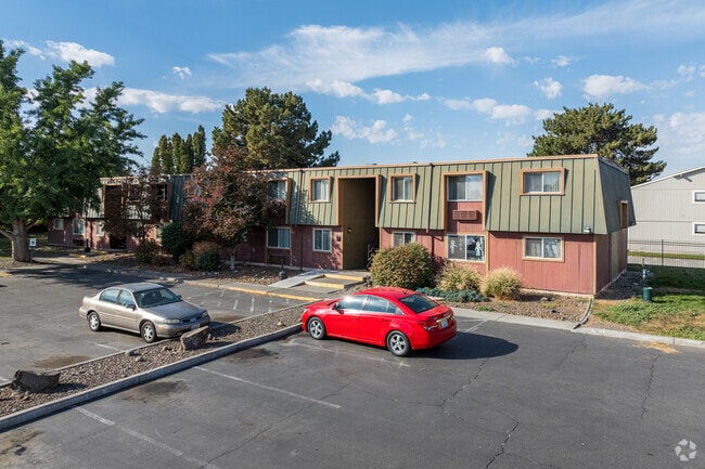
4711 W Metaline Ave
Kennewick-Richland, WA
The Highlands
133994020032010
SECTION 33 TOWNSHIP 9 RANGE 29 QUARTER SE THE EAST 81 FEET OF THE NORTH 361 FEET AS MEASURED ALONG THE EAST LINE OF TRACT 32 THE HIGHLANDS PLAT A ACCORDING TO THE PLAT THEREOF RECORDED IN VOLUME 2 OF PLATS PAGE 2 RECORDS OF BENTON COUNTY
Multifamilydwelling
Benton
2024
Washington
2024
2.04 AC
010901
Yakima/Kennewick
36,920 SF
Other Market Areas
DEMOGRAPHICS near 4711 W Metaline Ave
1 Mile
3 Mile
5 Mile
2024 Total Population
13,637
80,494
186,121
2029 Population
14,628
86,623
200,868
Pop Growth 2024-2029
+ 7.27%
+ 7.61%
+ 7.92%
Average Age
35
37
36
2024 Total Households
5,226
29,606
65,073
HH Growth 2024-2029
+ 7.37%
+ 7.64%
+ 7.94%
Median Household Inc
$54,084
$67,617
$75,585
Avg Household Size
2.50
2.60
2.80
2024 Avg HH Vehicles
2.00
2.00
2.00
Median Home Value
$263,106
$322,974
$326,911
Median Year Built
1973
1978
1991
Nearby Places
Map Layers
Map Styles
 Street
 Aerial
- Restaurants
- Banks
- Shops
- Fitness
- Groceries
PUBLIC TRANSPORTATION
COMMUTER RAIL
Pasco Amtrak Station (Empire Builder - Amtrak)
DRIVE
WALK
Distance
Pasco Amtrak Station (Empire Builder - Amtrak)
13 min
6.7 mi
AIRPORT
Tri-Cities
DRIVE
WALK
Distance
Tri-Cities
12 min
6.7 mi
Freight Ports
Port of Tacoma
DRIVE
WALK
Distance
Port of Tacoma
270 min
234.6 mi
Nearby Properties
Address
Land Use
TOTAL SIZE
Lot Size
Zoning
Address
Land Use
TOTAL SIZE
Lot Size
Zoning
478,378 SF
25.15 AC
KENNEWICK
Address
Land Use
TOTAL SIZE
Lot Size
Zoning
192,199 SF
Address
Land Use
TOTAL SIZE
Lot Size
Zoning
254,856 SF
10.47 AC
Address
Land Use
TOTAL SIZE
Lot Size
Zoning
190,434 SF
47.42 AC
Address
Land Use
TOTAL SIZE
Lot Size
Zoning
232,463 SF
31.54 AC
Address
Land Use
TOTAL SIZE
Lot Size
Zoning
141,940 SF
7.49 AC
Address
Land Use
TOTAL SIZE
Lot Size
Zoning
377,541 SF
24.58 AC
Address
Land Use
TOTAL SIZE
Lot Size
Zoning
138,421 SF
31.09 AC
Address
Land Use
TOTAL SIZE
Lot Size
Zoning
195,749 SF
12.29 AC
35
Address
Land Use
TOTAL SIZE
Lot Size
Zoning
148,301 SF
6.41 AC
Address
Land Use
TOTAL SIZE
Lot Size
Zoning
224,114 SF
13.37 AC
Address
Land Use
TOTAL SIZE
Lot Size
Zoning
248,623 SF
12 AC
Address
Land Use
TOTAL SIZE
Lot Size
Zoning
168,650 SF
10.43 AC
KENNEWICK
Address
Land Use
TOTAL SIZE
Lot Size
Zoning
Address
Land Use
TOTAL SIZE
Lot Size
Zoning
159,807 SF
Address
Land Use
TOTAL SIZE
Lot Size
Zoning
179,139 SF
11.79 AC
Address
Land Use
TOTAL SIZE
Lot Size
Zoning
206,208 SF
10.01 AC
KENNEWICK
Address
Land Use
TOTAL SIZE
Lot Size
Zoning
82,470 SF
12.38 AC
Address
Land Use
TOTAL SIZE
Lot Size
Zoning
113,585 SF
15.43 AC
Address
Land Use
TOTAL SIZE
Lot Size
Zoning
126,589 SF
4.05 AC
Address
Land Use
TOTAL SIZE
Lot Size
Zoning
74,556 SF
1.22 AC
Address
Land Use
TOTAL SIZE
Lot Size
Zoning
144,723 SF
6.88 AC
Address
Land Use
TOTAL SIZE
Lot Size
Zoning
213,921 SF
22.78 AC
Address
Land Use
TOTAL SIZE
Lot Size
Zoning
118,412 SF
9.91 AC
KENNEWICK
Address
Land Use
TOTAL SIZE
Lot Size
Zoning
52,900 SF
10.23 AC
Address
Land Use
TOTAL SIZE
Lot Size
Zoning
114,673 SF
6.58 AC
Address
Land Use
TOTAL SIZE
Lot Size
Zoning
127,840 SF
3.69 AC
Address
Land Use
TOTAL SIZE
Lot Size
Zoning
116,283 SF
11.18 AC
RICHLAND -
Address
Land Use
TOTAL SIZE
Lot Size
Zoning
172,573 SF
15.30 AC
Address
Land Use
TOTAL SIZE
Lot Size
Zoning
105,026 SF
8.63 AC
KENNEWICK
The World's #1 Commercial Real Estate Marketplace
Connect with us
© 2025 CoStar Group
The information above has been obtained from sources believed reliable. While we do not doubt its accuracy we have not verified it and make no guarantee, warranty or representation about it. It is your responsibility to independently confirm its accuracy and completeness. Any projections, opinions, assumptions, or estimates used are for example only and do not represent the current or future performance of the property. The value of this transaction to you depends on tax and other factors which should be evaluated by your tax, financial, and legal advisors. You and your advisors should conduct a careful, independent investigation of the property to determine to your satisfaction the suitability of the property for your needs.