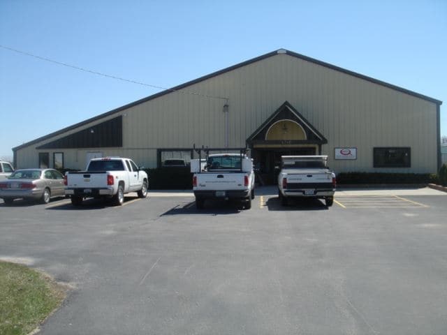
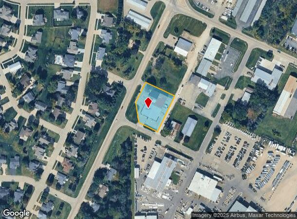
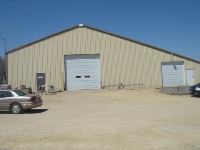
Property Record
4712 N John Paul Rd, Milton, WI 53563
NEARBY LISTINGS FOR SALE OR LEASE
Property Detail
4712 N John Paul Rd
676-53B
PT NE1/4 COM 1444.75' S OF N1/4 COR, NE 179.06',SE 233' SW 234', NW 200', SW 11.7', N 74.72' TO POB (EXC HWY)
Commercialnec
Rock
X
Wisconsin
55105C0201E
0.96 AC
2024
Rock County
2024
Milwaukee/Madison
001303
Janesville-Beloit, WI
DEMOGRAPHICS near 4712 N John Paul Rd
1 Mile
3 Mile
5 Mile
2024 Total Population
3,312
24,351
60,347
2029 Population
3,381
24,650
61,050
Pop Growth 2024-2029
+ 2.08%
+ 1.23%
+ 1.16%
Average Age
42
41
41
2024 Total Households
1,167
10,008
25,155
HH Growth 2024-2029
+ 2.14%
+ 1.17%
+ 1.19%
Median Household Inc
$107,995
$71,817
$68,765
Avg Household Size
2.80
2.40
2.30
2024 Avg HH Vehicles
2.00
2.00
2.00
Median Home Value
$279,132
$229,716
$208,575
Median Year Built
1996
1986
1973
Nearby Places
Map Layers
Map Styles
 Street
 Aerial
- Restaurants
- Banks
- Shops
- Fitness
- Groceries
SALE & LEASE HISTORY
LISTING DATE
SALE/LEASE

May 25, 2017
For Lease
Nearby Properties
Address
Land Use
TOTAL SIZE
Lot Size
Zoning
Address
Land Use
TOTAL SIZE
Lot Size
Zoning
135,322 SF
18.41 AC
B2
Address
Land Use
TOTAL SIZE
Lot Size
Zoning
2,800 SF
69 AC
M1
Address
Land Use
TOTAL SIZE
Lot Size
Zoning
183,339 SF
9.97 AC
B4
Address
Land Use
TOTAL SIZE
Lot Size
Zoning
77,811 SF
8.74 AC
B4
Address
Land Use
TOTAL SIZE
Lot Size
Zoning
98,370 SF
8.64 AC
B4
Address
Land Use
TOTAL SIZE
Lot Size
Zoning
175,991 SF
26.17 AC
B4
Address
Land Use
TOTAL SIZE
Lot Size
Zoning
7.52 AC
R3
Address
Land Use
TOTAL SIZE
Lot Size
Zoning
161,640 SF
20.71 AC
B4
Address
Land Use
TOTAL SIZE
Lot Size
Zoning
14,580 SF
28.75 AC
M1
Address
Land Use
TOTAL SIZE
Lot Size
Zoning
42.07 AC
Address
Land Use
TOTAL SIZE
Lot Size
Zoning
134,515 SF
16.08 AC
B4
Address
Land Use
TOTAL SIZE
Lot Size
Zoning
17,183 SF
6.65 AC
B3
Address
Land Use
TOTAL SIZE
Lot Size
Zoning
24,960 SF
8.85 AC
B4
Address
Land Use
TOTAL SIZE
Lot Size
Zoning
110,820 SF
10.62 AC
B4
Address
Land Use
TOTAL SIZE
Lot Size
Zoning
17.14 AC
M1
Address
Land Use
TOTAL SIZE
Lot Size
Zoning
111,847 SF
11.72 AC
B4
Address
Land Use
TOTAL SIZE
Lot Size
Zoning
8.66 AC
Address
Land Use
TOTAL SIZE
Lot Size
Zoning
1,020 SF
9.77 AC
B4
Address
Land Use
TOTAL SIZE
Lot Size
Zoning
2.30 AC
Address
Land Use
TOTAL SIZE
Lot Size
Zoning
10,534 SF
9.14 AC
B4
Address
Land Use
TOTAL SIZE
Lot Size
Zoning
2,662 SF
4.48 AC
B4
Address
Land Use
TOTAL SIZE
Lot Size
Zoning
35,800 SF
17.55 AC
B4
Address
Land Use
TOTAL SIZE
Lot Size
Zoning
12,838 SF
21.41 AC
B4
Address
Land Use
TOTAL SIZE
Lot Size
Zoning
18.84 AC
M1
Address
Land Use
TOTAL SIZE
Lot Size
Zoning
8,549 SF
7.52 AC
B4
Address
Land Use
TOTAL SIZE
Lot Size
Zoning
14,838 SF
5.33 AC
B4
Address
Land Use
TOTAL SIZE
Lot Size
Zoning
14,492 SF
3.50 AC
B4
Address
Land Use
TOTAL SIZE
Lot Size
Zoning
16,240 SF
10.64 AC
B3
Address
Land Use
TOTAL SIZE
Lot Size
Zoning
3,130 SF
7.65 AC
B4
Address
Land Use
TOTAL SIZE
Lot Size
Zoning
20,360 SF
2.13 AC
B4
The World's #1 Commercial Real Estate Marketplace
Connect with us
© 2025 CoStar Group
The information above has been obtained from sources believed reliable. While we do not doubt its accuracy we have not verified it and make no guarantee, warranty or representation about it. It is your responsibility to independently confirm its accuracy and completeness. Any projections, opinions, assumptions, or estimates used are for example only and do not represent the current or future performance of the property. The value of this transaction to you depends on tax and other factors which should be evaluated by your tax, financial, and legal advisors. You and your advisors should conduct a careful, independent investigation of the property to determine to your satisfaction the suitability of the property for your needs.