Property Record
4714 S Zarzamora St, San Antonio, TX 78211
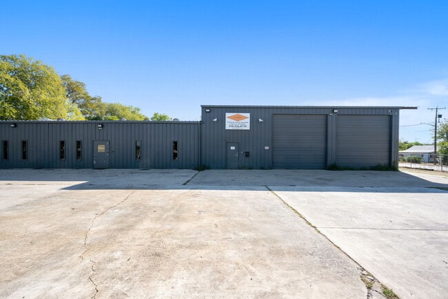

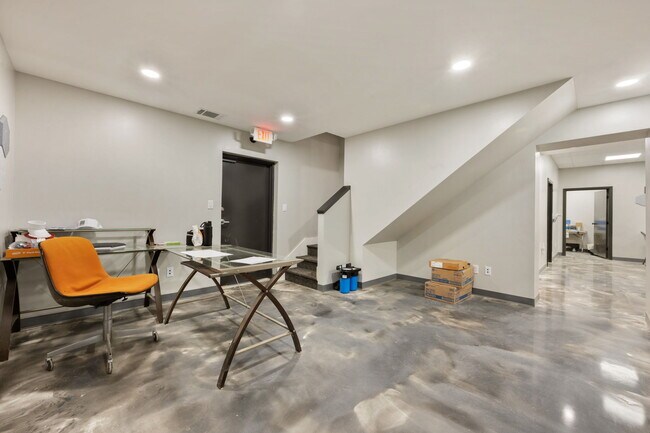
This Property Is For Sale
NEARBY LISTINGS FOR SALE OR LEASE
Property Detail
4714 S Zarzamora St
San Antonio-New Braunfels, TX
Conv A/S Code
08701-020-0090
NCB 8701 BLK 20 LOT 9, 10, 11 & 12 2015 MERGE PER CR #32851 DTD 2/20/14
Warehouse
Bexar
X
Texas
48029C0395G
9
2024
0.81 AC
2025
South
150501
San Antonio
10,800 SF
DEMOGRAPHICS near 4714 S Zarzamora St
1 Mile
3 Mile
5 Mile
2024 Total Population
14,519
120,015
305,576
2029 Population
15,291
127,283
324,965
Pop Growth 2024-2029
+ 5.32%
+ 6.06%
+ 6.35%
Average Age
39
38
37
2024 Total Households
4,644
40,298
101,289
HH Growth 2024-2029
+ 5.36%
+ 6.35%
+ 6.79%
Median Household Inc
$44,545
$38,656
$38,314
Avg Household Size
3.00
2.90
2.80
2024 Avg HH Vehicles
2.00
2.00
2.00
Median Home Value
$82,246
$96,194
$112,757
Median Year Built
1954
1958
1961
Nearby Places
Map Layers
Map Styles
 Street
 Aerial
- Restaurants
- Banks
- Shops
- Fitness
- Groceries
PUBLIC TRANSPORTATION
COMMUTER RAIL
San Antonio Amtrak Station (Sunset Limited - Amtrak, Texas Eagle - Amtrak)
DRIVE
WALK
Distance
San Antonio Amtrak Station (Sunset Limited - Amtrak, Texas Eagle - Amtrak)
10 min
5.4 mi
AIRPORT
San Antonio International
DRIVE
WALK
Distance
San Antonio International
18 min
12.1 mi
Freight Ports
Calhoun Port
DRIVE
WALK
Distance
Calhoun Port
184 min
149.2 mi
Nearby Properties
Address
Land Use
TOTAL SIZE
Lot Size
Zoning
Address
Land Use
TOTAL SIZE
Lot Size
Zoning
180,980 SF
1,373.90 AC
Address
Land Use
TOTAL SIZE
Lot Size
Zoning
548,048 SF
27.53 AC
Address
Land Use
TOTAL SIZE
Lot Size
Zoning
156,480 SF
3.46 AC
Address
Land Use
TOTAL SIZE
Lot Size
Zoning
291,374 SF
13.49 AC
Address
Land Use
TOTAL SIZE
Lot Size
Zoning
176,336 SF
18.74 AC
Address
Land Use
TOTAL SIZE
Lot Size
Zoning
197,115 SF
2.29 AC
Address
Land Use
TOTAL SIZE
Lot Size
Zoning
242,297 SF
7.45 AC
Address
Land Use
TOTAL SIZE
Lot Size
Zoning
447,169 SF
46.74 AC
Address
Land Use
TOTAL SIZE
Lot Size
Zoning
245,371 SF
20.50 AC
Address
Land Use
TOTAL SIZE
Lot Size
Zoning
63,850 SF
33.42 AC
Address
Land Use
TOTAL SIZE
Lot Size
Zoning
306,922 SF
32.07 AC
Address
Land Use
TOTAL SIZE
Lot Size
Zoning
218,003 SF
12.33 AC
Address
Land Use
TOTAL SIZE
Lot Size
Zoning
Address
Land Use
TOTAL SIZE
Lot Size
Zoning
251,400 SF
10.62 AC
Address
Land Use
TOTAL SIZE
Lot Size
Zoning
11,553 SF
67.15 AC
Address
Land Use
TOTAL SIZE
Lot Size
Zoning
231,592 SF
47.96 AC
Address
Land Use
TOTAL SIZE
Lot Size
Zoning
20.58 AC
Address
Land Use
TOTAL SIZE
Lot Size
Zoning
45,363 SF
4.29 AC
Address
Land Use
TOTAL SIZE
Lot Size
Zoning
143,067 SF
11.69 AC
Address
Land Use
TOTAL SIZE
Lot Size
Zoning
56,875 SF
10.04 AC
Address
Land Use
TOTAL SIZE
Lot Size
Zoning
166,270 SF
13.95 AC
Address
Land Use
TOTAL SIZE
Lot Size
Zoning
142,030 SF
2.83 AC
Address
Land Use
TOTAL SIZE
Lot Size
Zoning
141,606 SF
13.74 AC
Address
Land Use
TOTAL SIZE
Lot Size
Zoning
360,000 SF
0.01 AC
Address
Land Use
TOTAL SIZE
Lot Size
Zoning
109,591 SF
5.65 AC
Address
Land Use
TOTAL SIZE
Lot Size
Zoning
47.74 AC
Address
Land Use
TOTAL SIZE
Lot Size
Zoning
48,688 SF
7.77 AC
Address
Land Use
TOTAL SIZE
Lot Size
Zoning
73,178 SF
23.11 AC
Address
Land Use
TOTAL SIZE
Lot Size
Zoning
196,328 SF
7.83 AC
Address
Land Use
TOTAL SIZE
Lot Size
Zoning
144,137 SF
10.44 AC
The World's #1 Commercial Real Estate Marketplace
Connect with us
© 2025 CoStar Group
The information above has been obtained from sources believed reliable. While we do not doubt its accuracy we have not verified it and make no guarantee, warranty or representation about it. It is your responsibility to independently confirm its accuracy and completeness. Any projections, opinions, assumptions, or estimates used are for example only and do not represent the current or future performance of the property. The value of this transaction to you depends on tax and other factors which should be evaluated by your tax, financial, and legal advisors. You and your advisors should conduct a careful, independent investigation of the property to determine to your satisfaction the suitability of the property for your needs.