Property Record
4715 Boonsboro Rd, Lynchburg, VA 24503


Save to a Folder
{{folder.Name}}
{{folder.ListingIds.length}} Properties
{{folder.ListingIds.length}} Property
Create a New Folder
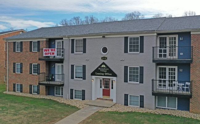
Property Detail
4715 Boonsboro Rd
182-09-010
LEXINGTON PIKE
Apartmenthouse5plusunits
Lynchburg City
252919
Virginia
B and X Area of moderate flood hazard, usually the area between the limits of the 100-year and 500-year floods.
15.56 AC
2025
Lynchburg
2025
Other Market Areas
000201
Lynchburg, VA
133,114 SF
NEARBY LISTINGS FOR SALE OR LEASE
-
-
View all Lynchburg listings for sale on LoopNet.com
DEMOGRAPHICS near 4715 Boonsboro Rd
1 mile
3 mile
5 mile
2025 Total Population
3,849
22,477
63,950
2030 Population
3,855
22,714
65,066
Pop Growth 2025-2030
+ 0.16%
+ 1.05%
+ 1.75%
Average Age
41
40
38
2025 Total Households
1,536
9,299
26,491
HH Growth 2025-2030
+ 0.13%
+ 1.05%
+ 1.83%
Median Household Inc
$107,426
$86,149
$68,439
Avg Household Size
2.50
2.30
2.30
2025 Avg HH Vehicles
2.00
2.00
2.00
Median Home Value
$370,932
$340,587
$267,352
Median Year Built
1969
1972
1969
Nearby Places
Map Layers
Map Styles
 Street
 Aerial
Layers
 Traffic
 Biking
Places
Listings with unknown addresses are not visible on the map
- Restaurants
- Banks
- Shops
- Fitness
- Groceries
PUBLIC TRANSPORTATION
COMMUTER RAIL
Lynchburg (Crescent - Amtrak, Northeast Regional - Amtrak)
Drive
Walk
Distance
Lynchburg (Crescent - Amtrak, Northeast Regional - Amtrak)
13 min
5.4 mi
AIRPORT
Lynchburg Regional/Preston Glenn Field
Drive
Walk
Distance
Lynchburg Regional/Preston Glenn Field
20 min
10.8 mi
Freight Ports
Virginia Port Authority - Richmond
Drive
Walk
Distance
Virginia Port Authority - Richmond
163 min
115.4 mi
Nearby Properties
Address
Land Use
TOTAL SIZE
Lot Size
Zoning
Address
Land Use
TOTAL SIZE
Lot Size
Zoning
20.17 AC
251921
Address
Land Use
TOTAL SIZE
Lot Size
Zoning
516,183 SF
16.46 AC
R1
Address
Land Use
TOTAL SIZE
Lot Size
Zoning
16,566 SF
Address
Land Use
TOTAL SIZE
Lot Size
Zoning
16,566 SF
Address
Land Use
TOTAL SIZE
Lot Size
Zoning
626,329 SF
50.88 AC
2521
Address
Land Use
TOTAL SIZE
Lot Size
Zoning
10.13 AC
R4RC
Address
Land Use
TOTAL SIZE
Lot Size
Zoning
28.74 AC
Address
Land Use
TOTAL SIZE
Lot Size
Zoning
343,261 SF
11.45 AC
130527
Address
Land Use
TOTAL SIZE
Lot Size
Zoning
186,273 SF
35 AC
R1RC
Address
Land Use
TOTAL SIZE
Lot Size
Zoning
185,130 SF
32.87 AC
B3
Address
Land Use
TOTAL SIZE
Lot Size
Zoning
135,668 SF
14.51 AC
B3R4
Address
Land Use
TOTAL SIZE
Lot Size
Zoning
108,105 SF
108.66 AC
R1R2
Address
Land Use
TOTAL SIZE
Lot Size
Zoning
157,498 SF
11.25 AC
R3
Address
Land Use
TOTAL SIZE
Lot Size
Zoning
231,708 SF
31.08 AC
I3RC
Address
Land Use
TOTAL SIZE
Lot Size
Zoning
150,883 SF
7.41 AC
R4
Address
Land Use
TOTAL SIZE
Lot Size
Zoning
328.77 AC
Address
Land Use
TOTAL SIZE
Lot Size
Zoning
19.97 AC
R1
Address
Land Use
TOTAL SIZE
Lot Size
Zoning
64,610 SF
20.90 AC
R1R4
Address
Land Use
TOTAL SIZE
Lot Size
Zoning
76,938 SF
7.96 AC
B3R1
Address
Land Use
TOTAL SIZE
Lot Size
Zoning
Address
Land Use
TOTAL SIZE
Lot Size
Zoning
1,109 SF
10.36 AC
R1
Address
Land Use
TOTAL SIZE
Lot Size
Zoning
17,697 SF
0.85 AC
2721
Address
Land Use
TOTAL SIZE
Lot Size
Zoning
45,622 SF
8.54 AC
R1
Address
Land Use
TOTAL SIZE
Lot Size
Zoning
110,124 SF
7.07 AC
252901
Address
Land Use
TOTAL SIZE
Lot Size
Zoning
33,921 SF
4.08 AC
B5
Address
Land Use
TOTAL SIZE
Lot Size
Zoning
56,400 SF
3.67 AC
R3
Address
Land Use
TOTAL SIZE
Lot Size
Zoning
37,488 SF
0.88 AC
B1
Address
Land Use
TOTAL SIZE
Lot Size
Zoning
48,954 SF
5.84 AC
R1
Address
Land Use
TOTAL SIZE
Lot Size
Zoning
120,428 SF
4.22 AC
R1
The World's #1 Commercial Real Estate Marketplace
Connect with us
© 2026 CoStar Group
The information above has been obtained from sources believed reliable. While we do not doubt its accuracy we have not verified it and make no guarantee, warranty or representation about it. It is your responsibility to independently confirm its accuracy and completeness. Any projections, opinions, assumptions, or estimates used are for example only and do not represent the current or future performance of the property. The value of this transaction to you depends on tax and other factors which should be evaluated by your tax, financial, and legal advisors. You and your advisors should conduct a careful, independent investigation of the property to determine to your satisfaction the suitability of the property for your needs.