Property Record
4715 S Florida Ave, Lakeland, FL 33813


NEARBY LISTINGS FOR SALE OR LEASE
Property Detail
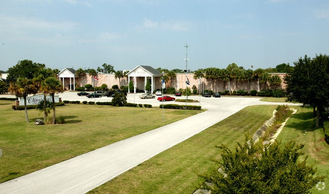
4715 S Florida Ave
Lakeland-Winter Haven, FL
Alamo Estates South
23-29-12-000000-011040
BEG NW COR OF S1/2 OF NE1/4 OF NE1/4 RUN S 220.99 FT E 831.79 FT N 43 DEG 40 MIN 40 SEC E 33.02 FT E TO SR 37 NELY ALONG R/W TO PT E OF POB W TO POB LESS RD R/WS & THAT PART OF VACATED WEBSTER AVE LYING S OF LOTS 9 & 10 OF BLKS 1 & 2 OF AVON VILLA PB
Storebuilding
Polk
A
Florida
12105C0480G
9,10
2024
5.12 AC
2025
Polk County
011901
Tampa/St Petersburg
123,899 SF
DEMOGRAPHICS near 4715 S Florida Ave
1 Mile
3 Mile
5 Mile
2024 Total Population
7,206
59,325
144,964
2029 Population
8,501
70,406
172,317
Pop Growth 2024-2029
+ 17.97%
+ 18.68%
+ 18.87%
Average Age
41
42
40
2024 Total Households
2,771
24,054
55,792
HH Growth 2024-2029
+ 17.94%
+ 18.65%
+ 19.14%
Median Household Inc
$74,889
$74,713
$65,886
Avg Household Size
2.60
2.40
2.40
2024 Avg HH Vehicles
2.00
2.00
2.00
Median Home Value
$253,932
$262,787
$235,842
Median Year Built
1979
1983
1984
Nearby Places
Map Layers
Map Styles
 Street
 Aerial
- Restaurants
- Banks
- Shops
- Fitness
- Groceries
PUBLIC TRANSPORTATION
COMMUTER RAIL
Lakeland (Silver Star - Amtrak)
DRIVE
WALK
Distance
Lakeland (Silver Star - Amtrak)
11 min
4.9 mi
Freight Ports
Port of Tampa Bay
DRIVE
WALK
Distance
Port of Tampa Bay
49 min
36.2 mi
Nearby Properties
Address
Land Use
TOTAL SIZE
Lot Size
Zoning
Address
Land Use
TOTAL SIZE
Lot Size
Zoning
315,901 SF
20.55 AC
Address
Land Use
TOTAL SIZE
Lot Size
Zoning
292,243 SF
11.94 AC
PUD
Address
Land Use
TOTAL SIZE
Lot Size
Zoning
336,260 SF
93.82 AC
RE1
Address
Land Use
TOTAL SIZE
Lot Size
Zoning
364,518 SF
23.38 AC
Address
Land Use
TOTAL SIZE
Lot Size
Zoning
363,147 SF
76.15 AC
Address
Land Use
TOTAL SIZE
Lot Size
Zoning
341,795 SF
37.28 AC
Address
Land Use
TOTAL SIZE
Lot Size
Zoning
432,087 SF
626.03 AC
PUD
Address
Land Use
TOTAL SIZE
Lot Size
Zoning
333,560 SF
44.88 AC
IND
Address
Land Use
TOTAL SIZE
Lot Size
Zoning
132,716 SF
20.62 AC
Address
Land Use
TOTAL SIZE
Lot Size
Zoning
202,378 SF
14.39 AC
PUD
Address
Land Use
TOTAL SIZE
Lot Size
Zoning
218,162 SF
16.32 AC
MF12
Address
Land Use
TOTAL SIZE
Lot Size
Zoning
77,358 SF
8.34 AC
PUD
Address
Land Use
TOTAL SIZE
Lot Size
Zoning
75,580 SF
8.92 AC
RE1
Address
Land Use
TOTAL SIZE
Lot Size
Zoning
242,284 SF
22.90 AC
C4
Address
Land Use
TOTAL SIZE
Lot Size
Zoning
148,182 SF
24.15 AC
Address
Land Use
TOTAL SIZE
Lot Size
Zoning
63,740 SF
8.63 AC
Address
Land Use
TOTAL SIZE
Lot Size
Zoning
106,312 SF
22.64 AC
RC
Address
Land Use
TOTAL SIZE
Lot Size
Zoning
162,990 SF
11.47 AC
MF16
Address
Land Use
TOTAL SIZE
Lot Size
Zoning
128,382 SF
6.42 AC
MF22
Address
Land Use
TOTAL SIZE
Lot Size
Zoning
106,000 SF
15.35 AC
RA3
Address
Land Use
TOTAL SIZE
Lot Size
Zoning
76,527 SF
17.51 AC
R1
Address
Land Use
TOTAL SIZE
Lot Size
Zoning
101,103 SF
13.87 AC
Address
Land Use
TOTAL SIZE
Lot Size
Zoning
160,914 SF
8.72 AC
MF22
Address
Land Use
TOTAL SIZE
Lot Size
Zoning
147,718 SF
52.29 AC
PUD
Address
Land Use
TOTAL SIZE
Lot Size
Zoning
77,232 SF
0.46 AC
Address
Land Use
TOTAL SIZE
Lot Size
Zoning
80,208 SF
4.33 AC
Address
Land Use
TOTAL SIZE
Lot Size
Zoning
70,604 SF
7.79 AC
Address
Land Use
TOTAL SIZE
Lot Size
Zoning
149,240 SF
12.54 AC
C4
Address
Land Use
TOTAL SIZE
Lot Size
Zoning
149,602 SF
13.36 AC
Address
Land Use
TOTAL SIZE
Lot Size
Zoning
119,901 SF
8.46 AC
The World's #1 Commercial Real Estate Marketplace
Connect with us
© 2025 CoStar Group
The information above has been obtained from sources believed reliable. While we do not doubt its accuracy we have not verified it and make no guarantee, warranty or representation about it. It is your responsibility to independently confirm its accuracy and completeness. Any projections, opinions, assumptions, or estimates used are for example only and do not represent the current or future performance of the property. The value of this transaction to you depends on tax and other factors which should be evaluated by your tax, financial, and legal advisors. You and your advisors should conduct a careful, independent investigation of the property to determine to your satisfaction the suitability of the property for your needs.