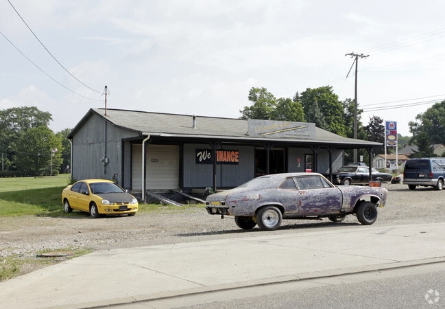
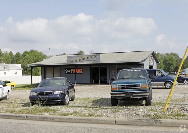
Property Record
4715 State Route 82, Mantua, OH 44255
NEARBY LISTINGS FOR SALE OR LEASE
Property Detail
4715 State Route 82
Akron, OH
LOT 23 SD-8-17
23-023-00-00-064-000
Portage
Storebuilding
Ohio
2024
23
2024
1.58 AC
600200
Portage County
1,296 SF
Cleveland
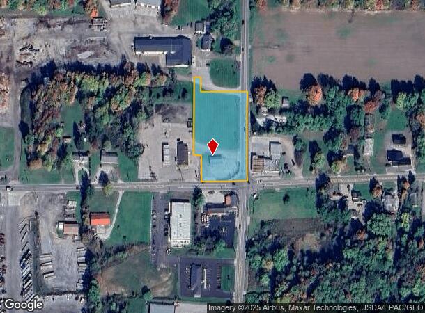
DEMOGRAPHICS near 4715 State Route 82
1 Mile
3 Mile
5 Mile
2024 Total Population
492
4,848
13,194
2029 Population
495
4,867
13,205
Pop Growth 2024-2029
+ 0.61%
+ 0.39%
+ 0.08%
Average Age
45
44
43
2024 Total Households
205
2,000
5,090
HH Growth 2024-2029
+ 0.49%
+ 0.30%
+ 0.02%
Median Household Inc
$82,894
$73,692
$84,528
Avg Household Size
2.40
2.40
2.50
2024 Avg HH Vehicles
2.00
2.00
2.00
Median Home Value
$217,391
$218,782
$242,596
Median Year Built
1957
1961
1970
Nearby Places
Map Layers
Map Styles
 Street
 Aerial
- Restaurants
- Banks
- Shops
- Fitness
- Groceries
PUBLIC TRANSPORTATION
AIRPORT
Cleveland-Hopkins International
DRIVE
WALK
Distance
Cleveland-Hopkins International
57 min
40.9 mi
Akron-Canton Regional
DRIVE
WALK
Distance
Akron-Canton Regional
58 min
42.4 mi
Nearby Properties
Address
Land Use
TOTAL SIZE
Lot Size
Zoning
Address
Land Use
TOTAL SIZE
Lot Size
Zoning
129,894 SF
32.27 AC
Address
Land Use
TOTAL SIZE
Lot Size
Zoning
211,593 SF
64.96 AC
Address
Land Use
TOTAL SIZE
Lot Size
Zoning
18,878 SF
209.39 AC
Address
Land Use
TOTAL SIZE
Lot Size
Zoning
21,651 SF
16.29 AC
Address
Land Use
TOTAL SIZE
Lot Size
Zoning
18,376 SF
110.92 AC
Address
Land Use
TOTAL SIZE
Lot Size
Zoning
38,460 SF
15 AC
Address
Land Use
TOTAL SIZE
Lot Size
Zoning
3.45 AC
Address
Land Use
TOTAL SIZE
Lot Size
Zoning
18,700 SF
3 AC
Address
Land Use
TOTAL SIZE
Lot Size
Zoning
17,364 SF
10.73 AC
R1
Address
Land Use
TOTAL SIZE
Lot Size
Zoning
11,589 SF
82.25 AC
Address
Land Use
TOTAL SIZE
Lot Size
Zoning
3,170 SF
183.40 AC
Address
Land Use
TOTAL SIZE
Lot Size
Zoning
8,555 SF
73.42 AC
Address
Land Use
TOTAL SIZE
Lot Size
Zoning
34,840 SF
2 AC
Address
Land Use
TOTAL SIZE
Lot Size
Zoning
30,464 SF
4.18 AC
Address
Land Use
TOTAL SIZE
Lot Size
Zoning
2,800 SF
59.38 AC
Address
Land Use
TOTAL SIZE
Lot Size
Zoning
4,315 SF
94.69 AC
Address
Land Use
TOTAL SIZE
Lot Size
Zoning
27,642 SF
24.13 AC
Address
Land Use
TOTAL SIZE
Lot Size
Zoning
12,896 SF
3.02 AC
Address
Land Use
TOTAL SIZE
Lot Size
Zoning
24,225 SF
1 AC
Address
Land Use
TOTAL SIZE
Lot Size
Zoning
152,420 SF
8.95 AC
Address
Land Use
TOTAL SIZE
Lot Size
Zoning
8,826 SF
13.30 AC
Address
Land Use
TOTAL SIZE
Lot Size
Zoning
4,208 SF
101.03 AC
Address
Land Use
TOTAL SIZE
Lot Size
Zoning
57.78 AC
Address
Land Use
TOTAL SIZE
Lot Size
Zoning
9,684 SF
1.21 AC
Address
Land Use
TOTAL SIZE
Lot Size
Zoning
11,664 SF
2 AC
Address
Land Use
TOTAL SIZE
Lot Size
Zoning
55,716 SF
1 AC
Address
Land Use
TOTAL SIZE
Lot Size
Zoning
8,409 SF
112.25 AC
Address
Land Use
TOTAL SIZE
Lot Size
Zoning
5,258 SF
85.20 AC
Address
Land Use
TOTAL SIZE
Lot Size
Zoning
16,100 SF
2.87 AC
Address
Land Use
TOTAL SIZE
Lot Size
Zoning
4,626 SF
68.88 AC
The World's #1 Commercial Real Estate Marketplace
Connect with us
© 2025 CoStar Group
The information above has been obtained from sources believed reliable. While we do not doubt its accuracy we have not verified it and make no guarantee, warranty or representation about it. It is your responsibility to independently confirm its accuracy and completeness. Any projections, opinions, assumptions, or estimates used are for example only and do not represent the current or future performance of the property. The value of this transaction to you depends on tax and other factors which should be evaluated by your tax, financial, and legal advisors. You and your advisors should conduct a careful, independent investigation of the property to determine to your satisfaction the suitability of the property for your needs.