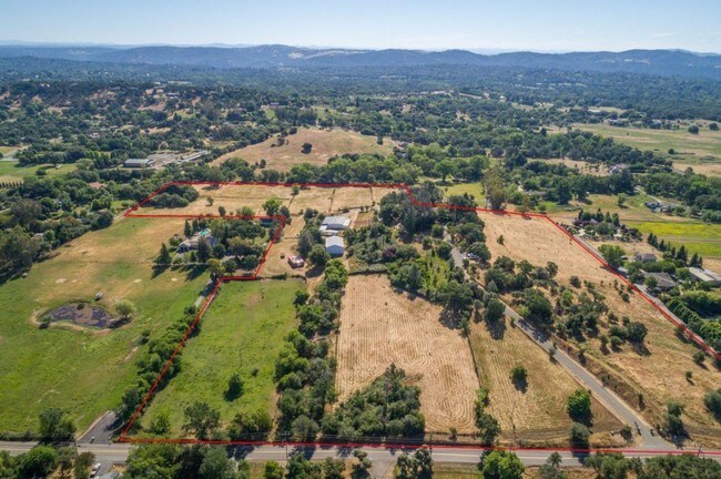
Property Record
4717 Val Verde Rd, Loomis, CA 95650


NEARBY LISTINGS FOR SALE OR LEASE
Property Detail
4717 Val Verde Rd
Sacramento-Roseville-Folsom, CA
Clayton Estates
036-031-025
7.4 AC PAR 2 PMOR 26 123
Vacantlandnec
Placer
X
California
06061C0966H
7.40 AC
2024
Roseville/Rocklin
2025
Sacramento
020607
DEMOGRAPHICS near 4717 Val Verde Rd
1 mile
3 mile
5 mile
2024 Total Population
1,148
20,508
65,223
2029 Population
1,233
21,964
69,881
Pop Growth 2024-2029
+ 7.40%
+ 7.10%
+ 7.14%
Average Age
44
42
43
2024 Total Households
405
7,312
24,043
HH Growth 2024-2029
+ 7.65%
+ 7.22%
+ 7.26%
Median Household Inc
$154,508
$122,378
$119,075
Avg Household Size
2.80
2.80
2.70
2024 Avg HH Vehicles
3.00
2.00
2.00
Median Home Value
$822,510
$823,977
$754,592
Median Year Built
1984
1986
1988
Nearby Places
Map Layers
Map Styles
 Street
 Aerial
Transit
 Traffic
 Biking
Places
Listings with unknown addresses are not visible on the map
- Restaurants
- Banks
- Shops
- Fitness
- Groceries
PUBLIC TRANSPORTATION
COMMUTER RAIL
Rocklin Amtrak Station (Capitol Corridor - Amtrak)
Drive
Walk
Distance
Rocklin Amtrak Station (Capitol Corridor - Amtrak)
12 min
6.3 mi
AIRPORT
Sacramento International
Drive
Walk
Distance
Sacramento International
46 min
34.0 mi
Freight Ports
Port of Stockton
Drive
Walk
Distance
Port of Stockton
89 min
74.2 mi
SALE & LEASE HISTORY
LISTING DATE
SALE/LEASE

Apr 23, 2018
For Sale
Nearby Properties
Address
Land Use
TOTAL SIZE
Lot Size
Zoning
Address
Land Use
TOTAL SIZE
Lot Size
Zoning
182,547 SF
10.19 AC
Address
Land Use
TOTAL SIZE
Lot Size
Zoning
246,349 SF
9.89 AC
Address
Land Use
TOTAL SIZE
Lot Size
Zoning
154,696 SF
10.80 AC
Address
Land Use
TOTAL SIZE
Lot Size
Zoning
194,087 SF
15.82 AC
Address
Land Use
TOTAL SIZE
Lot Size
Zoning
159,029 SF
17.62 AC
Address
Land Use
TOTAL SIZE
Lot Size
Zoning
136,101 SF
10 AC
Address
Land Use
TOTAL SIZE
Lot Size
Zoning
1,992 SF
44.99 AC
RAB100
Address
Land Use
TOTAL SIZE
Lot Size
Zoning
73,756 SF
6.60 AC
Address
Land Use
TOTAL SIZE
Lot Size
Zoning
6,167 SF
12.20 AC
Address
Land Use
TOTAL SIZE
Lot Size
Zoning
100,348 SF
12.50 AC
Address
Land Use
TOTAL SIZE
Lot Size
Zoning
89,928 SF
6 AC
CG
Address
Land Use
TOTAL SIZE
Lot Size
Zoning
48,170 SF
4 AC
Address
Land Use
TOTAL SIZE
Lot Size
Zoning
63,608 SF
5.20 AC
CG
Address
Land Use
TOTAL SIZE
Lot Size
Zoning
34,066 SF
2.90 AC
Address
Land Use
TOTAL SIZE
Lot Size
Zoning
29,380 SF
4.70 AC
Address
Land Use
TOTAL SIZE
Lot Size
Zoning
19,604 SF
3.08 AC
Address
Land Use
TOTAL SIZE
Lot Size
Zoning
1,500 SF
15.80 AC
RMDL10SP
Address
Land Use
TOTAL SIZE
Lot Size
Zoning
85,435 SF
2.75 AC
Address
Land Use
TOTAL SIZE
Lot Size
Zoning
3,063 SF
239 AC
RABX
Address
Land Use
TOTAL SIZE
Lot Size
Zoning
20,800 SF
2.10 AC
Address
Land Use
TOTAL SIZE
Lot Size
Zoning
35,146 SF
4 AC
Address
Land Use
TOTAL SIZE
Lot Size
Zoning
25,368 SF
1.08 AC
RH
Address
Land Use
TOTAL SIZE
Lot Size
Zoning
39,825 SF
3.10 AC
Address
Land Use
TOTAL SIZE
Lot Size
Zoning
17,733 SF
1.40 AC
C1UPDC
Address
Land Use
TOTAL SIZE
Lot Size
Zoning
6,925 SF
2.60 AC
RABX
Address
Land Use
TOTAL SIZE
Lot Size
Zoning
26,750 SF
5.20 AC
CG
Address
Land Use
TOTAL SIZE
Lot Size
Zoning
26,884 SF
1.40 AC
Address
Land Use
TOTAL SIZE
Lot Size
Zoning
6,109 SF
9.70 AC
RABX
Address
Land Use
TOTAL SIZE
Lot Size
Zoning
25,000 SF
2.40 AC
Address
Land Use
TOTAL SIZE
Lot Size
Zoning
14,410 SF
12.60 AC
The World's #1 Commercial Real Estate Marketplace
Connect with us
© 2026 CoStar Group
The information above has been obtained from sources believed reliable. While we do not doubt its accuracy we have not verified it and make no guarantee, warranty or representation about it. It is your responsibility to independently confirm its accuracy and completeness. Any projections, opinions, assumptions, or estimates used are for example only and do not represent the current or future performance of the property. The value of this transaction to you depends on tax and other factors which should be evaluated by your tax, financial, and legal advisors. You and your advisors should conduct a careful, independent investigation of the property to determine to your satisfaction the suitability of the property for your needs.