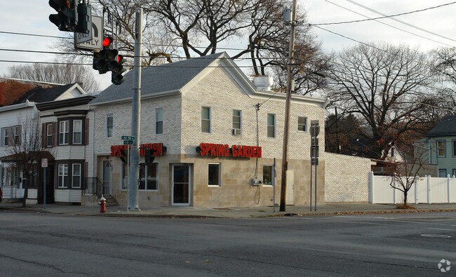
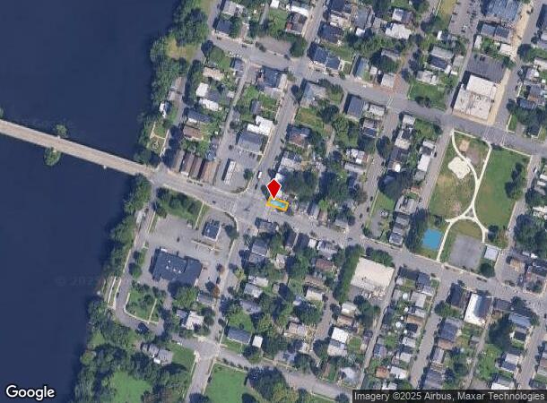
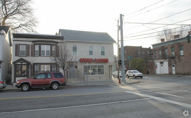
Property Record
472 2Nd Ave, Troy, NY 12182
NEARBY LISTINGS FOR SALE OR LEASE
Property Detail
472 2Nd Ave
1700-080.63-7-15
2 STY FR & BR HSE 285-14/SWPT 57
Commercialofficeresidentialmixeduse
Rensselaer
ARE
New York
36083C0118D
15.000
2025
0.03 AC
2024
Greater Troy
040200
Albany/Schenectady/Troy
2,300 SF
Albany-Schenectady-Troy, NY
DEMOGRAPHICS near 472 2Nd Ave
1 Mile
3 Mile
5 Mile
2024 Total Population
11,416
66,514
131,425
2029 Population
11,008
65,636
129,991
Pop Growth 2024-2029
(3.57%)
(1.32%)
(1.09%)
Average Age
40
40
39
2024 Total Households
5,337
29,352
55,718
HH Growth 2024-2029
(3.65%)
(1.40%)
(1.20%)
Median Household Inc
$49,106
$55,914
$64,109
Avg Household Size
2.00
2.10
2.20
2024 Avg HH Vehicles
1.00
1.00
1.00
Median Home Value
$153,115
$187,114
$219,446
Median Year Built
1947
1951
1958
Nearby Places
- Restaurants
- Banks
- Shops
- Fitness
- Groceries
PUBLIC TRANSPORTATION
AIRPORT
Albany International
DRIVE
WALK
Distance
Albany International
16 min
9.5 mi
Freight Ports
Albany, NY Port
DRIVE
WALK
Distance
Albany, NY Port
20 min
12.2 mi
Nearby Properties
Address
Land Use
TOTAL SIZE
Lot Size
Zoning
Address
Land Use
TOTAL SIZE
Lot Size
Zoning
34,971 SF
108.68 AC
CI
Address
Land Use
TOTAL SIZE
Lot Size
Zoning
313,907 SF
8.23 AC
CI
Address
Land Use
TOTAL SIZE
Lot Size
Zoning
9,643 SF
5.36 AC
CI
Address
Land Use
TOTAL SIZE
Lot Size
Zoning
Address
Land Use
TOTAL SIZE
Lot Size
Zoning
5,000 SF
48.44 AC
CR
Address
Land Use
TOTAL SIZE
Lot Size
Zoning
67,335 SF
65.54 AC
CI
Address
Land Use
TOTAL SIZE
Lot Size
Zoning
150,000 SF
45.60 AC
07 - MIXED
Address
Land Use
TOTAL SIZE
Lot Size
Zoning
38,176 SF
8.99 AC
06 - INDUS
Address
Land Use
TOTAL SIZE
Lot Size
Zoning
501,506 SF
48 AC
01 - NOT Z
Address
Land Use
TOTAL SIZE
Lot Size
Zoning
77,193 SF
28.41 AC
SF
Address
Land Use
TOTAL SIZE
Lot Size
Zoning
353,510 SF
2.94 AC
WMU
Address
Land Use
TOTAL SIZE
Lot Size
Zoning
Address
Land Use
TOTAL SIZE
Lot Size
Zoning
10,271 SF
11.22 AC
05 - COMME
Address
Land Use
TOTAL SIZE
Lot Size
Zoning
16,698 SF
46.45 AC
MF
Address
Land Use
TOTAL SIZE
Lot Size
Zoning
193,144 SF
41.18 AC
Address
Land Use
TOTAL SIZE
Lot Size
Zoning
251,672 SF
16.18 AC
06 - INDUS
Address
Land Use
TOTAL SIZE
Lot Size
Zoning
346,727 SF
15.06 AC
03 - MULTI
Address
Land Use
TOTAL SIZE
Lot Size
Zoning
113,400 SF
3.40 AC
CI
Address
Land Use
TOTAL SIZE
Lot Size
Zoning
1.30 AC
Address
Land Use
TOTAL SIZE
Lot Size
Zoning
210,415 SF
1.69 AC
MF
Address
Land Use
TOTAL SIZE
Lot Size
Zoning
Address
Land Use
TOTAL SIZE
Lot Size
Zoning
723,643 SF
27.56 AC
Address
Land Use
TOTAL SIZE
Lot Size
Zoning
77,928 SF
2.25 AC
WMU
Address
Land Use
TOTAL SIZE
Lot Size
Zoning
93,373 SF
4.50 AC
02 - SINGL
Address
Land Use
TOTAL SIZE
Lot Size
Zoning
5,500 SF
15.31 AC
MU2
Address
Land Use
TOTAL SIZE
Lot Size
Zoning
148,200 SF
7.43 AC
06 - INDUS
Address
Land Use
TOTAL SIZE
Lot Size
Zoning
1,500 SF
7.01 AC
WMU
Address
Land Use
TOTAL SIZE
Lot Size
Zoning
154,587 SF
3.79 AC
CC
Address
Land Use
TOTAL SIZE
Lot Size
Zoning
155,900 SF
1.30 AC
DMU
Address
Land Use
TOTAL SIZE
Lot Size
Zoning
3,600 SF
17.54 AC
MF
The World's #1 Commercial Real Estate Marketplace
Connect with us
© 2025 CoStar Group
The information above has been obtained from sources believed reliable. While we do not doubt its accuracy we have not verified it and make no guarantee, warranty or representation about it. It is your responsibility to independently confirm its accuracy and completeness. Any projections, opinions, assumptions, or estimates used are for example only and do not represent the current or future performance of the property. The value of this transaction to you depends on tax and other factors which should be evaluated by your tax, financial, and legal advisors. You and your advisors should conduct a careful, independent investigation of the property to determine to your satisfaction the suitability of the property for your needs.