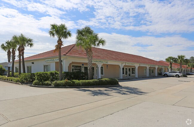
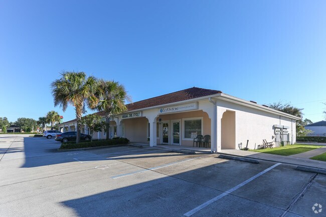
Property Record
4721 E Moody Blvd, Bunnell, FL 32110

NEARBY LISTINGS FOR SALE OR LEASE
-
-
-
-
-
-
No Photo
-
View all Bunnell listings for lease on LoopNet.com
Property Detail
4721 E Moody Blvd
Deltona-Daytona Beach-Ormond Beach, FL
Bunnell Dev Co
12-12-30-0650-000A0-0112
0004.45 ACRES BUNNELL DEV CO SUBD BLOCK A PART OF TRACTS 11 & 12 PARCEL HAS 186.56 ALONG SR 100; 385.77 ON SLY R/W OF OLD MOODY BLVD & IS 215WEST OF EAST SECTION LINE OR 113 PG 153 OR 316 PG 464 OR 387 PG 1000 OR 408 PG 940 OR 453 PG 862 OR 628 PG 34
Regionalshoppingcenterormallwithanchorstore
Flagler
X
Florida
12035C0226E
112
2024
4.92 AC
2025
Daytona Area
060207
Other Market Areas
41,293 SF
DEMOGRAPHICS near 4721 E Moody Blvd
1 Mile
3 Mile
5 Mile
2024 Total Population
2,909
29,068
59,511
2029 Population
3,576
35,620
72,864
Pop Growth 2024-2029
+ 22.93%
+ 22.54%
+ 22.44%
Average Age
48
45
45
2024 Total Households
1,208
11,536
23,448
HH Growth 2024-2029
+ 22.27%
+ 21.88%
+ 21.69%
Median Household Inc
$64,767
$56,818
$62,788
Avg Household Size
2.40
2.50
2.50
2024 Avg HH Vehicles
2.00
2.00
2.00
Median Home Value
$304,469
$255,944
$257,087
Median Year Built
2005
2004
2003
Nearby Places
Map Layers
Map Styles
 Street
 Aerial
- Restaurants
- Banks
- Shops
- Fitness
- Groceries
PUBLIC TRANSPORTATION
AIRPORT
Daytona Beach International
DRIVE
WALK
Distance
Daytona Beach International
35 min
26.9 mi
SALE & LEASE HISTORY
LISTING DATE
SALE/LEASE

May 30, 2017
For Lease
Apr 07, 2022
For Lease
Nearby Properties
Address
Land Use
TOTAL SIZE
Lot Size
Zoning
Address
Land Use
TOTAL SIZE
Lot Size
Zoning
345,915 SF
94.85 AC
COM-2
Address
Land Use
TOTAL SIZE
Lot Size
Zoning
913,614 SF
85.53 AC
PSP
Address
Land Use
TOTAL SIZE
Lot Size
Zoning
320,259 SF
83.19 AC
P
Address
Land Use
TOTAL SIZE
Lot Size
Zoning
217,927 SF
1,165.37 AC
I-C
Address
Land Use
TOTAL SIZE
Lot Size
Zoning
280,742 SF
16.06 AC
MPD
Address
Land Use
TOTAL SIZE
Lot Size
Zoning
225,108 SF
41.71 AC
MPD
Address
Land Use
TOTAL SIZE
Lot Size
Zoning
236,316 SF
61.38 AC
PSP
Address
Land Use
TOTAL SIZE
Lot Size
Zoning
138,991 SF
18.66 AC
P
Address
Land Use
TOTAL SIZE
Lot Size
Zoning
141,171 SF
8.18 AC
MPD
Address
Land Use
TOTAL SIZE
Lot Size
Zoning
121,173 SF
10 AC
AC
Address
Land Use
TOTAL SIZE
Lot Size
Zoning
64,208 SF
8.41 AC
PSP
Address
Land Use
TOTAL SIZE
Lot Size
Zoning
76,544 SF
48.85 AC
R/C
Address
Land Use
TOTAL SIZE
Lot Size
Zoning
124,911 SF
10.18 AC
PUD
Address
Land Use
TOTAL SIZE
Lot Size
Zoning
15.91 AC
PSP
Address
Land Use
TOTAL SIZE
Lot Size
Zoning
220,314 SF
17.41 AC
MPD
Address
Land Use
TOTAL SIZE
Lot Size
Zoning
82,459 SF
4.09 AC
MPD
Address
Land Use
TOTAL SIZE
Lot Size
Zoning
122,353 SF
17.97 AC
MPD
Address
Land Use
TOTAL SIZE
Lot Size
Zoning
208,450 SF
11.85 AC
MPD
Address
Land Use
TOTAL SIZE
Lot Size
Zoning
68,684 SF
9.68 AC
MPD
Address
Land Use
TOTAL SIZE
Lot Size
Zoning
89,590 SF
9.90 AC
B-1
Address
Land Use
TOTAL SIZE
Lot Size
Zoning
220.05 AC
MPD
Address
Land Use
TOTAL SIZE
Lot Size
Zoning
42,025 SF
15.64 AC
MPD
Address
Land Use
TOTAL SIZE
Lot Size
Zoning
84,899 SF
10.35 AC
COM-2
Address
Land Use
TOTAL SIZE
Lot Size
Zoning
35,243 SF
8.45 AC
COM-3
Address
Land Use
TOTAL SIZE
Lot Size
Zoning
28,591 SF
3.84 AC
PUD
Address
Land Use
TOTAL SIZE
Lot Size
Zoning
59,889 SF
0.75 AC
R-3A
Address
Land Use
TOTAL SIZE
Lot Size
Zoning
54,500 SF
4.95 AC
COM-2
Address
Land Use
TOTAL SIZE
Lot Size
Zoning
47,264 SF
10.20 AC
MPD
The World's #1 Commercial Real Estate Marketplace
Connect with us
© 2026 CoStar Group
The information above has been obtained from sources believed reliable. While we do not doubt its accuracy we have not verified it and make no guarantee, warranty or representation about it. It is your responsibility to independently confirm its accuracy and completeness. Any projections, opinions, assumptions, or estimates used are for example only and do not represent the current or future performance of the property. The value of this transaction to you depends on tax and other factors which should be evaluated by your tax, financial, and legal advisors. You and your advisors should conduct a careful, independent investigation of the property to determine to your satisfaction the suitability of the property for your needs.