Property Record
4725 Panama Ln, Bakersfield, CA 93313
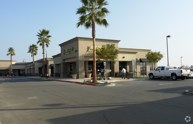

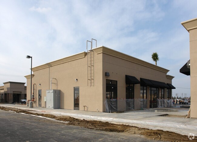

Property Detail
4725 Panama Ln
515-031-26-00-5
PARCEL MAP 11508 , LOT 2
Regionalshoppingcenterormallwithanchorstore
Kern
C2
California
B and X Area of moderate flood hazard, usually the area between the limits of the 100-year and 500-year floods.
2
2024
4.66 AC
2025
SW Outlying Kern County
003209
Bakersfield
3,510 SF
Bakersfield-Delano, CA
NEARBY LISTINGS FOR SALE OR LEASE
DEMOGRAPHICS near 4725 Panama Ln
1 mile
3 mile
5 mile
2025 Total Population
22,902
136,454
252,998
2030 Population
23,200
137,916
255,978
Pop Growth 2025-2030
+ 1.30%
+ 1.07%
+ 1.18%
Average Age
35
34
35
2025 Total Households
6,419
39,741
77,755
HH Growth 2025-2030
+ 1.22%
+ 0.97%
+ 1.11%
Median Household Inc
$92,550
$75,869
$74,257
Avg Household Size
3.50
3.40
3.20
2025 Avg HH Vehicles
2.00
2.00
2.00
Median Home Value
$357,243
$340,217
$348,583
Median Year Built
1996
1987
1984
Nearby Places
Map Layers
Map Styles
 Street
 Aerial
Layers
 Traffic
 Biking
Places
Listings with unknown addresses are not visible on the map
- Restaurants
- Banks
- Shops
- Fitness
- Groceries
PUBLIC TRANSPORTATION
COMMUTER RAIL
Drive
Walk
Distance
16 min
9.1 mi
AIRPORT
Meadows Field
Drive
Walk
Distance
Meadows Field
23 min
12.6 mi
Nearby Properties
Address
Land Use
TOTAL SIZE
Lot Size
Zoning
Address
Land Use
TOTAL SIZE
Lot Size
Zoning
587,976 SF
40.01 AC
M-2
Address
Land Use
TOTAL SIZE
Lot Size
Zoning
114,500 SF
12.02 AC
C-2
Address
Land Use
TOTAL SIZE
Lot Size
Zoning
354,000 SF
20 AC
M2
Address
Land Use
TOTAL SIZE
Lot Size
Zoning
269,429 SF
12.71 AC
R-2
Address
Land Use
TOTAL SIZE
Lot Size
Zoning
17.96 AC
C2
Address
Land Use
TOTAL SIZE
Lot Size
Zoning
218,345 SF
19.54 AC
PCD
Address
Land Use
TOTAL SIZE
Lot Size
Zoning
37,760 SF
12.16 AC
R3
Address
Land Use
TOTAL SIZE
Lot Size
Zoning
223,557 SF
21.31 AC
PCD
Address
Land Use
TOTAL SIZE
Lot Size
Zoning
62,941 SF
8.79 AC
M-1
Address
Land Use
TOTAL SIZE
Lot Size
Zoning
88,988 SF
9.82 AC
C-2
Address
Land Use
TOTAL SIZE
Lot Size
Zoning
11,780 SF
11.25 AC
C1
Address
Land Use
TOTAL SIZE
Lot Size
Zoning
23,600 SF
8.17 AC
C2
Address
Land Use
TOTAL SIZE
Lot Size
Zoning
135,549 SF
12 AC
M1
Address
Land Use
TOTAL SIZE
Lot Size
Zoning
58,496 SF
7.32 AC
Address
Land Use
TOTAL SIZE
Lot Size
Zoning
69,414 SF
4.47 AC
M1
Address
Land Use
TOTAL SIZE
Lot Size
Zoning
12,008 SF
7.18 AC
Address
Land Use
TOTAL SIZE
Lot Size
Zoning
149,499 SF
13.20 AC
GC
Address
Land Use
TOTAL SIZE
Lot Size
Zoning
92,469 SF
7.15 AC
R-3
Address
Land Use
TOTAL SIZE
Lot Size
Zoning
41,507 SF
10.37 AC
C2
Address
Land Use
TOTAL SIZE
Lot Size
Zoning
10,073 SF
15.48 AC
PCD
Address
Land Use
TOTAL SIZE
Lot Size
Zoning
161,608 SF
10.70 AC
M2
Address
Land Use
TOTAL SIZE
Lot Size
Zoning
1,100 SF
6.28 AC
R-3
Address
Land Use
TOTAL SIZE
Lot Size
Zoning
81,682 SF
12.27 AC
M-2
Address
Land Use
TOTAL SIZE
Lot Size
Zoning
94,240 SF
4.95 AC
C-2
Address
Land Use
TOTAL SIZE
Lot Size
Zoning
232,000 SF
15.74 AC
M-2
Address
Land Use
TOTAL SIZE
Lot Size
Zoning
113,910 SF
9.43 AC
M2
Address
Land Use
TOTAL SIZE
Lot Size
Zoning
149,777 SF
15.27 AC
C2
Address
Land Use
TOTAL SIZE
Lot Size
Zoning
7.62 AC
C2
Address
Land Use
TOTAL SIZE
Lot Size
Zoning
4.02 AC
C2
Address
Land Use
TOTAL SIZE
Lot Size
Zoning
140,235 SF
8 AC
M2
The World's #1 Commercial Real Estate Marketplace
Connect with us
© 2026 CoStar Group
The information above has been obtained from sources believed reliable. While we do not doubt its accuracy we have not verified it and make no guarantee, warranty or representation about it. It is your responsibility to independently confirm its accuracy and completeness. Any projections, opinions, assumptions, or estimates used are for example only and do not represent the current or future performance of the property. The value of this transaction to you depends on tax and other factors which should be evaluated by your tax, financial, and legal advisors. You and your advisors should conduct a careful, independent investigation of the property to determine to your satisfaction the suitability of the property for your needs.