Property Record
4726 Security Dr, Springfield, OH 45503
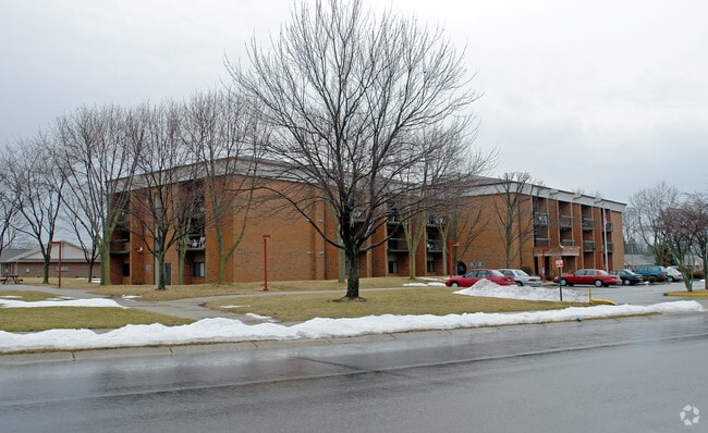

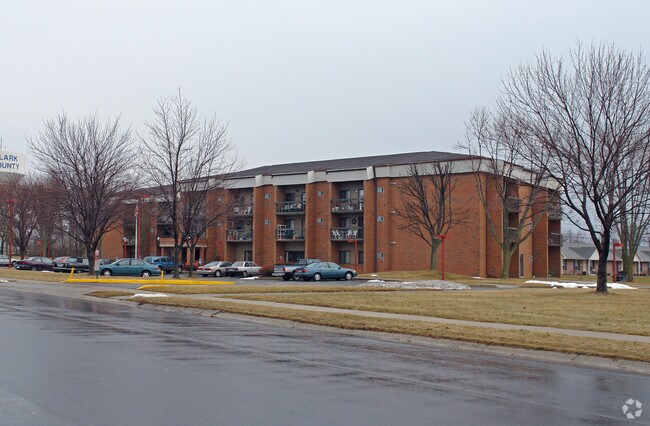
Property Detail
4726 Security Dr
22-00300-02721-2026
PT N E QR (2)
Municipalproperty
Clark
R4
Ohio
B and X Area of moderate flood hazard, usually the area between the limits of the 100-year and 500-year floods.
26
0
3 AC
2025
Springfield
002608
Cincinnati/Dayton
42,516 SF
Springfield, OH
NEARBY LISTINGS FOR SALE OR LEASE
-
-
View all Springfield listings for sale on LoopNet.com
DEMOGRAPHICS near 4726 Security Dr
1 mile
3 mile
5 mile
2025 Total Population
6,991
21,704
48,717
2030 Population
6,868
21,420
48,382
Pop Growth 2025-2030
(1.76%)
(1.31%)
(0.69%)
Average Age
45
46
42
2025 Total Households
3,088
9,881
20,833
HH Growth 2025-2030
(1.78%)
(1.25%)
(0.64%)
Median Household Inc
$80,601
$61,862
$57,754
Avg Household Size
2.20
2.10
2.20
2025 Avg HH Vehicles
2.00
2.00
2.00
Median Home Value
$182,927
$188,321
$177,997
Median Year Built
1973
1975
1966
Nearby Places
Map Layers
Map Styles
 Street
 Aerial
Layers
 Traffic
 Biking
Places
Listings with unknown addresses are not visible on the map
- Restaurants
- Banks
- Shops
- Fitness
- Groceries
PUBLIC TRANSPORTATION
AIRPORT
James M Cox Dayton International
Drive
Walk
Distance
James M Cox Dayton International
42 min
32.1 mi
Nearby Properties
Address
Land Use
TOTAL SIZE
Lot Size
Zoning
Address
Land Use
TOTAL SIZE
Lot Size
Zoning
3,360 SF
96.84 AC
Address
Land Use
TOTAL SIZE
Lot Size
Zoning
193,701 SF
16.31 AC
Address
Land Use
TOTAL SIZE
Lot Size
Zoning
1,582 SF
42.13 AC
Address
Land Use
TOTAL SIZE
Lot Size
Zoning
1,667,526 SF
104.07 AC
I-1
Address
Land Use
TOTAL SIZE
Lot Size
Zoning
48,514 SF
9.72 AC
R-4S
Address
Land Use
TOTAL SIZE
Lot Size
Zoning
62,085 SF
6.05 AC
A-1
Address
Land Use
TOTAL SIZE
Lot Size
Zoning
79,187 SF
7.70 AC
Address
Land Use
TOTAL SIZE
Lot Size
Zoning
36,172 SF
2.14 AC
Address
Land Use
TOTAL SIZE
Lot Size
Zoning
12.76 AC
Address
Land Use
TOTAL SIZE
Lot Size
Zoning
28,228 SF
7.47 AC
A-1
Address
Land Use
TOTAL SIZE
Lot Size
Zoning
41,710 SF
5.25 AC
Address
Land Use
TOTAL SIZE
Lot Size
Zoning
20,448 SF
7.35 AC
Address
Land Use
TOTAL SIZE
Lot Size
Zoning
36,858 SF
17.81 AC
Address
Land Use
TOTAL SIZE
Lot Size
Zoning
521,780 SF
206.66 AC
I-1
Address
Land Use
TOTAL SIZE
Lot Size
Zoning
16,860 SF
18.13 AC
Address
Land Use
TOTAL SIZE
Lot Size
Zoning
6,636 SF
5.53 AC
Address
Land Use
TOTAL SIZE
Lot Size
Zoning
Address
Land Use
TOTAL SIZE
Lot Size
Zoning
65,174 SF
4.06 AC
Address
Land Use
TOTAL SIZE
Lot Size
Zoning
96,300 SF
11.57 AC
Address
Land Use
TOTAL SIZE
Lot Size
Zoning
60,518 SF
5.18 AC
Address
Land Use
TOTAL SIZE
Lot Size
Zoning
25,824 SF
3.32 AC
Address
Land Use
TOTAL SIZE
Lot Size
Zoning
1,912 SF
321.57 AC
Address
Land Use
TOTAL SIZE
Lot Size
Zoning
14,900 SF
5.91 AC
Address
Land Use
TOTAL SIZE
Lot Size
Zoning
52,698 SF
2.56 AC
Address
Land Use
TOTAL SIZE
Lot Size
Zoning
41,450 SF
4.50 AC
Address
Land Use
TOTAL SIZE
Lot Size
Zoning
64,600 SF
15.08 AC
I-1
Address
Land Use
TOTAL SIZE
Lot Size
Zoning
66,354 SF
5.36 AC
Address
Land Use
TOTAL SIZE
Lot Size
Zoning
25,378 SF
3.56 AC
Address
Land Use
TOTAL SIZE
Lot Size
Zoning
243.39 AC
Address
Land Use
TOTAL SIZE
Lot Size
Zoning
17,360 SF
3.88 AC
The World's #1 Commercial Real Estate Marketplace
Connect with us
© 2026 CoStar Group
The information above has been obtained from sources believed reliable. While we do not doubt its accuracy we have not verified it and make no guarantee, warranty or representation about it. It is your responsibility to independently confirm its accuracy and completeness. Any projections, opinions, assumptions, or estimates used are for example only and do not represent the current or future performance of the property. The value of this transaction to you depends on tax and other factors which should be evaluated by your tax, financial, and legal advisors. You and your advisors should conduct a careful, independent investigation of the property to determine to your satisfaction the suitability of the property for your needs.