Property Record
4726 W Ox Rd, Fairfax, VA 22030

NEARBY LISTINGS FOR SALE OR LEASE
Property Detail
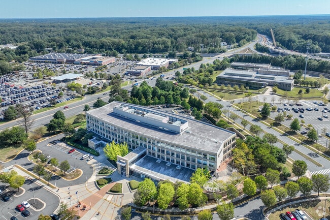
4726 W Ox Rd
Washington-Arlington-Alexandria, DC-VA-MD-WV
Legato
0561-01-0003B
LEGATO
Officebuilding
Fairfax
X
Virginia
51059C0255E
3b
0
7.38 AC
2025
Fairfax Center
440600
Washington, DC
159,277 SF
DEMOGRAPHICS near 4726 W Ox Rd
1 Mile
3 Mile
5 Mile
2024 Total Population
12,423
94,635
239,988
2029 Population
12,279
93,489
237,404
Pop Growth 2024-2029
(1.16%)
(1.21%)
(1.08%)
Average Age
37
39
39
2024 Total Households
5,348
35,506
82,853
HH Growth 2024-2029
(1.36%)
(1.35%)
(1.14%)
Median Household Inc
$118,703
$134,598
$141,979
Avg Household Size
2.30
2.60
2.80
2024 Avg HH Vehicles
2.00
2.00
2.00
Median Home Value
$632,500
$683,534
$667,229
Median Year Built
1997
1992
1987
Nearby Places
Map Layers
Map Styles
 Street
 Aerial
- Restaurants
- Banks
- Shops
- Fitness
- Groceries
PUBLIC TRANSPORTATION
COMMUTER RAIL
Burke Centre (Manassas Line - Virginia Railway Express)
DRIVE
WALK
Distance
Burke Centre (Manassas Line - Virginia Railway Express)
17 min
8.0 mi
Manassas Park (Manassas Line - Virginia Railway Express)
DRIVE
WALK
Distance
Manassas Park (Manassas Line - Virginia Railway Express)
21 min
9.8 mi
AIRPORT
Washington Dulles International
DRIVE
WALK
Distance
Washington Dulles International
28 min
14.0 mi
Ronald Reagan Washington Ntl
DRIVE
WALK
Distance
Ronald Reagan Washington Ntl
37 min
23.9 mi
Freight Ports
Port of Baltimore
DRIVE
WALK
Distance
Port of Baltimore
81 min
59.6 mi
Nearby Properties
Address
Land Use
TOTAL SIZE
Lot Size
Zoning
Address
Land Use
TOTAL SIZE
Lot Size
Zoning
619,592 SF
45.35 AC
403
Address
Land Use
TOTAL SIZE
Lot Size
Zoning
819,810 SF
41.50 AC
470
Address
Land Use
TOTAL SIZE
Lot Size
Zoning
602,129 SF
32.09 AC
220
Address
Land Use
TOTAL SIZE
Lot Size
Zoning
565,554 SF
21.17 AC
402
Address
Land Use
TOTAL SIZE
Lot Size
Zoning
561,458 SF
8.30 AC
COMMERCIAL
Address
Land Use
TOTAL SIZE
Lot Size
Zoning
484,415 SF
13.53 AC
400
Address
Land Use
TOTAL SIZE
Lot Size
Zoning
464,995 SF
17.05 AC
312
Address
Land Use
TOTAL SIZE
Lot Size
Zoning
470,385 SF
7.87 AC
312
Address
Land Use
TOTAL SIZE
Lot Size
Zoning
533,047 SF
31.77 AC
320
Address
Land Use
TOTAL SIZE
Lot Size
Zoning
374,028 SF
24.23 AC
402
Address
Land Use
TOTAL SIZE
Lot Size
Zoning
384,763 SF
7.40 AC
400
Address
Land Use
TOTAL SIZE
Lot Size
Zoning
349,581 SF
28.70 AC
460
Address
Land Use
TOTAL SIZE
Lot Size
Zoning
351,708 SF
6.12 AC
350
Address
Land Use
TOTAL SIZE
Lot Size
Zoning
356,098 SF
16.04 AC
320
Address
Land Use
TOTAL SIZE
Lot Size
Zoning
411,843 SF
16.10 AC
400
Address
Land Use
TOTAL SIZE
Lot Size
Zoning
296,435 SF
13.20 AC
320
Address
Land Use
TOTAL SIZE
Lot Size
Zoning
685,715 SF
81.86 AC
400
Address
Land Use
TOTAL SIZE
Lot Size
Zoning
225,494 SF
30.39 AC
110
Address
Land Use
TOTAL SIZE
Lot Size
Zoning
283,458 SF
4.07 AC
403
Address
Land Use
TOTAL SIZE
Lot Size
Zoning
335,906 SF
19.81 AC
402
Address
Land Use
TOTAL SIZE
Lot Size
Zoning
269,934 SF
10.03 AC
400
Address
Land Use
TOTAL SIZE
Lot Size
Zoning
270,152 SF
6.94 AC
180
Address
Land Use
TOTAL SIZE
Lot Size
Zoning
276,035 SF
5.69 AC
403
Address
Land Use
TOTAL SIZE
Lot Size
Zoning
342,550 SF
14.17 AC
316
Address
Land Use
TOTAL SIZE
Lot Size
Zoning
222,392 SF
350
Address
Land Use
TOTAL SIZE
Lot Size
Zoning
215,791 SF
5.82 AC
400
Address
Land Use
TOTAL SIZE
Lot Size
Zoning
273,847 SF
9.11 AC
400
Address
Land Use
TOTAL SIZE
Lot Size
Zoning
173,935 SF
15.89 AC
496
The World's #1 Commercial Real Estate Marketplace
Connect with us
© 2025 CoStar Group
The information above has been obtained from sources believed reliable. While we do not doubt its accuracy we have not verified it and make no guarantee, warranty or representation about it. It is your responsibility to independently confirm its accuracy and completeness. Any projections, opinions, assumptions, or estimates used are for example only and do not represent the current or future performance of the property. The value of this transaction to you depends on tax and other factors which should be evaluated by your tax, financial, and legal advisors. You and your advisors should conduct a careful, independent investigation of the property to determine to your satisfaction the suitability of the property for your needs.