Property Record
473 Highway 138 E, Stockbridge, GA 30281


NEARBY LISTINGS FOR SALE OR LEASE
Property Detail
473 Highway 138 E
068B-01-023-000
LAND LOT: 64 /LAND DISTRICT: 11; INDUSTRIAL
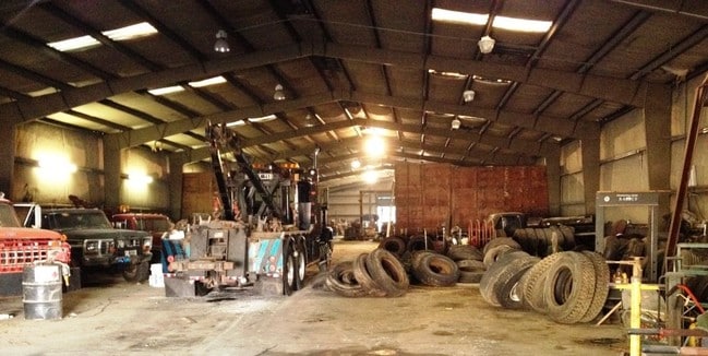
Sfr
Henry
X
Georgia
13151C0087D
40 AC
2025
S Clayton/Henry Cnty
2025
Atlanta
070113
Atlanta-Sandy Springs-Roswell, GA
6,620 SF
DEMOGRAPHICS near 473 Highway 138 E
1 mile
3 mile
5 mile
2024 Total Population
2,947
27,796
84,658
2029 Population
3,239
30,195
91,457
Pop Growth 2024-2029
+ 9.91%
+ 8.63%
+ 8.03%
Average Age
38
39
39
2024 Total Households
1,062
10,036
29,969
HH Growth 2024-2029
+ 9.89%
+ 8.66%
+ 8.02%
Median Household Inc
$61,401
$67,705
$70,600
Avg Household Size
2.70
2.70
2.80
2024 Avg HH Vehicles
2.00
2.00
2.00
Median Home Value
$199,999
$224,443
$229,721
Median Year Built
1988
1992
1995
Nearby Places
Map Layers
Map Styles
 Street
 Aerial
Transit
 Traffic
 Biking
Places
Listings with unknown addresses are not visible on the map
- Restaurants
- Banks
- Shops
- Fitness
- Groceries
PUBLIC TRANSPORTATION
AIRPORT
Hartsfield - Jackson Atlanta International
Drive
Walk
Distance
Hartsfield - Jackson Atlanta International
28 min
18.4 mi
SALE & LEASE HISTORY
LISTING DATE
SALE/LEASE

Sep 23, 2016
For Sale
Nearby Properties
Address
Land Use
TOTAL SIZE
Lot Size
Zoning
Address
Land Use
TOTAL SIZE
Lot Size
Zoning
19,140 SF
40.11 AC
RM
Address
Land Use
TOTAL SIZE
Lot Size
Zoning
21,678 SF
26.44 AC
RM
Address
Land Use
TOTAL SIZE
Lot Size
Zoning
13,072 SF
32.50 AC
RM
Address
Land Use
TOTAL SIZE
Lot Size
Zoning
707,800 SF
27.81 AC
M1
Address
Land Use
TOTAL SIZE
Lot Size
Zoning
25,952 SF
28.88 AC
RM
Address
Land Use
TOTAL SIZE
Lot Size
Zoning
9,264 SF
26.63 AC
RM
Address
Land Use
TOTAL SIZE
Lot Size
Zoning
510,053 SF
39.93 AC
M1
Address
Land Use
TOTAL SIZE
Lot Size
Zoning
439,225 SF
19.81 AC
M1
Address
Land Use
TOTAL SIZE
Lot Size
Zoning
399,189 SF
29.60 AC
M1
Address
Land Use
TOTAL SIZE
Lot Size
Zoning
269,100 SF
30.64 AC
Address
Land Use
TOTAL SIZE
Lot Size
Zoning
68,500 SF
140.42 AC
R2
Address
Land Use
TOTAL SIZE
Lot Size
Zoning
8,590 SF
11.09 AC
R3
Address
Land Use
TOTAL SIZE
Lot Size
Zoning
466,048 SF
6.51 AC
RA
Address
Land Use
TOTAL SIZE
Lot Size
Zoning
630 SF
15 AC
C1
Address
Land Use
TOTAL SIZE
Lot Size
Zoning
46,964 SF
2.72 AC
Address
Land Use
TOTAL SIZE
Lot Size
Zoning
25,020 SF
169.25 AC
RA
Address
Land Use
TOTAL SIZE
Lot Size
Zoning
3,600 SF
7.67 AC
M1
Address
Land Use
TOTAL SIZE
Lot Size
Zoning
44,830 SF
3.52 AC
C2
Address
Land Use
TOTAL SIZE
Lot Size
Zoning
60,450 SF
5.43 AC
C2
Address
Land Use
TOTAL SIZE
Lot Size
Zoning
79,565 SF
9.67 AC
C2
Address
Land Use
TOTAL SIZE
Lot Size
Zoning
117,710 SF
5.28 AC
C2
Address
Land Use
TOTAL SIZE
Lot Size
Zoning
35,324 SF
7.86 AC
C1
Address
Land Use
TOTAL SIZE
Lot Size
Zoning
72,808 SF
13.66 AC
C2
Address
Land Use
TOTAL SIZE
Lot Size
Zoning
206,400 SF
16.20 AC
M1
Address
Land Use
TOTAL SIZE
Lot Size
Zoning
45,169 SF
6.12 AC
Address
Land Use
TOTAL SIZE
Lot Size
Zoning
100,546 SF
25.18 AC
RA
Address
Land Use
TOTAL SIZE
Lot Size
Zoning
137,858 SF
39.87 AC
C1
Address
Land Use
TOTAL SIZE
Lot Size
Zoning
116,076 SF
4.55 AC
C3
Address
Land Use
TOTAL SIZE
Lot Size
Zoning
37,960 SF
10.92 AC
RM
Address
Land Use
TOTAL SIZE
Lot Size
Zoning
30,285 SF
600.44 AC
M1
The World's #1 Commercial Real Estate Marketplace
Connect with us
© 2026 CoStar Group
The information above has been obtained from sources believed reliable. While we do not doubt its accuracy we have not verified it and make no guarantee, warranty or representation about it. It is your responsibility to independently confirm its accuracy and completeness. Any projections, opinions, assumptions, or estimates used are for example only and do not represent the current or future performance of the property. The value of this transaction to you depends on tax and other factors which should be evaluated by your tax, financial, and legal advisors. You and your advisors should conduct a careful, independent investigation of the property to determine to your satisfaction the suitability of the property for your needs.