Property Record
473 New Jersey Church Rd, Lexington, NC 27292

NEARBY LISTINGS FOR SALE OR LEASE
Property Detail
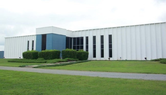
473 New Jersey Church Rd
06-008-0-000-0007-0-0-0
Sutlane Source
Heavymanufacturing
L7 BK2317-2131 NEW JERSEY CH RD
X
Davidson
3710672300J
North Carolina
2025
202.76 AC
2025
South Davidson County
061803
Greensboro/Winston-Salem
943,340 SF
Winston-Salem, NC
DEMOGRAPHICS near 473 New Jersey Church Rd
1 Mile
3 Mile
5 Mile
2024 Total Population
673
6,269
30,017
2029 Population
703
6,611
31,818
Pop Growth 2024-2029
+ 4.46%
+ 5.46%
+ 6.00%
Average Age
41
42
41
2024 Total Households
252
2,492
12,074
HH Growth 2024-2029
+ 4.37%
+ 5.42%
+ 5.91%
Median Household Inc
$50,395
$52,274
$46,301
Avg Household Size
2.50
2.40
2.40
2024 Avg HH Vehicles
2.00
2.00
2.00
Median Home Value
$163,461
$154,333
$164,920
Median Year Built
1984
1981
1979
Nearby Places
Map Layers
Map Styles
 Street
 Aerial
- Restaurants
- Banks
- Shops
- Fitness
- Groceries
Nearby Properties
Address
Land Use
TOTAL SIZE
Lot Size
Zoning
Address
Land Use
TOTAL SIZE
Lot Size
Zoning
4,622 SF
246.40 AC
I
Address
Land Use
TOTAL SIZE
Lot Size
Zoning
22,560 SF
204.19 AC
I
Address
Land Use
TOTAL SIZE
Lot Size
Zoning
3,600 SF
198.35 AC
EC
Address
Land Use
TOTAL SIZE
Lot Size
Zoning
3,156 SF
332.28 AC
HI
Address
Land Use
TOTAL SIZE
Lot Size
Zoning
207,185 SF
29.84 AC
B
Address
Land Use
TOTAL SIZE
Lot Size
Zoning
43,008 SF
25.21 AC
B
Address
Land Use
TOTAL SIZE
Lot Size
Zoning
114,109 SF
20.39 AC
I
Address
Land Use
TOTAL SIZE
Lot Size
Zoning
116,842 SF
20.04 AC
I
Address
Land Use
TOTAL SIZE
Lot Size
Zoning
142,700 SF
18.21 AC
B
Address
Land Use
TOTAL SIZE
Lot Size
Zoning
101,475 SF
108.36 AC
I
Address
Land Use
TOTAL SIZE
Lot Size
Zoning
6,000 SF
33.27 AC
HI
Address
Land Use
TOTAL SIZE
Lot Size
Zoning
90,678 SF
39.70 AC
RA1
Address
Land Use
TOTAL SIZE
Lot Size
Zoning
103,720 SF
21.05 AC
I
Address
Land Use
TOTAL SIZE
Lot Size
Zoning
46,562 SF
1.73 AC
B
Address
Land Use
TOTAL SIZE
Lot Size
Zoning
5,490 SF
212.79 AC
RA1
Address
Land Use
TOTAL SIZE
Lot Size
Zoning
131,100 SF
17.78 AC
I
Address
Land Use
TOTAL SIZE
Lot Size
Zoning
214,592 SF
20.01 AC
I
Address
Land Use
TOTAL SIZE
Lot Size
Zoning
14,148 SF
3.34 AC
B
Address
Land Use
TOTAL SIZE
Lot Size
Zoning
201,600 SF
9.90 AC
I
Address
Land Use
TOTAL SIZE
Lot Size
Zoning
131,250 SF
14.30 AC
I
Address
Land Use
TOTAL SIZE
Lot Size
Zoning
23,572 SF
36.39 AC
I
Address
Land Use
TOTAL SIZE
Lot Size
Zoning
59,281 SF
4.34 AC
B
Address
Land Use
TOTAL SIZE
Lot Size
Zoning
49,552 SF
3.33 AC
B
Address
Land Use
TOTAL SIZE
Lot Size
Zoning
104,230 SF
62.20 AC
I
Address
Land Use
TOTAL SIZE
Lot Size
Zoning
19,137 SF
2.01 AC
B
Address
Land Use
TOTAL SIZE
Lot Size
Zoning
100,490 SF
18.18 AC
I
Address
Land Use
TOTAL SIZE
Lot Size
Zoning
157,650 SF
28.11 AC
LI
Address
Land Use
TOTAL SIZE
Lot Size
Zoning
11,316 SF
9.83 AC
TN
Address
Land Use
TOTAL SIZE
Lot Size
Zoning
115,838 SF
57.83 AC
I
The World's #1 Commercial Real Estate Marketplace
Connect with us
© 2026 CoStar Group
The information above has been obtained from sources believed reliable. While we do not doubt its accuracy we have not verified it and make no guarantee, warranty or representation about it. It is your responsibility to independently confirm its accuracy and completeness. Any projections, opinions, assumptions, or estimates used are for example only and do not represent the current or future performance of the property. The value of this transaction to you depends on tax and other factors which should be evaluated by your tax, financial, and legal advisors. You and your advisors should conduct a careful, independent investigation of the property to determine to your satisfaction the suitability of the property for your needs.