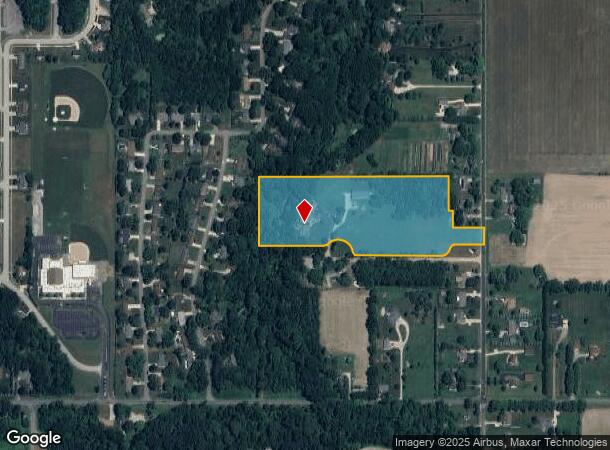
Property Record
4730 Scottdale Rd, Saint Joseph, MI 49085
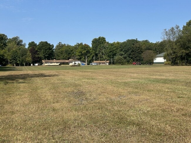
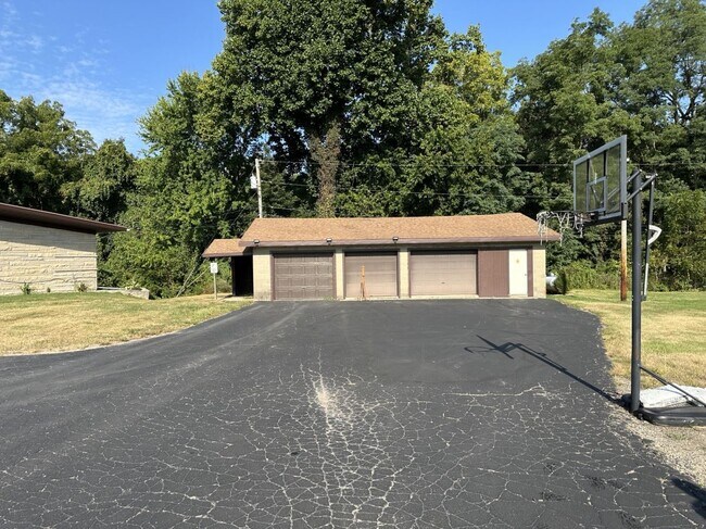
This Property Is For Sale
NEARBY LISTINGS FOR SALE OR LEASE
-
-
View all Saint Joseph listings for sale on LoopNet.com
Property Detail
4730 Scottdale Rd
11-17-0018-0008-09-9
COM 923.18'N OF SE COR FRL SEC 18 T5S R18W TH S89DEG46' W 152.5'TH ON A 68.69'RAD CUR LT A CHORD DIS OF S61DEG 26'W 65.23'TH ON A 68.69'RAD CUR RT A CHORD DIS OF S61DEG 26'W 65.23'TH S89DEG48'W 501.47'TH ON A 20'RAD CUR RT A CHORD DIS OF N43DEG55'W 2
Commercialnec
Berrien
AE
Michigan
26021C0112C
a
0
11.58 AC
2025
Michigan Southwest Area
001800
Other Market Areas
4,537 SF
Niles-Benton Harbor, MI
DEMOGRAPHICS near 4730 Scottdale Rd
1 Mile
3 Mile
5 Mile
2024 Total Population
1,600
12,736
42,717
2029 Population
1,526
12,287
41,512
Pop Growth 2024-2029
(4.63%)
(3.53%)
(2.82%)
Average Age
43
43
42
2024 Total Households
549
4,904
17,643
HH Growth 2024-2029
(5.28%)
(3.71%)
(3.05%)
Median Household Inc
$114,062
$92,309
$70,621
Avg Household Size
2.70
2.50
2.30
2024 Avg HH Vehicles
2.00
2.00
2.00
Median Home Value
$291,315
$265,017
$228,263
Median Year Built
1979
1976
1968
Nearby Places
- Restaurants
- Banks
- Shops
- Fitness
- Groceries
PUBLIC TRANSPORTATION
COMMUTER RAIL
DRIVE
WALK
Distance
16 min
7.3 mi
AIRPORT
South Bend International
DRIVE
WALK
Distance
South Bend International
45 min
28.5 mi
Nearby Properties
Address
Land Use
TOTAL SIZE
Lot Size
Zoning
Address
Land Use
TOTAL SIZE
Lot Size
Zoning
87,978 SF
4.36 AC
R2 MDR
Address
Land Use
TOTAL SIZE
Lot Size
Zoning
69,180 SF
3.58 AC
D1 COMM
Address
Land Use
TOTAL SIZE
Lot Size
Zoning
73,505 SF
4.02 AC
D1 COMM
Address
Land Use
TOTAL SIZE
Lot Size
Zoning
53,504 SF
Address
Land Use
TOTAL SIZE
Lot Size
Zoning
61,732 SF
3.51 AC
D1 COMM
Address
Land Use
TOTAL SIZE
Lot Size
Zoning
42,610 SF
5.30 AC
C4 HEAVY
Address
Land Use
TOTAL SIZE
Lot Size
Zoning
45,270 SF
10.30 AC
C1 GEN COM
Address
Land Use
TOTAL SIZE
Lot Size
Zoning
49,527 SF
4.47 AC
PUD
Address
Land Use
TOTAL SIZE
Lot Size
Zoning
9,136 SF
79.96 AC
MH
Address
Land Use
TOTAL SIZE
Lot Size
Zoning
62,721 SF
16.85 AC
CMU
Address
Land Use
TOTAL SIZE
Lot Size
Zoning
23,234 SF
3.94 AC
PUD
Address
Land Use
TOTAL SIZE
Lot Size
Zoning
29,032 SF
4.62 AC
C1 GEN COM
Address
Land Use
TOTAL SIZE
Lot Size
Zoning
36,912 SF
30.54 AC
E RESTRICT
Address
Land Use
TOTAL SIZE
Lot Size
Zoning
33,550 SF
1.94 AC
C1 GEN COM
Address
Land Use
TOTAL SIZE
Lot Size
Zoning
28,344 SF
4.62 AC
C1 GEN COM
Address
Land Use
TOTAL SIZE
Lot Size
Zoning
Address
Land Use
TOTAL SIZE
Lot Size
Zoning
40,758 SF
9.20 AC
Address
Land Use
TOTAL SIZE
Lot Size
Zoning
25,029 SF
4.22 AC
B2 - RET/S
Address
Land Use
TOTAL SIZE
Lot Size
Zoning
57,754 SF
6.78 AC
D1 COMM
Address
Land Use
TOTAL SIZE
Lot Size
Zoning
53,219 SF
10.10 AC
I1
Address
Land Use
TOTAL SIZE
Lot Size
Zoning
13,425 SF
2.14 AC
R1 - LD
Address
Land Use
TOTAL SIZE
Lot Size
Zoning
34.16 AC
A - AG
Address
Land Use
TOTAL SIZE
Lot Size
Zoning
9,366 SF
0.44 AC
C1 GEN COM
Address
Land Use
TOTAL SIZE
Lot Size
Zoning
13,360 SF
1.61 AC
C1 GEN COM
Address
Land Use
TOTAL SIZE
Lot Size
Zoning
29,665 SF
10.74 AC
PUD
Address
Land Use
TOTAL SIZE
Lot Size
Zoning
59,433 SF
7.85 AC
R1
Address
Land Use
TOTAL SIZE
Lot Size
Zoning
30,240 SF
10 AC
LD
Address
Land Use
TOTAL SIZE
Lot Size
Zoning
52,548 SF
8.29 AC
B2 - RET/S
Address
Land Use
TOTAL SIZE
Lot Size
Zoning
1,632 SF
125.92 AC
A - AG
Address
Land Use
TOTAL SIZE
Lot Size
Zoning
14,258 SF
2.30 AC
CMU
The World's #1 Commercial Real Estate Marketplace
Connect with us
© 2025 CoStar Group
The information above has been obtained from sources believed reliable. While we do not doubt its accuracy we have not verified it and make no guarantee, warranty or representation about it. It is your responsibility to independently confirm its accuracy and completeness. Any projections, opinions, assumptions, or estimates used are for example only and do not represent the current or future performance of the property. The value of this transaction to you depends on tax and other factors which should be evaluated by your tax, financial, and legal advisors. You and your advisors should conduct a careful, independent investigation of the property to determine to your satisfaction the suitability of the property for your needs.