Property Record
4738 S Interstate 35, Austin, TX 78745
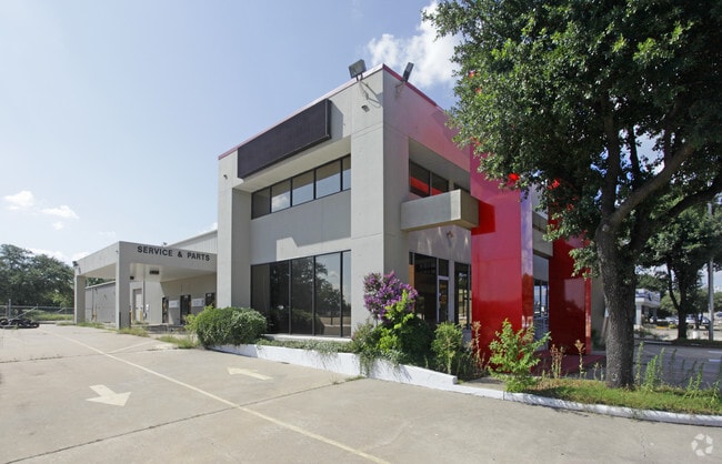


Property Detail
4738 S Interstate 35
Austin-Round Rock-San Marcos, TX
LOT 4 JARKCO SUBDIVISION
322743
Travis
Vehiclerentalsvehiclesales
Texas
B and X Area of moderate flood hazard, usually the area between the limits of the 100-year and 500-year floods.
4
2025
2.09 AC
2025
South
002403
Austin
25,283 SF
NEARBY LISTINGS FOR SALE OR LEASE
DEMOGRAPHICS near 4738 S Interstate 35
1 mile
3 mile
5 mile
2025 Total Population
12,343
146,912
327,968
2030 Population
13,007
154,077
345,505
Pop Growth 2025-2030
+ 5.38%
+ 4.88%
+ 5.35%
Average Age
37
36
37
2025 Total Households
4,571
65,564
149,295
HH Growth 2025-2030
+ 6.13%
+ 5.60%
+ 6.05%
Median Household Inc
$72,257
$74,883
$91,050
Avg Household Size
2.40
2.10
2.10
2025 Avg HH Vehicles
2.00
2.00
2.00
Median Home Value
$434,166
$520,369
$569,873
Median Year Built
1997
1989
2000
Nearby Places
Map Layers
Map Styles
 Street
 Aerial
Transit
 Traffic
 Biking
Places
Listings with unknown addresses are not visible on the map
- Restaurants
- Banks
- Shops
- Fitness
- Groceries
PUBLIC TRANSPORTATION
COMMUTER RAIL
Austin (Texas Eagle - Amtrak)
Drive
Walk
Distance
Austin (Texas Eagle - Amtrak)
14 min
7.8 mi
AIRPORT
Austin-Bergstrom International
Drive
Walk
Distance
Austin-Bergstrom International
22 min
10.0 mi
Freight Ports
Calhoun Port
Drive
Walk
Distance
Calhoun Port
184 min
154.6 mi
Nearby Properties
Address
Land Use
TOTAL SIZE
Lot Size
Zoning
Address
Land Use
TOTAL SIZE
Lot Size
Zoning
8,213 SF
36.95 AC
Address
Land Use
TOTAL SIZE
Lot Size
Zoning
368,349 SF
17.13 AC
Address
Land Use
TOTAL SIZE
Lot Size
Zoning
456,650 SF
15 AC
Address
Land Use
TOTAL SIZE
Lot Size
Zoning
454,740 SF
27.77 AC
Address
Land Use
TOTAL SIZE
Lot Size
Zoning
290,643 SF
13.59 AC
Address
Land Use
TOTAL SIZE
Lot Size
Zoning
413,880 SF
30.21 AC
Address
Land Use
TOTAL SIZE
Lot Size
Zoning
316,847 SF
10.35 AC
Address
Land Use
TOTAL SIZE
Lot Size
Zoning
342,956 SF
6.15 AC
Address
Land Use
TOTAL SIZE
Lot Size
Zoning
539,533 SF
26.50 AC
Address
Land Use
TOTAL SIZE
Lot Size
Zoning
386,952 SF
6.77 AC
Address
Land Use
TOTAL SIZE
Lot Size
Zoning
335,913 SF
13.83 AC
Address
Land Use
TOTAL SIZE
Lot Size
Zoning
256,182 SF
3.63 AC
Address
Land Use
TOTAL SIZE
Lot Size
Zoning
281,588 SF
6.29 AC
Address
Land Use
TOTAL SIZE
Lot Size
Zoning
266,871 SF
9.13 AC
Address
Land Use
TOTAL SIZE
Lot Size
Zoning
270,600 SF
3.90 AC
Address
Land Use
TOTAL SIZE
Lot Size
Zoning
366,275 SF
39.95 AC
Address
Land Use
TOTAL SIZE
Lot Size
Zoning
372,125 SF
26.22 AC
Address
Land Use
TOTAL SIZE
Lot Size
Zoning
314,325 SF
29.53 AC
Address
Land Use
TOTAL SIZE
Lot Size
Zoning
264,897 SF
2.54 AC
Address
Land Use
TOTAL SIZE
Lot Size
Zoning
9.80 AC
Address
Land Use
TOTAL SIZE
Lot Size
Zoning
287,267 SF
13.28 AC
Address
Land Use
TOTAL SIZE
Lot Size
Zoning
297,552 SF
15.93 AC
Address
Land Use
TOTAL SIZE
Lot Size
Zoning
239,000 SF
2.62 AC
Address
Land Use
TOTAL SIZE
Lot Size
Zoning
359,144 SF
Address
Land Use
TOTAL SIZE
Lot Size
Zoning
210,375 SF
3.36 AC
Address
Land Use
TOTAL SIZE
Lot Size
Zoning
402,658 SF
20.26 AC
Address
Land Use
TOTAL SIZE
Lot Size
Zoning
315,198 SF
8.88 AC
Address
Land Use
TOTAL SIZE
Lot Size
Zoning
434,872 SF
12.57 AC
Address
Land Use
TOTAL SIZE
Lot Size
Zoning
287,100 SF
13.20 AC
Address
Land Use
TOTAL SIZE
Lot Size
Zoning
226,050 SF
2.28 AC
The World's #1 Commercial Real Estate Marketplace
Connect with us
© 2026 CoStar Group
The information above has been obtained from sources believed reliable. While we do not doubt its accuracy we have not verified it and make no guarantee, warranty or representation about it. It is your responsibility to independently confirm its accuracy and completeness. Any projections, opinions, assumptions, or estimates used are for example only and do not represent the current or future performance of the property. The value of this transaction to you depends on tax and other factors which should be evaluated by your tax, financial, and legal advisors. You and your advisors should conduct a careful, independent investigation of the property to determine to your satisfaction the suitability of the property for your needs.