Property Record
474 Commerce Dr, Hurricane, UT 84737
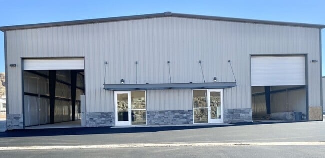


Property Detail
474 Commerce Dr
0838714
SUBDIVISION: FAIRGROUNDS INDUSTRIAL PARK (H) LOT: 29
Commercialnec
Washington
M1
Utah
B and X Area of moderate flood hazard, usually the area between the limits of the 100-year and 500-year floods.
29
2024
0.93 AC
2025
Cedar City & St George
270905
Other Market Areas
12,450 SF
St. George, UT
NEARBY LISTINGS FOR SALE OR LEASE
DEMOGRAPHICS near 474 Commerce Dr
1 mile
3 mile
5 mile
2025 Total Population
619
9,113
22,861
2030 Population
678
10,174
25,654
Pop Growth 2025-2030
+ 9.53%
+ 11.64%
+ 12.22%
Average Age
43
42
43
2025 Total Households
263
3,354
8,601
HH Growth 2025-2030
+ 9.51%
+ 11.96%
+ 12.46%
Median Household Inc
$37,999
$70,235
$71,557
Avg Household Size
2.30
2.60
2.60
2025 Avg HH Vehicles
2.00
2.00
2.00
Median Home Value
$96,236
$477,793
$517,045
Median Year Built
1995
2009
2009
Nearby Places
Map Layers
Map Styles
 Street
 Aerial
Transit
 Traffic
 Biking
Places
Listings with unknown addresses are not visible on the map
- Restaurants
- Banks
- Shops
- Fitness
- Groceries
PUBLIC TRANSPORTATION
AIRPORT
St George Regional
Drive
Walk
Distance
St George Regional
24 min
14.0 mi
SALE & LEASE HISTORY
LISTING DATE
SALE/LEASE

Feb 18, 2021
For Lease
Feb 18, 2021
For Sale
Nearby Properties
Address
Land Use
TOTAL SIZE
Lot Size
Zoning
Address
Land Use
TOTAL SIZE
Lot Size
Zoning
963,552 SF
47.03 AC
PDO
Address
Land Use
TOTAL SIZE
Lot Size
Zoning
1,066,406 SF
210.11 AC
M1
Address
Land Use
TOTAL SIZE
Lot Size
Zoning
112,925 SF
211 AC
OS
Address
Land Use
TOTAL SIZE
Lot Size
Zoning
163,468 SF
19.73 AC
HC
Address
Land Use
TOTAL SIZE
Lot Size
Zoning
81,097 SF
23.10 AC
Address
Land Use
TOTAL SIZE
Lot Size
Zoning
277,666 SF
13.25 AC
PD
Address
Land Use
TOTAL SIZE
Lot Size
Zoning
17,388 SF
41.83 AC
Address
Land Use
TOTAL SIZE
Lot Size
Zoning
1,144 SF
189.53 AC
PDO
Address
Land Use
TOTAL SIZE
Lot Size
Zoning
199,684 SF
21.48 AC
Address
Land Use
TOTAL SIZE
Lot Size
Zoning
64,047 SF
19.99 AC
M1
Address
Land Use
TOTAL SIZE
Lot Size
Zoning
133,182 SF
11.67 AC
PDO
Address
Land Use
TOTAL SIZE
Lot Size
Zoning
23,235 SF
49.61 AC
A
Address
Land Use
TOTAL SIZE
Lot Size
Zoning
10,820 SF
106 AC
Address
Land Use
TOTAL SIZE
Lot Size
Zoning
63,654 SF
2.54 AC
Address
Land Use
TOTAL SIZE
Lot Size
Zoning
90,302 SF
5.03 AC
PDO
Address
Land Use
TOTAL SIZE
Lot Size
Zoning
11,451 SF
31.90 AC
PDO
Address
Land Use
TOTAL SIZE
Lot Size
Zoning
29,523 SF
13.21 AC
PDO
Address
Land Use
TOTAL SIZE
Lot Size
Zoning
86,000 SF
6.05 AC
BMP
Address
Land Use
TOTAL SIZE
Lot Size
Zoning
112,222 SF
5 AC
PDO
Address
Land Use
TOTAL SIZE
Lot Size
Zoning
40,320 SF
10.67 AC
PDO
Address
Land Use
TOTAL SIZE
Lot Size
Zoning
84,026 SF
3.82 AC
HC
Address
Land Use
TOTAL SIZE
Lot Size
Zoning
79,426 SF
5.65 AC
PDO
Address
Land Use
TOTAL SIZE
Lot Size
Zoning
32,230 SF
14.21 AC
OS
Address
Land Use
TOTAL SIZE
Lot Size
Zoning
77,317 SF
5.01 AC
Address
Land Use
TOTAL SIZE
Lot Size
Zoning
74,444 SF
7.67 AC
PDO
The World's #1 Commercial Real Estate Marketplace
Connect with us
© 2026 CoStar Group
The information above has been obtained from sources believed reliable. While we do not doubt its accuracy we have not verified it and make no guarantee, warranty or representation about it. It is your responsibility to independently confirm its accuracy and completeness. Any projections, opinions, assumptions, or estimates used are for example only and do not represent the current or future performance of the property. The value of this transaction to you depends on tax and other factors which should be evaluated by your tax, financial, and legal advisors. You and your advisors should conduct a careful, independent investigation of the property to determine to your satisfaction the suitability of the property for your needs.