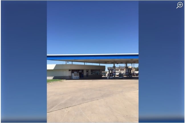
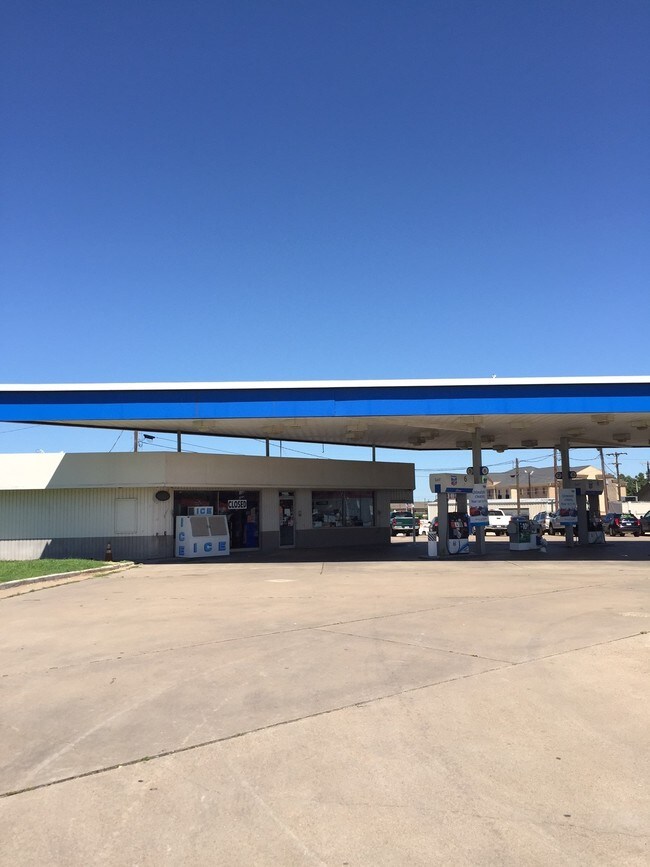
Property Record
474 W Interstate 45 N, Fairfield, TX 75840

Property Detail
474 W Interstate 45 N
Commercialnec
I H REED A-23 TACO BELL
AA2
FREESTONE
2025
Texas
2025
0.89 AC
000101
Other Market Areas
10,786 SF
44375
NEARBY LISTINGS FOR SALE OR LEASE
-
-
View all Fairfield listings for sale on LoopNet.com
DEMOGRAPHICS near 474 W Interstate 45 N
1 mile
3 mile
5 mile
2025 Total Population
1,032
4,715
6,177
2030 Population
1,097
4,919
6,414
Pop Growth 2025-2030
+ 6.30%
+ 4.33%
+ 3.84%
Average Age
41
41
42
2025 Total Households
422
1,802
2,319
HH Growth 2025-2030
+ 6.16%
+ 4.33%
+ 3.84%
Median Household Inc
$34,825
$56,806
$57,287
Avg Household Size
2.40
2.50
2.50
2025 Avg HH Vehicles
2.00
2.00
2.00
Median Home Value
$146,850
$196,810
$206,281
Median Year Built
1976
1983
1985
Nearby Places
Map Layers
Map Styles
 Street
 Aerial
Transit
 Traffic
 Biking
Places
Listings with unknown addresses are not visible on the map
- Restaurants
- Banks
- Shops
- Fitness
- Groceries
SALE & LEASE HISTORY
LISTING DATE
SALE/LEASE

Sep 26, 2017
For Sale
Nearby Properties
Address
Land Use
TOTAL SIZE
Lot Size
Zoning
Address
Land Use
TOTAL SIZE
Lot Size
Zoning
161,334 SF
10.95 AC
AA2
Address
Land Use
TOTAL SIZE
Lot Size
Zoning
143,529 SF
17.35 AC
AA2
Address
Land Use
TOTAL SIZE
Lot Size
Zoning
83,509 SF
9.30 AC
AA2
Address
Land Use
TOTAL SIZE
Lot Size
Zoning
422,229 SF
33.48 AC
AA2
Address
Land Use
TOTAL SIZE
Lot Size
Zoning
45.56 AC
AA2
Address
Land Use
TOTAL SIZE
Lot Size
Zoning
90,429 SF
2.29 AC
AA2
Address
Land Use
TOTAL SIZE
Lot Size
Zoning
173,279 SF
12.04 AC
Address
Land Use
TOTAL SIZE
Lot Size
Zoning
192,705 SF
4 AC
AA2
Address
Land Use
TOTAL SIZE
Lot Size
Zoning
61,908 SF
5.95 AC
AA2
Address
Land Use
TOTAL SIZE
Lot Size
Zoning
393 SF
2.41 AC
AA2
Address
Land Use
TOTAL SIZE
Lot Size
Zoning
123,778 SF
3.39 AC
AA2
Address
Land Use
TOTAL SIZE
Lot Size
Zoning
31,727 SF
1.64 AC
AA2
Address
Land Use
TOTAL SIZE
Lot Size
Zoning
151,800 SF
19.16 AC
Address
Land Use
TOTAL SIZE
Lot Size
Zoning
169,550 SF
33.19 AC
AA2
Address
Land Use
TOTAL SIZE
Lot Size
Zoning
1,532 SF
1.13 AC
AA2
Address
Land Use
TOTAL SIZE
Lot Size
Zoning
65,534 SF
1.57 AC
AA2
Address
Land Use
TOTAL SIZE
Lot Size
Zoning
31,676 SF
2.33 AC
AA2
Address
Land Use
TOTAL SIZE
Lot Size
Zoning
10.45 AC
AA2
Address
Land Use
TOTAL SIZE
Lot Size
Zoning
34,660 SF
3.58 AC
AA2
Address
Land Use
TOTAL SIZE
Lot Size
Zoning
110,321 SF
7.20 AC
AA2
Address
Land Use
TOTAL SIZE
Lot Size
Zoning
19,448 SF
5.54 AC
AA2
Address
Land Use
TOTAL SIZE
Lot Size
Zoning
26,200 SF
5.01 AC
AA2
Address
Land Use
TOTAL SIZE
Lot Size
Zoning
14,494 SF
15.12 AC
Address
Land Use
TOTAL SIZE
Lot Size
Zoning
88,332 SF
8.38 AC
AA2
Address
Land Use
TOTAL SIZE
Lot Size
Zoning
47,289 SF
10.74 AC
AA2
Address
Land Use
TOTAL SIZE
Lot Size
Zoning
172,779 SF
5.21 AC
AA2
Address
Land Use
TOTAL SIZE
Lot Size
Zoning
46,350 SF
3.18 AC
AA2
Address
Land Use
TOTAL SIZE
Lot Size
Zoning
46,717 SF
1.61 AC
AA2
Address
Land Use
TOTAL SIZE
Lot Size
Zoning
16,007 SF
3.25 AC
AA2
Address
Land Use
TOTAL SIZE
Lot Size
Zoning
139,439 SF
5.20 AC
AA2
The World's #1 Commercial Real Estate Marketplace
Connect with us
© 2026 CoStar Group
The information above has been obtained from sources believed reliable. While we do not doubt its accuracy we have not verified it and make no guarantee, warranty or representation about it. It is your responsibility to independently confirm its accuracy and completeness. Any projections, opinions, assumptions, or estimates used are for example only and do not represent the current or future performance of the property. The value of this transaction to you depends on tax and other factors which should be evaluated by your tax, financial, and legal advisors. You and your advisors should conduct a careful, independent investigation of the property to determine to your satisfaction the suitability of the property for your needs.