Property Record
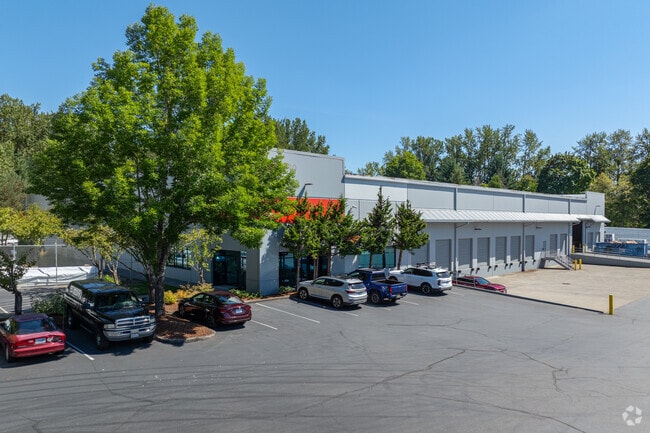
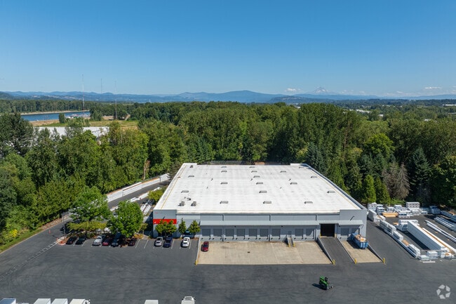
4630 Ne 166Th Ave, Portland, OR 97230

Property Detail
4630 Ne 166Th Ave
R320237
SECTION 19 1N 3E, TL 1500 10.34 ACRES
Commercialnec
MULTNOMAH
IG2
Oregon
2025
10.34 AC
2025
East Columbia Corridor
010200
Portland
194,760 SF
Portland-Vancouver-Hillsboro, OR-WA
NEARBY LISTINGS FOR SALE OR LEASE
DEMOGRAPHICS near 4630 Ne 166Th Ave
1 mile
3 mile
5 mile
2025 Total Population
2,759
80,183
282,174
2030 Population
2,686
79,320
280,862
Pop Growth 2025-2030
(2.65%)
(1.08%)
(0.46%)
Average Age
42
41
40
2025 Total Households
1,045
29,135
104,710
HH Growth 2025-2030
(2.87%)
(1.34%)
(0.59%)
Median Household Inc
$77,957
$69,676
$74,199
Avg Household Size
2.50
2.60
2.60
2025 Avg HH Vehicles
2.00
2.00
2.00
Median Home Value
$444,278
$454,349
$461,583
Median Year Built
1991
1981
1981
Nearby Places
Map Layers
Map Styles
 Street
 Aerial
Transit
 Traffic
 Biking
Places
Listings with unknown addresses are not visible on the map
- Restaurants
- Banks
- Shops
- Fitness
- Groceries
PUBLIC TRANSPORTATION
AIRPORT
Portland International
Drive
Walk
Distance
Portland International
13 min
5.8 mi
Freight Ports
Port of Vancouver
Drive
Walk
Distance
Port of Vancouver
28 min
14.6 mi
SALE & LEASE HISTORY
LISTING DATE
SALE/LEASE

Jun 05, 2024
For Lease
Jan 18, 2022
For Lease
Nearby Properties
Address
Land Use
TOTAL SIZE
Lot Size
Zoning
Address
Land Use
TOTAL SIZE
Lot Size
Zoning
21.39 AC
NULL
Address
Land Use
TOTAL SIZE
Lot Size
Zoning
3,800 SF
27.96 AC
LI
Address
Land Use
TOTAL SIZE
Lot Size
Zoning
273,811 SF
6.39 AC
NULL
Address
Land Use
TOTAL SIZE
Lot Size
Zoning
236,035 SF
13.01 AC
R7
Address
Land Use
TOTAL SIZE
Lot Size
Zoning
64.20 AC
HI
Address
Land Use
TOTAL SIZE
Lot Size
Zoning
339,894 SF
27.82 AC
R-22
Address
Land Use
TOTAL SIZE
Lot Size
Zoning
140,000 SF
14.53 AC
R7
Address
Land Use
TOTAL SIZE
Lot Size
Zoning
365,000 SF
38.87 AC
GI
Address
Land Use
TOTAL SIZE
Lot Size
Zoning
260,995 SF
6.49 AC
RTC
Address
Land Use
TOTAL SIZE
Lot Size
Zoning
603,750 SF
49.11 AC
IL
Address
Land Use
TOTAL SIZE
Lot Size
Zoning
698,484 SF
34.21 AC
GI
Address
Land Use
TOTAL SIZE
Lot Size
Zoning
60,788 SF
10.21 AC
GI
Address
Land Use
TOTAL SIZE
Lot Size
Zoning
174,510 SF
9.76 AC
BP
Address
Land Use
TOTAL SIZE
Lot Size
Zoning
378,000 SF
18.91 AC
LI
Address
Land Use
TOTAL SIZE
Lot Size
Zoning
21.39 AC
HI
Address
Land Use
TOTAL SIZE
Lot Size
Zoning
58,843 SF
4.53 AC
EG2
Address
Land Use
TOTAL SIZE
Lot Size
Zoning
489,695 SF
23.76 AC
IG2P
Address
Land Use
TOTAL SIZE
Lot Size
Zoning
175,276 SF
13.05 AC
IG2
Address
Land Use
TOTAL SIZE
Lot Size
Zoning
191,466 SF
34.68 AC
R/CSP
Address
Land Use
TOTAL SIZE
Lot Size
Zoning
492,161 SF
28.13 AC
IG2
Address
Land Use
TOTAL SIZE
Lot Size
Zoning
Address
Land Use
TOTAL SIZE
Lot Size
Zoning
129,462 SF
15.90 AC
R7
Address
Land Use
TOTAL SIZE
Lot Size
Zoning
357,603 SF
22.69 AC
GI
Address
Land Use
TOTAL SIZE
Lot Size
Zoning
86,138 SF
5.93 AC
R7
Address
Land Use
TOTAL SIZE
Lot Size
Zoning
Address
Land Use
TOTAL SIZE
Lot Size
Zoning
304,649 SF
14.13 AC
GI
Address
Land Use
TOTAL SIZE
Lot Size
Zoning
143,800 SF
14.86 AC
IG2X
Address
Land Use
TOTAL SIZE
Lot Size
Zoning
11,000 SF
8.60 AC
IG2
Address
Land Use
TOTAL SIZE
Lot Size
Zoning
296,622 SF
27.67 AC
LI
Address
Land Use
TOTAL SIZE
Lot Size
Zoning
121,144 SF
2.30 AC
RM3
The World's #1 Commercial Real Estate Marketplace
Connect with us
© 2026 CoStar Group
The information above has been obtained from sources believed reliable. While we do not doubt its accuracy we have not verified it and make no guarantee, warranty or representation about it. It is your responsibility to independently confirm its accuracy and completeness. Any projections, opinions, assumptions, or estimates used are for example only and do not represent the current or future performance of the property. The value of this transaction to you depends on tax and other factors which should be evaluated by your tax, financial, and legal advisors. You and your advisors should conduct a careful, independent investigation of the property to determine to your satisfaction the suitability of the property for your needs.