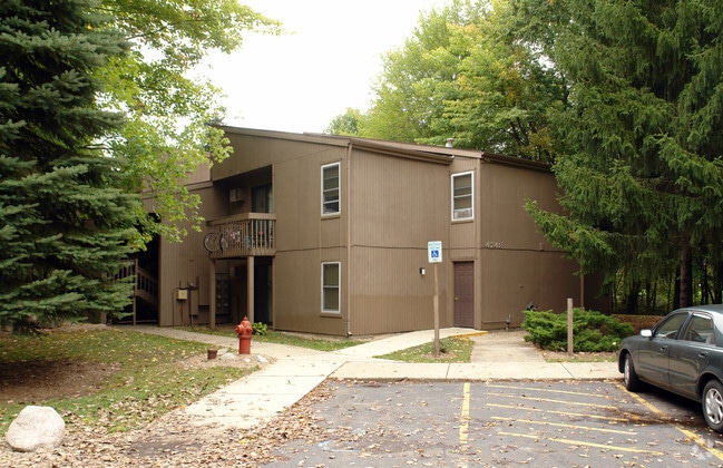
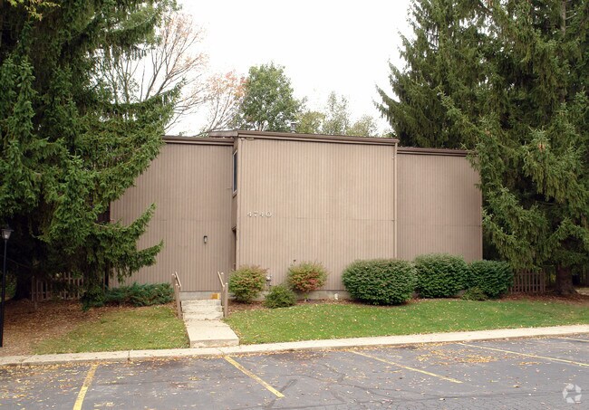
Property Record
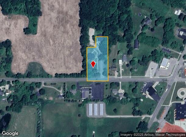
4740 W Butterfield Hwy, Olivet, MI 49076
NEARBY LISTINGS FOR SALE OR LEASE
-
-
View all Olivet listings for sale on LoopNet.com
Property Detail
4740 W Butterfield Hwy
Lansing-East Lansing, MI
Assessors Plat #2
600-040-601-308-00
COM SW CORNER LOT 130, N 2DEG 58MIN 44SEC W 318.33 FT, N 87DEG 01MIN 16SEC E 84.99 FT, N 2DEG 58MIN 44SEC W 100 FT, N 87DEG 01MIN 16SEC E 115 FT, S 2DEG 58MIN 44SEC E 420 FT, SWLY TO BEG. ASSESSORS PLAT NO.2, VILLAGE OF OLIVET 1980
Commercialnec
Eaton
X
Michigan
26025C0095C
130
0
1.73 AC
2025
Outer Eaton County
021100
West Michigan
DEMOGRAPHICS near 4740 W Butterfield Hwy
1 Mile
3 Mile
5 Mile
2024 Total Population
1,896
3,420
7,077
2029 Population
1,916
3,441
7,092
Pop Growth 2024-2029
+ 1.05%
+ 0.61%
+ 0.21%
Average Age
33
37
39
2024 Total Households
499
1,068
2,492
HH Growth 2024-2029
+ 2.00%
+ 0.94%
+ 0.32%
Median Household Inc
$46,687
$57,662
$63,087
Avg Household Size
2.50
2.60
2.50
2024 Avg HH Vehicles
2.00
2.00
2.00
Median Home Value
$169,999
$188,888
$193,158
Median Year Built
1962
1969
1970
Nearby Places
Map Layers
Map Styles
 Street
 Aerial
- Restaurants
- Banks
- Shops
- Fitness
- Groceries
PUBLIC TRANSPORTATION
AIRPORT
Capital Region International
DRIVE
WALK
Distance
Capital Region International
44 min
34.1 mi
Kalamazoo/Battle Creek International
DRIVE
WALK
Distance
Kalamazoo/Battle Creek International
56 min
43.6 mi
Nearby Properties
Address
Land Use
TOTAL SIZE
Lot Size
Zoning
Address
Land Use
TOTAL SIZE
Lot Size
Zoning
10,504 SF
1.49 AC
Address
Land Use
TOTAL SIZE
Lot Size
Zoning
1.70 AC
Address
Land Use
TOTAL SIZE
Lot Size
Zoning
2,464 SF
179.20 AC
LA
Address
Land Use
TOTAL SIZE
Lot Size
Zoning
4,968 SF
0.16 AC
Address
Land Use
TOTAL SIZE
Lot Size
Zoning
2,235 SF
170 AC
LA
Address
Land Use
TOTAL SIZE
Lot Size
Zoning
760 SF
3.99 AC
Address
Land Use
TOTAL SIZE
Lot Size
Zoning
1,840 SF
164 AC
LA
Address
Land Use
TOTAL SIZE
Lot Size
Zoning
107.30 AC
AG
Address
Land Use
TOTAL SIZE
Lot Size
Zoning
4,800 SF
0.74 AC
Address
Land Use
TOTAL SIZE
Lot Size
Zoning
41,000 SF
6.80 AC
I
Address
Land Use
TOTAL SIZE
Lot Size
Zoning
1,528 SF
160 AC
LA
Address
Land Use
TOTAL SIZE
Lot Size
Zoning
2,581 SF
0.53 AC
Address
Land Use
TOTAL SIZE
Lot Size
Zoning
17,890 SF
1.55 AC
Address
Land Use
TOTAL SIZE
Lot Size
Zoning
4,476 SF
0.20 AC
Address
Land Use
TOTAL SIZE
Lot Size
Zoning
3.10 AC
Address
Land Use
TOTAL SIZE
Lot Size
Zoning
3,638 SF
40 AC
LA
Address
Land Use
TOTAL SIZE
Lot Size
Zoning
9,376 SF
0.88 AC
Address
Land Use
TOTAL SIZE
Lot Size
Zoning
1.74 AC
Address
Land Use
TOTAL SIZE
Lot Size
Zoning
1,624 SF
80 AC
LA
Address
Land Use
TOTAL SIZE
Lot Size
Zoning
4,600 SF
0.76 AC
Address
Land Use
TOTAL SIZE
Lot Size
Zoning
1,578 SF
100 AC
LA
Address
Land Use
TOTAL SIZE
Lot Size
Zoning
145 AC
AGRICULTUR
Address
Land Use
TOTAL SIZE
Lot Size
Zoning
2,504 SF
85.17 AC
LA
Address
Land Use
TOTAL SIZE
Lot Size
Zoning
19,000 SF
1.75 AC
I
Address
Land Use
TOTAL SIZE
Lot Size
Zoning
120 AC
LA
Address
Land Use
TOTAL SIZE
Lot Size
Zoning
7,875 SF
0.32 AC
Address
Land Use
TOTAL SIZE
Lot Size
Zoning
2,825 SF
80 AC
LA
Address
Land Use
TOTAL SIZE
Lot Size
Zoning
1,171 SF
80 AC
LA
Address
Land Use
TOTAL SIZE
Lot Size
Zoning
3,565 SF
0.21 AC
The World's #1 Commercial Real Estate Marketplace
Connect with us
© 2026 CoStar Group
The information above has been obtained from sources believed reliable. While we do not doubt its accuracy we have not verified it and make no guarantee, warranty or representation about it. It is your responsibility to independently confirm its accuracy and completeness. Any projections, opinions, assumptions, or estimates used are for example only and do not represent the current or future performance of the property. The value of this transaction to you depends on tax and other factors which should be evaluated by your tax, financial, and legal advisors. You and your advisors should conduct a careful, independent investigation of the property to determine to your satisfaction the suitability of the property for your needs.