Property Record
4742 Parete Rd S, Jacksonville, FL 32218
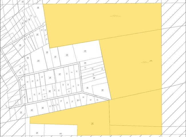

NEARBY LISTINGS FOR SALE OR LEASE
Property Detail
4742 Parete Rd S
Jacksonville, FL
Ogilvies D S/D Pt Gibson
019589-0000
9-10 41-1S-26E 4.0 WM A OGILVIE ESTATE PT LOT 10 RECD O/R 21435-2178
Miscellaneous
Duval
X
Florida
12031C0040J
10
2024
4 AC
2026
Northeast Jacksonville
010301
Jacksonville (Florida)
1,960 SF
DEMOGRAPHICS near 4742 Parete Rd S
1 Mile
3 Mile
5 Mile
2024 Total Population
243
2,469
13,339
2029 Population
251
2,552
14,568
Pop Growth 2024-2029
+ 3.29%
+ 3.36%
+ 9.21%
Average Age
38
38
36
2024 Total Households
74
758
4,287
HH Growth 2024-2029
+ 4.05%
+ 3.17%
+ 9.56%
Median Household Inc
$67,500
$67,333
$80,996
Avg Household Size
2.80
2.80
2.90
2024 Avg HH Vehicles
2.00
2.00
2.00
Median Home Value
$264,705
$265,173
$258,552
Median Year Built
2007
2007
2009
Nearby Places
Map Layers
Map Styles
 Street
 Aerial
- Restaurants
- Banks
- Shops
- Fitness
- Groceries
PUBLIC TRANSPORTATION
AIRPORT
Jacksonville International
DRIVE
WALK
Distance
Jacksonville International
27 min
11.4 mi
Freight Ports
Jacksonville Port
DRIVE
WALK
Distance
Jacksonville Port
39 min
18.8 mi
Nearby Properties
Address
Land Use
TOTAL SIZE
Lot Size
Zoning
Address
Land Use
TOTAL SIZE
Lot Size
Zoning
2,999,392 SF
5,204.78 AC
PUD
Address
Land Use
TOTAL SIZE
Lot Size
Zoning
132.15 AC
PBF-3
Address
Land Use
TOTAL SIZE
Lot Size
Zoning
101.11 AC
PUD
Address
Land Use
TOTAL SIZE
Lot Size
Zoning
86,615 SF
398.67 AC
PBF-1
Address
Land Use
TOTAL SIZE
Lot Size
Zoning
1.33 AC
OR
Address
Land Use
TOTAL SIZE
Lot Size
Zoning
21,994 SF
12.01 AC
RR-ACRE
Address
Land Use
TOTAL SIZE
Lot Size
Zoning
1.25 AC
OR
Address
Land Use
TOTAL SIZE
Lot Size
Zoning
19,007 SF
289.87 AC
PBF-1
Address
Land Use
TOTAL SIZE
Lot Size
Zoning
67.30 AC
PUD
Address
Land Use
TOTAL SIZE
Lot Size
Zoning
30.78 AC
IL
Address
Land Use
TOTAL SIZE
Lot Size
Zoning
96.07 AC
IL
Address
Land Use
TOTAL SIZE
Lot Size
Zoning
45.53 AC
PUD
Address
Land Use
TOTAL SIZE
Lot Size
Zoning
3,240 SF
945.77 AC
PUD
Address
Land Use
TOTAL SIZE
Lot Size
Zoning
360 AC
OR
Address
Land Use
TOTAL SIZE
Lot Size
Zoning
118.95 AC
ROS
Address
Land Use
TOTAL SIZE
Lot Size
Zoning
5,632 SF
2.12 AC
RM
Address
Land Use
TOTAL SIZE
Lot Size
Zoning
13,835 SF
390.40 AC
AGR
Address
Land Use
TOTAL SIZE
Lot Size
Zoning
7,971 SF
8.84 AC
RR-ACRE
Address
Land Use
TOTAL SIZE
Lot Size
Zoning
7,543 SF
4.81 AC
RR-ACRE
Address
Land Use
TOTAL SIZE
Lot Size
Zoning
203 AC
OR
Address
Land Use
TOTAL SIZE
Lot Size
Zoning
2,383 SF
22.23 AC
AGR
Address
Land Use
TOTAL SIZE
Lot Size
Zoning
13,811 SF
61.60 AC
AGR
Address
Land Use
TOTAL SIZE
Lot Size
Zoning
32.12 AC
AGR
Address
Land Use
TOTAL SIZE
Lot Size
Zoning
4,601 SF
4.89 AC
RR-ACRE
Address
Land Use
TOTAL SIZE
Lot Size
Zoning
4.10 AC
IL
Address
Land Use
TOTAL SIZE
Lot Size
Zoning
4,182 SF
6.36 AC
AGR
Address
Land Use
TOTAL SIZE
Lot Size
Zoning
6.76 AC
RR-ACRE
Address
Land Use
TOTAL SIZE
Lot Size
Zoning
6,548 SF
5.07 AC
PBF-1
Address
Land Use
TOTAL SIZE
Lot Size
Zoning
3,300 SF
1.70 AC
RR-ACRE
The World's #1 Commercial Real Estate Marketplace
Connect with us
© 2025 CoStar Group
The information above has been obtained from sources believed reliable. While we do not doubt its accuracy we have not verified it and make no guarantee, warranty or representation about it. It is your responsibility to independently confirm its accuracy and completeness. Any projections, opinions, assumptions, or estimates used are for example only and do not represent the current or future performance of the property. The value of this transaction to you depends on tax and other factors which should be evaluated by your tax, financial, and legal advisors. You and your advisors should conduct a careful, independent investigation of the property to determine to your satisfaction the suitability of the property for your needs.