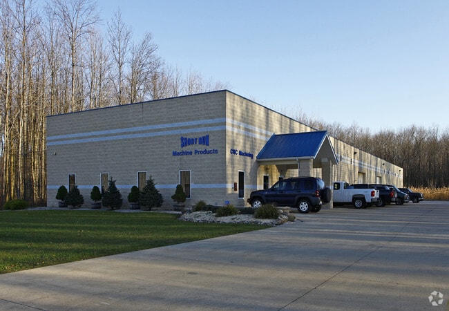
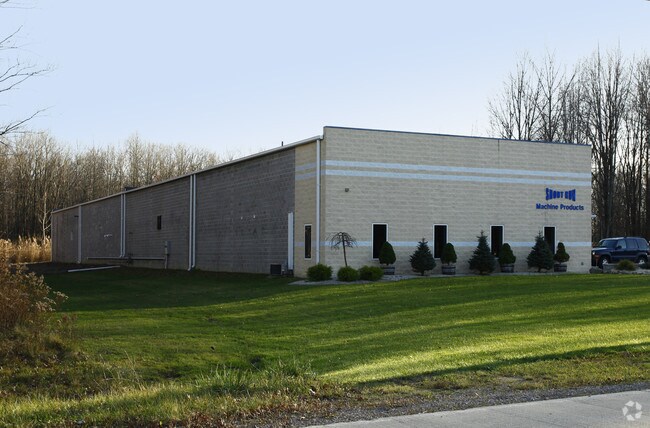
Property Record
4744 Kister Ct, Ashtabula, OH 44004

Property Detail
4744 Kister Ct
Cleveland-Elyria, OH
NORTH BEND INDUSTRIALPARK LOT #10 PHASE 1 EXEMPT #1196 DELETED
480081001000
Ashtabula
Industrialgeneral
Ohio
B and X Area of moderate flood hazard, usually the area between the limits of the 100-year and 500-year floods.
10
2024
1.62 AC
2024
Ashtabula County
000603
Cleveland
20,950 SF
NEARBY LISTINGS FOR SALE OR LEASE
-
-
View all Ashtabula listings for sale on LoopNet.com
DEMOGRAPHICS near 4744 Kister Ct
1 mile
3 mile
5 mile
2025 Total Population
350
9,383
32,589
2030 Population
347
9,493
32,713
Pop Growth 2025-2030
(0.86%)
+ 1.17%
+ 0.38%
Average Age
44
44
42
2025 Total Households
145
3,993
14,101
HH Growth 2025-2030
(0.69%)
+ 1.30%
+ 0.38%
Median Household Inc
$70,781
$59,234
$55,292
Avg Household Size
2.40
2.30
2.20
2025 Avg HH Vehicles
2.00
2.00
2.00
Median Home Value
$135,087
$164,688
$141,980
Median Year Built
1950
1963
1957
Nearby Places
Map Layers
Map Styles
 Street
 Aerial
Layers
 Traffic
 Biking
Places
Listings with unknown addresses are not visible on the map
- Restaurants
- Banks
- Shops
- Fitness
- Groceries
Nearby Properties
Address
Land Use
TOTAL SIZE
Lot Size
Zoning
Address
Land Use
TOTAL SIZE
Lot Size
Zoning
311,348 SF
128.96 AC
Address
Land Use
TOTAL SIZE
Lot Size
Zoning
224,856 SF
79.47 AC
Address
Land Use
TOTAL SIZE
Lot Size
Zoning
98,137 SF
40.63 AC
Address
Land Use
TOTAL SIZE
Lot Size
Zoning
936,616 SF
32.04 AC
Address
Land Use
TOTAL SIZE
Lot Size
Zoning
Address
Land Use
TOTAL SIZE
Lot Size
Zoning
231,332 SF
16.53 AC
Address
Land Use
TOTAL SIZE
Lot Size
Zoning
79,569 SF
6.16 AC
Address
Land Use
TOTAL SIZE
Lot Size
Zoning
59,788 SF
15.88 AC
Address
Land Use
TOTAL SIZE
Lot Size
Zoning
7,882 SF
13.53 AC
Address
Land Use
TOTAL SIZE
Lot Size
Zoning
Address
Land Use
TOTAL SIZE
Lot Size
Zoning
Address
Land Use
TOTAL SIZE
Lot Size
Zoning
78,016 SF
7.70 AC
Address
Land Use
TOTAL SIZE
Lot Size
Zoning
22,832 SF
9.89 AC
Address
Land Use
TOTAL SIZE
Lot Size
Zoning
206,345 SF
27.28 AC
Address
Land Use
TOTAL SIZE
Lot Size
Zoning
292,721 SF
19.05 AC
Address
Land Use
TOTAL SIZE
Lot Size
Zoning
380,401 SF
45.45 AC
Address
Land Use
TOTAL SIZE
Lot Size
Zoning
168,674 SF
6.29 AC
Address
Land Use
TOTAL SIZE
Lot Size
Zoning
60,600 SF
11.91 AC
Address
Land Use
TOTAL SIZE
Lot Size
Zoning
56,733 SF
5.02 AC
Address
Land Use
TOTAL SIZE
Lot Size
Zoning
16,230 SF
27.74 AC
Address
Land Use
TOTAL SIZE
Lot Size
Zoning
51,500 SF
5.11 AC
Address
Land Use
TOTAL SIZE
Lot Size
Zoning
62,044 SF
9.21 AC
Address
Land Use
TOTAL SIZE
Lot Size
Zoning
71,796 SF
29.42 AC
Address
Land Use
TOTAL SIZE
Lot Size
Zoning
62,044 SF
9.21 AC
Address
Land Use
TOTAL SIZE
Lot Size
Zoning
128,856 SF
8.89 AC
Address
Land Use
TOTAL SIZE
Lot Size
Zoning
140,172 SF
3.86 AC
Address
Land Use
TOTAL SIZE
Lot Size
Zoning
22,478 SF
3.99 AC
Address
Land Use
TOTAL SIZE
Lot Size
Zoning
63,021 SF
2.67 AC
Address
Land Use
TOTAL SIZE
Lot Size
Zoning
Address
Land Use
TOTAL SIZE
Lot Size
Zoning
21,431 SF
6.44 AC
The World's #1 Commercial Real Estate Marketplace
Connect with us
© 2026 CoStar Group
The information above has been obtained from sources believed reliable. While we do not doubt its accuracy we have not verified it and make no guarantee, warranty or representation about it. It is your responsibility to independently confirm its accuracy and completeness. Any projections, opinions, assumptions, or estimates used are for example only and do not represent the current or future performance of the property. The value of this transaction to you depends on tax and other factors which should be evaluated by your tax, financial, and legal advisors. You and your advisors should conduct a careful, independent investigation of the property to determine to your satisfaction the suitability of the property for your needs.