Property Record
4744 Weedpatch Hwy, Bakersfield, CA 93307


Property Detail
4744 Weedpatch Hwy
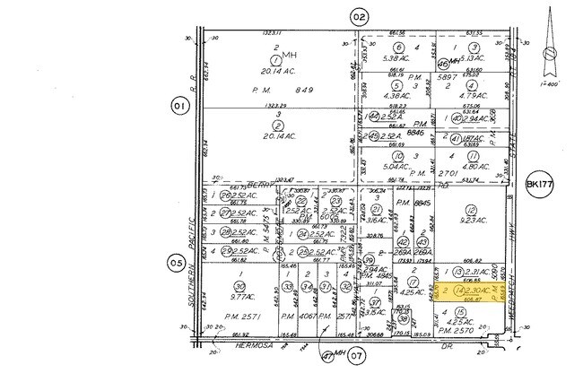
174-250-14-00-2
PARCEL MAP 5090 , LOT 2
Commercialnec
KERN
M2 PD
California
B and X Area of moderate flood hazard, usually the area between the limits of the 100-year and 500-year floods.
2
2024
2 AC
2025
Southeast Bakersfield
002401
Bakersfield
1,344 SF
Bakersfield-Delano, CA
NEARBY LISTINGS FOR SALE OR LEASE
DEMOGRAPHICS near 4744 Weedpatch Hwy
1 mile
3 mile
5 mile
2024 Total Population
1,201
9,942
84,030
2029 Population
1,224
10,202
84,915
Pop Growth 2024-2029
+ 1.92%
+ 2.62%
+ 1.05%
Average Age
35
34
33
2024 Total Households
321
2,544
22,011
HH Growth 2024-2029
+ 1.87%
+ 2.48%
+ 0.97%
Median Household Inc
$50,217
$66,386
$52,038
Avg Household Size
3.60
3.80
3.70
2024 Avg HH Vehicles
2.00
2.00
2.00
Median Home Value
$342,307
$355,307
$264,533
Median Year Built
1979
1988
1975
Nearby Places
Map Layers
Map Styles
 Street
 Aerial
Transit
 Traffic
 Biking
Places
Listings with unknown addresses are not visible on the map
- Restaurants
- Banks
- Shops
- Fitness
- Groceries
PUBLIC TRANSPORTATION
COMMUTER RAIL
Bakersfield (San Joaquins - Amtrak)
Drive
Walk
Distance
Bakersfield (San Joaquins - Amtrak)
15 min
8.9 mi
AIRPORT
Meadows Field
Drive
Walk
Distance
Meadows Field
27 min
16.9 mi
Freight Ports
The Port of Hueneme
Drive
Walk
Distance
The Port of Hueneme
156 min
122.3 mi
Nearby Properties
Address
Land Use
TOTAL SIZE
Lot Size
Zoning
Address
Land Use
TOTAL SIZE
Lot Size
Zoning
38.14 AC
M-3
Address
Land Use
TOTAL SIZE
Lot Size
Zoning
3,600 SF
18 AC
AG
Address
Land Use
TOTAL SIZE
Lot Size
Zoning
50,445 SF
2.53 AC
C2
Address
Land Use
TOTAL SIZE
Lot Size
Zoning
196.78 AC
A
Address
Land Use
TOTAL SIZE
Lot Size
Zoning
44,779 SF
2.17 AC
M2
Address
Land Use
TOTAL SIZE
Lot Size
Zoning
47,592 SF
35.87 AC
M2
Address
Land Use
TOTAL SIZE
Lot Size
Zoning
5.63 AC
C2
Address
Land Use
TOTAL SIZE
Lot Size
Zoning
83.70 AC
A
Address
Land Use
TOTAL SIZE
Lot Size
Zoning
83.70 AC
A
Address
Land Use
TOTAL SIZE
Lot Size
Zoning
Address
Land Use
TOTAL SIZE
Lot Size
Zoning
72.55 AC
A
Address
Land Use
TOTAL SIZE
Lot Size
Zoning
246.66 AC
A
Address
Land Use
TOTAL SIZE
Lot Size
Zoning
30,000 SF
12.56 AC
M-1
Address
Land Use
TOTAL SIZE
Lot Size
Zoning
160.43 AC
A
Address
Land Use
TOTAL SIZE
Lot Size
Zoning
8.90 AC
M
Address
Land Use
TOTAL SIZE
Lot Size
Zoning
78,550 SF
6.99 AC
M1
Address
Land Use
TOTAL SIZE
Lot Size
Zoning
84,324 SF
6.99 AC
M1
Address
Land Use
TOTAL SIZE
Lot Size
Zoning
153.69 AC
A
Address
Land Use
TOTAL SIZE
Lot Size
Zoning
9.40 AC
M-2 PD
Address
Land Use
TOTAL SIZE
Lot Size
Zoning
2,682 SF
1.04 AC
C-2 FPS
Address
Land Use
TOTAL SIZE
Lot Size
Zoning
29,900 SF
3.61 AC
M-2
Address
Land Use
TOTAL SIZE
Lot Size
Zoning
7,594 SF
79.09 AC
A
Address
Land Use
TOTAL SIZE
Lot Size
Zoning
3,600 SF
4.61 AC
C2
Address
Land Use
TOTAL SIZE
Lot Size
Zoning
9,374 SF
0.93 AC
M-2
Address
Land Use
TOTAL SIZE
Lot Size
Zoning
4,285 SF
0.70 AC
C2
Address
Land Use
TOTAL SIZE
Lot Size
Zoning
27,962 SF
1.73 AC
C-2
Address
Land Use
TOTAL SIZE
Lot Size
Zoning
36.64 AC
A
The World's #1 Commercial Real Estate Marketplace
Connect with us
© 2026 CoStar Group
The information above has been obtained from sources believed reliable. While we do not doubt its accuracy we have not verified it and make no guarantee, warranty or representation about it. It is your responsibility to independently confirm its accuracy and completeness. Any projections, opinions, assumptions, or estimates used are for example only and do not represent the current or future performance of the property. The value of this transaction to you depends on tax and other factors which should be evaluated by your tax, financial, and legal advisors. You and your advisors should conduct a careful, independent investigation of the property to determine to your satisfaction the suitability of the property for your needs.