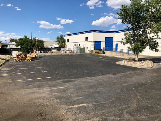
Property Record
4747 S Santa Fe Dr, Englewood, CO 80110


NEARBY LISTINGS FOR SALE OR LEASE
Property Detail
4747 S Santa Fe Dr
2077-09-3-00-100
SECTION 09 TOWNSHIP 05 RANGE 68 THAT PART OF THE SW 1/4 OF SEC 9-5-68 DESC AS BEG 23.62 FT E OF NE COR OF LOT 8 BLK 3 ENGLEWOOD COMMERCIAL INDUSTRIAL CENTER TH E 234.17 FT TO A PT ON THE WLY ROW LINE OF US HWY 85 TH SW 226.85 FT TH NW 198.24 FT TH NE
Servicestation
Arapahoe
X
Colorado
08005C0144L
8
2024
0.99 AC
2025
Southwest C-470
006400
Denver
16,850 SF
Denver-Aurora-Lakewood, CO
DEMOGRAPHICS near 4747 S Santa Fe Dr
1 Mile
3 Mile
5 Mile
2024 Total Population
8,872
102,586
300,368
2029 Population
8,975
103,056
301,476
Pop Growth 2024-2029
+ 1.16%
+ 0.46%
+ 0.37%
Average Age
40
41
41
2024 Total Households
4,108
43,950
123,698
HH Growth 2024-2029
+ 1.24%
+ 0.51%
+ 0.44%
Median Household Inc
$79,476
$77,241
$87,534
Avg Household Size
2.10
2.30
2.30
2024 Avg HH Vehicles
2.00
2.00
2.00
Median Home Value
$441,822
$517,604
$569,971
Median Year Built
1975
1971
1973
Nearby Places
Map Layers
Map Styles
 Street
 Aerial
- Restaurants
- Banks
- Shops
- Fitness
- Groceries
PUBLIC TRANSPORTATION
COMMUTER RAIL
Union Station: Lodo-Coors Field-16Th Street Mall (C Line - Denver Regional Transportation District Light Rail (TheRide), E Line - Denver Regional Transportation District Light Rail (TheRide), W Line - Denver Regional Transportation District Light Rail (TheRide))
DRIVE
WALK
Distance
Union Station: Lodo-Coors Field-16Th Street Mall (C Line - Denver Regional Transportation District Light Rail (TheRide), E Line - Denver Regional Transportation District Light Rail (TheRide), W Line - Denver Regional Transportation District Light Rail (TheRide))
15 min
9.8 mi
AIRPORT
Denver International
DRIVE
WALK
Distance
Denver International
44 min
32.6 mi
Freight Ports
Tulsa Port Of Catoosa
DRIVE
WALK
Distance
Tulsa Port Of Catoosa
740 min
715.3 mi
SALE & LEASE HISTORY
LISTING DATE
SALE/LEASE

Aug 22, 2019
For Lease
Aug 22, 2019
For Sale
Nearby Properties
Address
Land Use
TOTAL SIZE
Lot Size
Zoning
Address
Land Use
TOTAL SIZE
Lot Size
Zoning
117,535 SF
4.76 AC
Address
Land Use
TOTAL SIZE
Lot Size
Zoning
665,722 SF
615.85 AC
OS-B
Address
Land Use
TOTAL SIZE
Lot Size
Zoning
248,291 SF
128.77 AC
CMP-H2
Address
Land Use
TOTAL SIZE
Lot Size
Zoning
330,776 SF
48.11 AC
CMP-H2
Address
Land Use
TOTAL SIZE
Lot Size
Zoning
251,583 SF
38.03 AC
Address
Land Use
TOTAL SIZE
Lot Size
Zoning
98,523 SF
4.17 AC
Address
Land Use
TOTAL SIZE
Lot Size
Zoning
68,500 SF
2.14 AC
Address
Land Use
TOTAL SIZE
Lot Size
Zoning
214,192 SF
0.03 AC
Address
Land Use
TOTAL SIZE
Lot Size
Zoning
206,632 SF
33.68 AC
Address
Land Use
TOTAL SIZE
Lot Size
Zoning
250,402 SF
21 AC
Address
Land Use
TOTAL SIZE
Lot Size
Zoning
381 SF
66.05 AC
I-B
Address
Land Use
TOTAL SIZE
Lot Size
Zoning
14,029 SF
23.97 AC
Address
Land Use
TOTAL SIZE
Lot Size
Zoning
208,529 SF
34.81 AC
R-5
Address
Land Use
TOTAL SIZE
Lot Size
Zoning
38,992 SF
1 AC
Address
Land Use
TOTAL SIZE
Lot Size
Zoning
42,444 SF
1.41 AC
Address
Land Use
TOTAL SIZE
Lot Size
Zoning
33,500 SF
53.33 AC
Address
Land Use
TOTAL SIZE
Lot Size
Zoning
58,006 SF
1.80 AC
Address
Land Use
TOTAL SIZE
Lot Size
Zoning
110,016 SF
1.29 AC
Address
Land Use
TOTAL SIZE
Lot Size
Zoning
221,025 SF
8.45 AC
PUD
Address
Land Use
TOTAL SIZE
Lot Size
Zoning
139,858 SF
2.36 AC
Address
Land Use
TOTAL SIZE
Lot Size
Zoning
47.24 AC
Address
Land Use
TOTAL SIZE
Lot Size
Zoning
107,159 SF
26.40 AC
Address
Land Use
TOTAL SIZE
Lot Size
Zoning
118,881 SF
107.83 AC
Address
Land Use
TOTAL SIZE
Lot Size
Zoning
137,526 SF
11.35 AC
Address
Land Use
TOTAL SIZE
Lot Size
Zoning
229,830 SF
11.33 AC
Address
Land Use
TOTAL SIZE
Lot Size
Zoning
8,502 SF
3.32 AC
Address
Land Use
TOTAL SIZE
Lot Size
Zoning
90,350 SF
11.44 AC
Address
Land Use
TOTAL SIZE
Lot Size
Zoning
39.44 AC
Address
Land Use
TOTAL SIZE
Lot Size
Zoning
63,732 SF
1.58 AC
Address
Land Use
TOTAL SIZE
Lot Size
Zoning
10,260 SF
49.33 AC
CMP-H2
The World's #1 Commercial Real Estate Marketplace
Connect with us
© 2026 CoStar Group
The information above has been obtained from sources believed reliable. While we do not doubt its accuracy we have not verified it and make no guarantee, warranty or representation about it. It is your responsibility to independently confirm its accuracy and completeness. Any projections, opinions, assumptions, or estimates used are for example only and do not represent the current or future performance of the property. The value of this transaction to you depends on tax and other factors which should be evaluated by your tax, financial, and legal advisors. You and your advisors should conduct a careful, independent investigation of the property to determine to your satisfaction the suitability of the property for your needs.