Property Record
475 Fortman Dr, Saint Marys, OH 45885


NEARBY LISTINGS FOR SALE OR LEASE
-
-
View all Saint Marys listings for sale on LoopNet.com
Property Detail
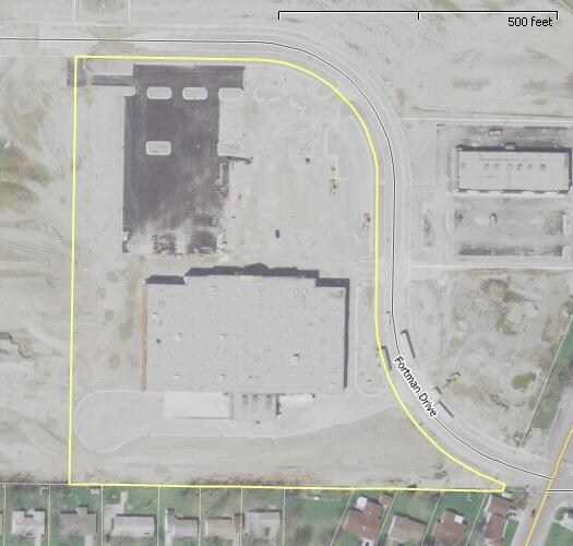
475 Fortman Dr
H43-341-001-00
SHOPPES AT ST MARYS SECTION 1 LOT 1
Supermarket
Auglaize
X
Ohio
39011C0145D
1
2024
9.84 AC
2025
Ohio North Area
040500
Other Market Areas
73,664 SF
Wapakoneta, OH
DEMOGRAPHICS near 475 Fortman Dr
1 Mile
3 Mile
5 Mile
2024 Total Population
4,625
10,865
13,729
2029 Population
4,660
10,896
13,739
Pop Growth 2024-2029
+ 0.76%
+ 0.29%
+ 0.07%
Average Age
39
40
41
2024 Total Households
1,877
4,452
5,636
HH Growth 2024-2029
+ 0.85%
+ 0.31%
+ 0.14%
Median Household Inc
$62,749
$66,438
$67,290
Avg Household Size
2.40
2.40
2.40
2024 Avg HH Vehicles
2.00
2.00
2.00
Median Home Value
$139,835
$147,517
$157,041
Median Year Built
1957
1964
1968
Nearby Places
Map Layers
Map Styles
 Street
 Aerial
- Restaurants
- Banks
- Shops
- Fitness
- Groceries
Nearby Properties
Address
Land Use
TOTAL SIZE
Lot Size
Zoning
Address
Land Use
TOTAL SIZE
Lot Size
Zoning
10.64 AC
Address
Land Use
TOTAL SIZE
Lot Size
Zoning
Address
Land Use
TOTAL SIZE
Lot Size
Zoning
12,410 SF
69.29 AC
Address
Land Use
TOTAL SIZE
Lot Size
Zoning
719,816 SF
58.89 AC
Address
Land Use
TOTAL SIZE
Lot Size
Zoning
224,987 SF
16.53 AC
Address
Land Use
TOTAL SIZE
Lot Size
Zoning
Address
Land Use
TOTAL SIZE
Lot Size
Zoning
21.12 AC
Address
Land Use
TOTAL SIZE
Lot Size
Zoning
157,015 SF
14.20 AC
Address
Land Use
TOTAL SIZE
Lot Size
Zoning
23,876 SF
7.72 AC
Address
Land Use
TOTAL SIZE
Lot Size
Zoning
63,944 SF
5.67 AC
Address
Land Use
TOTAL SIZE
Lot Size
Zoning
71,173 SF
13.86 AC
Address
Land Use
TOTAL SIZE
Lot Size
Zoning
114,001 SF
8.28 AC
Address
Land Use
TOTAL SIZE
Lot Size
Zoning
132,852 SF
14.39 AC
Address
Land Use
TOTAL SIZE
Lot Size
Zoning
Address
Land Use
TOTAL SIZE
Lot Size
Zoning
181,112 SF
58.41 AC
Address
Land Use
TOTAL SIZE
Lot Size
Zoning
116,664 SF
19.60 AC
Address
Land Use
TOTAL SIZE
Lot Size
Zoning
76,853 SF
6.76 AC
Address
Land Use
TOTAL SIZE
Lot Size
Zoning
17,632 SF
0.19 AC
Address
Land Use
TOTAL SIZE
Lot Size
Zoning
13.30 AC
Address
Land Use
TOTAL SIZE
Lot Size
Zoning
30,753 SF
6.13 AC
Address
Land Use
TOTAL SIZE
Lot Size
Zoning
96,441 SF
25.03 AC
Address
Land Use
TOTAL SIZE
Lot Size
Zoning
40,933 SF
5.81 AC
Address
Land Use
TOTAL SIZE
Lot Size
Zoning
74,999 SF
9.88 AC
Address
Land Use
TOTAL SIZE
Lot Size
Zoning
53,430 SF
13.22 AC
Address
Land Use
TOTAL SIZE
Lot Size
Zoning
11.64 AC
Address
Land Use
TOTAL SIZE
Lot Size
Zoning
21,906 SF
5.37 AC
Address
Land Use
TOTAL SIZE
Lot Size
Zoning
71,173 SF
13.86 AC
Address
Land Use
TOTAL SIZE
Lot Size
Zoning
2,990 SF
146.04 AC
Address
Land Use
TOTAL SIZE
Lot Size
Zoning
22,848 SF
0.55 AC
The World's #1 Commercial Real Estate Marketplace
Connect with us
© 2026 CoStar Group
The information above has been obtained from sources believed reliable. While we do not doubt its accuracy we have not verified it and make no guarantee, warranty or representation about it. It is your responsibility to independently confirm its accuracy and completeness. Any projections, opinions, assumptions, or estimates used are for example only and do not represent the current or future performance of the property. The value of this transaction to you depends on tax and other factors which should be evaluated by your tax, financial, and legal advisors. You and your advisors should conduct a careful, independent investigation of the property to determine to your satisfaction the suitability of the property for your needs.