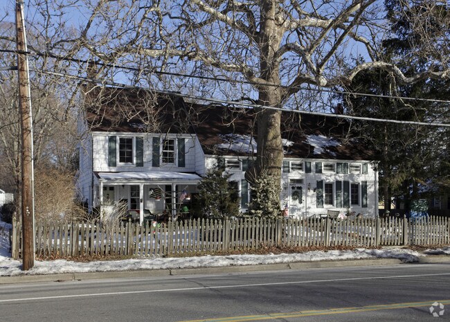
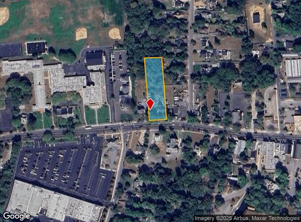
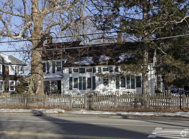
Property Record
475 Main St, Center Moriches, NY 11934
NEARBY LISTINGS FOR SALE OR LEASE
-
-
View all Center Moriches listings for sale on LoopNet.com
Property Detail
475 Main St
Nassau County-Suffolk County, NY
Center Moriches
0200-857-00-02-00-018-000
N STUART T116 E FERRER & ORS S MONT
Apartment
Suffolk
X
New York
36103C0741H
18
2024
0.75 AC
2024
Center Moriches
159604
Long Island (New York)
DEMOGRAPHICS near 475 Main St
1 Mile
3 Mile
5 Mile
2024 Total Population
5,045
36,709
86,833
2029 Population
5,020
36,413
86,215
Pop Growth 2024-2029
(0.50%)
(0.81%)
(0.71%)
Average Age
41
41
40
2024 Total Households
1,752
12,603
28,847
HH Growth 2024-2029
(0.74%)
(0.89%)
(0.84%)
Median Household Inc
$132,650
$99,580
$102,459
Avg Household Size
2.80
2.80
2.90
2024 Avg HH Vehicles
2.00
2.00
2.00
Median Home Value
$581,281
$421,947
$397,538
Median Year Built
1971
1978
1978
Nearby Places
Map Layers
Map Styles
 Street
 Aerial
- Restaurants
- Banks
- Shops
- Fitness
- Groceries
PUBLIC TRANSPORTATION
COMMUTER RAIL
Mastic-Shirley Station (Montauk Branch - Long Island Rail Road)
DRIVE
WALK
Distance
Mastic-Shirley Station (Montauk Branch - Long Island Rail Road)
8 min
4.0 mi
Speonk Station (Montauk Branch - Long Island Rail Road)
DRIVE
WALK
Distance
Speonk Station (Montauk Branch - Long Island Rail Road)
10 min
6.2 mi
AIRPORT
Long Island MacArthur
DRIVE
WALK
Distance
Long Island MacArthur
29 min
17.6 mi
Freight Ports
Port of New Haven
DRIVE
WALK
Distance
Port of New Haven
145 min
58.2 mi
Nearby Properties
Address
Land Use
TOTAL SIZE
Lot Size
Zoning
Address
Land Use
TOTAL SIZE
Lot Size
Zoning
Address
Land Use
TOTAL SIZE
Lot Size
Zoning
Address
Land Use
TOTAL SIZE
Lot Size
Zoning
109.78 AC
Address
Land Use
TOTAL SIZE
Lot Size
Zoning
Address
Land Use
TOTAL SIZE
Lot Size
Zoning
10.70 AC
Address
Land Use
TOTAL SIZE
Lot Size
Zoning
38.70 AC
Address
Land Use
TOTAL SIZE
Lot Size
Zoning
Address
Land Use
TOTAL SIZE
Lot Size
Zoning
Address
Land Use
TOTAL SIZE
Lot Size
Zoning
Address
Land Use
TOTAL SIZE
Lot Size
Zoning
48.60 AC
Address
Land Use
TOTAL SIZE
Lot Size
Zoning
30.60 AC
Address
Land Use
TOTAL SIZE
Lot Size
Zoning
1.37 AC
IND1
Address
Land Use
TOTAL SIZE
Lot Size
Zoning
53.54 AC
Address
Land Use
TOTAL SIZE
Lot Size
Zoning
13.63 AC
Address
Land Use
TOTAL SIZE
Lot Size
Zoning
Address
Land Use
TOTAL SIZE
Lot Size
Zoning
22 AC
Address
Land Use
TOTAL SIZE
Lot Size
Zoning
20.30 AC
Address
Land Use
TOTAL SIZE
Lot Size
Zoning
Address
Land Use
TOTAL SIZE
Lot Size
Zoning
18.70 AC
Address
Land Use
TOTAL SIZE
Lot Size
Zoning
Address
Land Use
TOTAL SIZE
Lot Size
Zoning
23.33 AC
Address
Land Use
TOTAL SIZE
Lot Size
Zoning
Address
Land Use
TOTAL SIZE
Lot Size
Zoning
Address
Land Use
TOTAL SIZE
Lot Size
Zoning
12.55 AC
Address
Land Use
TOTAL SIZE
Lot Size
Zoning
19.19 AC
Address
Land Use
TOTAL SIZE
Lot Size
Zoning
8.06 AC
Address
Land Use
TOTAL SIZE
Lot Size
Zoning
Address
Land Use
TOTAL SIZE
Lot Size
Zoning
4.40 AC
Address
Land Use
TOTAL SIZE
Lot Size
Zoning
Address
Land Use
TOTAL SIZE
Lot Size
Zoning
The World's #1 Commercial Real Estate Marketplace
Connect with us
© 2025 CoStar Group
The information above has been obtained from sources believed reliable. While we do not doubt its accuracy we have not verified it and make no guarantee, warranty or representation about it. It is your responsibility to independently confirm its accuracy and completeness. Any projections, opinions, assumptions, or estimates used are for example only and do not represent the current or future performance of the property. The value of this transaction to you depends on tax and other factors which should be evaluated by your tax, financial, and legal advisors. You and your advisors should conduct a careful, independent investigation of the property to determine to your satisfaction the suitability of the property for your needs.